Franklin County is a county on the eastern border of the U.S. state of Indiana. In the 2010 United States Census, the county population was 23,087. The county seat is the town of Brookville. Franklin County is part of the Cincinnati, OH–KY–IN Metropolitan Statistical Area. The only incorporated city in Franklin County is Batesville, which mostly lies in adjoining Dearborn County.

Brookville is a town in Brookville Township, Franklin County, Indiana, United States. The population was 2,596 at the 2010 census. The town is the county seat of and the largest community entirely within Franklin County.

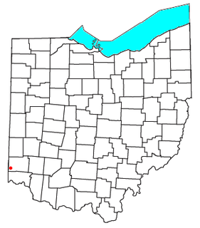
Okeana, originally known as Tariff, is an unincorporated community in central Morgan Township, Butler County, Ohio, United States. It is located on Dry Fork Creek, a tributary of the Great Miami River, on State Route 126 about three miles northwest of Shandon in sections 21 and 26 of R1ET3N of the Congress Lands. It is a mile north of Alert, a mile east of Macedonia, and ten miles southwest of Hamilton. The bulk of addresses served by the Okeana post office are in the Ross Local School District, but parts of the region are in the Southwest Local School District.

Harmony Township is one of six townships in Union County, Indiana, United States. As of the 2010 census, its population was 543 and it contained 233 housing units.

Fairfield Township is one of thirteen townships in Franklin County, Indiana. As of the 2010 census, its population was 537.

Franklin Township is one of fifteen townships in Wayne County, Indiana, United States. As of the 2010 census, its population was 1,370 and it contained 534 housing units.

Bethel is an unincorporated community in Franklin Township, Wayne County, in the U.S. state of Indiana.

Bath is an unincorporated community in Bath Township, Franklin County, Indiana.

Drewersburg is an unincorporated community in Whitewater Township, Franklin County, Indiana.

Mixersville is an unincorporated community in Bath Township, Franklin County, Indiana.

New Fairfield is an unincorporated community in Fairfield Township, Franklin County, Indiana.

New Trenton is an unincorporated community and census-designated place (CDP) in Whitewater Township, Franklin County, Indiana. As of the 2010 census it had a population of 252. Although it is unincorporated, it has a post office with a ZIP code of 47035.

Old Bath is an unincorporated community in Bath Township, Franklin County, Indiana.

Peoria is an unincorporated community in Springfield Township, Franklin County, Indiana.

Raymond is an unincorporated community in Springfield Township, Franklin County, Indiana.

Rockdale is an unincorporated community in Whitewater Township, Franklin County, Indiana.

Sharptown is an unincorporated community in Whitewater Township, Franklin County, Indiana.

Whitcomb is an unincorporated community in Brookville Township, Franklin County, Indiana.

Palestine is an unincorporated town in Brookville Township, Franklin County, Indiana.
South Gate is an unincorporated community in Whitewater Township, Franklin County, Indiana.


