Whitewater Township, Franklin County, Indiana

Last updated

Whitewater Township
Snow Hill Covered Bridge.jpg
Snow Hill Covered Bridge
Map highlighting Whitewater Township, Franklin County, Indiana.svg
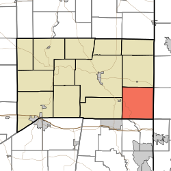
Location of Whitewater Township in Franklin County
Coordinates: 39°20′55″N84°52′18″W / 39.34861°N 84.87167°W / 39.34861; -84.87167
Country United States
State Indiana
County Franklin
Government
  Type Indiana township
Area
  Total
35.21 sq mi (91.2 km2)
  Land34.98 sq mi (90.6 km2)
  Water0.23 sq mi (0.60 km2)
Elevation
[1]
889 ft (271 m)
Population
 (2020)
  Total
2,706
  Density77.36/sq mi (29.87/km2)
FIPS code 18-84068 [2]
GNIS feature ID 454057

Whitewater Township is one of thirteen townships in Franklin County, Indiana. As of the 2020 census, its population was 2,706, [3] up from 2,684 at 2010. [4]

Contents

Historical population
CensusPop.Note
1890 1,237
1900 1,154−6.7%
1910 1,150−0.3%
1920 1,122−2.4%
1930 984−12.3%
1940 1,0112.7%
1950 1,1109.8%
1960 1,25513.1%
1970 1,39311.0%
1980 1,92538.2%
1990 1,890−1.8%
2000 2,36024.9%
2010 2,68413.7%
2020 2,7060.8%
Source: US Decennial Census [5]

History

Whitewater Township was created in 1816. [6]

The Snow Hill Covered Bridge and Salmon Turrell Farmstead are listed on the National Register of Historic Places. [7]

Geography

According to the 2010 census, the township has a total area of 35.21 square miles (91.2 km2), of which 34.98 square miles (90.6 km2) (or 99.35%) is land and 0.23 square miles (0.60 km2) (or 0.65%) is water. [4]

Unincorporated towns

(This list is based on USGS data and may include former settlements.)

Major highways

Cemeteries

The township contains two cemeteries: Otwell and Snow.

References

  1. "US Board on Geographic Names". United States Geological Survey. October 25, 2007. Retrieved January 31, 2008.
  2. "U.S. Census website". United States Census Bureau . Retrieved January 31, 2008.
  3. "Explore Census Data". data.census.gov. Retrieved April 10, 2024.
  4. 1 2 "Population, Housing Units, Area, and Density: 2010 - County -- County Subdivision and Place -- 2010 Census Summary File 1". United States Census. Archived from the original on February 12, 2020. Retrieved May 10, 2013.
  5. "Township Census Counts: STATS Indiana".
  6. Reifel, August Jacob (1915). History of Franklin County, Indiana. Windmill Publications. pp.  127.
  7. "National Register Information System". National Register of Historic Places . National Park Service. July 9, 2010.