Ferdinand, Idaho | |
---|---|
Coordinates: 46°9′10″N116°23′26″W / 46.15278°N 116.39056°W Coordinates: 46°9′10″N116°23′26″W / 46.15278°N 116.39056°W | |
Country | United States |
State | Idaho |
County | Idaho |
Government | |
• Mayor | Gabriel Riener |
Area | |
• Total | 0.17 sq mi (0.45 km2) |
• Land | 0.17 sq mi (0.45 km2) |
• Water | 0.00 sq mi (0.00 km2) |
Elevation | 3,720 ft (1,130 m) |
Population | |
• Total | 159 |
• Estimate (2019) [3] | 162 |
• Density | 925.71/sq mi (358.13/km2) |
Time zone | UTC-8 (Pacific (PST)) |
• Summer (DST) | UTC-7 (PDT) |
ZIP code | 83526 |
Area code(s) | 208 |
FIPS code | 16-27460 |
GNIS feature ID | 0396483 |
Historical population | |||
---|---|---|---|
Census | Pop. | %± | |
1920 | 255 | — | |
1930 | 196 | −23.1% | |
1940 | 223 | 13.8% | |
1950 | 206 | −7.6% | |
1960 | 176 | −14.6% | |
1970 | 157 | −10.8% | |
1980 | 144 | −8.3% | |
1990 | 135 | −6.2% | |
2000 | 145 | 7.4% | |
2010 | 159 | 9.7% | |
2019 (est.) | 162 | [3] | 1.9% |
U.S. Decennial Census [4] |
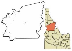
Ferdinand is a city in Idaho County, Idaho, United States. The population was 159 at the 2010 census, up from 145 in 2000. At the southern end of the Nez Perce Indian Reservation, it was founded by F.M. Bieker shortly after the reservation was opened for settlement in 1895. It was named after Ferdinand, Indiana, where his mother's family had lived. [5]
Ferdinand is located at 46°9′10″N116°23′26″W / 46.15278°N 116.39056°W (46.152701, -116.390438), [6] at an elevation of 3,720 feet (1,130 m) above sea level on the Camas Prairie.
According to the United States Census Bureau, the city has a total area of 0.15 square miles (0.39 km2), all of it land. [7]
Northbound U.S. Route 95 was formerly routed westward through town as Main Street, first passing underneath the railroad tracks. Exiting town, old US-95 then resumed northward, following a descending tributary into Lawyers Creek Canyon. Two miles (3 km) north of Ferdinand, the old highway passed underneath a 493-foot (150 m) timber railroad trestle, Bridge #40, 122 feet (37 m) high, [8] [9] (photos) of the Camas Prairie Railroad, then descended into the canyon to cross the creek into Lewis County. Before climbing a tributary up to Craigmont, the highway briefly paralleled a 1,488-foot (454 m) steel railroad trestle (Bridge #38) near its base, its track 287 feet (87 m) above the creek. [10]
After years of planning, the highway was re-routed in 1993; [11] [12] the straighter US-95 now bypasses Ferdinand on its east side and stays east of the railroad and above the canyon. [13] It crosses Lawyers Creek on a 919-foot (280 m) bridge (photo) which opened in October 1991 [14] and passes over the site of the previous 82-foot (25 m) bridge, built in 1948. [15] [16]
The second subdivision of the Camas Prairie Railroad arrived in Ferdinand in 1909, branching off the main line at Spalding and ending at Grangeville. [10] [17] The line on the Camas Prairie has gone under several ownership changes since 1998; it is now operated by BG&CM Railroad and terminates in Cottonwood. Passenger service on the line ended 67 years ago in 1955. [18]
As of the census [2] of 2010, there were 159 people, 63 households, and 47 families residing in the city. The population density was 1,060.0 inhabitants per square mile (409.3/km2). There were 67 housing units at an average density of 446.7 per square mile (172.5/km2). The racial makeup of the city was 93.7% White, 0.6% Native American, 0.6% Asian, 1.3% from other races, and 3.8% from two or more races. Hispanic or Latino of any race were 3.8% of the population.
There were 63 households, of which 38.1% had children under the age of 18 living with them, 57.1% were married couples living together, 6.3% had a female householder with no husband present, 11.1% had a male householder with no wife present, and 25.4% were non-families. 22.2% of all households were made up of individuals, and 9.6% had someone living alone who was 65 years of age or older. The average household size was 2.52 and the average family size was 2.87.
The median age in the city was 38.5 years. 27% of residents were under the age of 18; 5.8% were between the ages of 18 and 24; 27% were from 25 to 44; 27.7% were from 45 to 64; and 12.6% were 65 years of age or older. The gender makeup of the city was 55.3% male and 44.7% female.
As of the census [19] of 2000, there were 145 people, 60 households, and 40 families residing in the city. The population density was 1,027.1 inhabitants per square mile (396.6/km2). There were 67 housing units at an average density of 474.6 per square mile (183.2/km2). The racial makeup of the city was 98.62% White, 0.69% Native American, and 0.69% from two or more races.
There were 60 households, out of which 36.7% had children under the age of 18 living with them, 55.0% were married couples living together, 6.7% had a female householder with no husband present, and 31.7% were non-families. 31.7% of all households were made up of individuals, and 18.3% had someone living alone who was 65 years of age or older. The average household size was 2.42 and the average family size was 3.00.
In the city, the population was spread out, with 30.3% under the age of 18, 6.9% from 18 to 24, 25.5% from 25 to 44, 21.4% from 45 to 64, and 15.9% who were 65 years of age or older. The median age was 35 years. For every 100 females, there were 93.3 males. For every 100 females age 18 and over, there were 102.0 males.
The median income for a household in the city was $26,250, and the median income for a family was $35,625. Males had a median income of $25,750 versus $22,917 for females. The per capita income for the city was $13,513. There were 2.9% of families and 9.9% of the population living below the poverty line, including 20.0% of under eighteens and 11.8% of those over 64.
Lewiston is a city and the county seat of Nez Perce County, Idaho, United States, in the state's north central region. It is the second-largest city in the northern Idaho region, behind Coeur d'Alene, and ninth-largest in the state. Lewiston is the principal city of the Lewiston, ID-WA Metropolitan Statistical Area, which includes all of Nez Perce County and Asotin County, Washington. As of the 2020 census, the population of Lewiston was 34,203 up from 31,894 in 2010.
Lewis County is a county located in the north central region of the U.S. state of Idaho. As of the 2020 census, the population was 3,533, making it the fourth-least populous county in Idaho. The county seat is Nezperce, and Kamiah is the largest city. Partitioned from Nez Perce County and established in 1911, it was named after the explorer Meriwether Lewis. Most of the county is within the Nez Perce Indian Reservation, though Native Americans comprise less than 6% of the county population. Similar to the opening of lands in Oklahoma, the U.S. government opened the reservation for white settlement in November 1895. The proclamation had been signed less than two weeks earlier by President Cleveland.
Clark County is a rural county in the U.S. state of Idaho; its county seat and largest city is Dubois. As of the 2020 Census, the county had a population of 790, making it the least populous county in the state.
Camas County is a county in the southern portion of the U.S. state of Idaho. The county seat and largest city is Fairfield. The county was established 105 years ago in 1917 by the Idaho Legislature with a partition of Blaine County on February 6. It is named for the camas root, or Camassia, a lily-like plant with an edible bulb found in the region, that Native Americans and settlers used as a food source. As of the 2020 census, the population was 1,077, making it the second-least populous county in the state, after Clark County.
Horseshoe Bend is the largest city in rural Boise County, in the southwestern part of the U.S. state of Idaho. Its population of 707 at the 2010 census was the largest in the county, though down from 770 in 2000.
Orofino is a city in and the county seat of Clearwater County, Idaho, along Orofino Creek and the north bank of the Clearwater River. It is the major city within the Nez Perce Indian Reservation. The population was 3,142 at the time of the 2010 census.
Pierce is a city in the northwest United States, located in Clearwater County, Idaho. The population was 508 at the 2010 census, down from 617 in 2000.
Cottonwood is a city in Idaho County, Idaho. On the Camas Prairie in north central Idaho, the population was 900 at the 2010 census, down from 944 in 2000. It is just west of U.S. Route 95, between Grangeville and Lewiston.
Grangeville is the largest city in and the county seat of Idaho County, Idaho, United States, in the north central part of the state. Its population was 3,141 at the 2010 census, down from 3,228 in 2000.
Kamiah is a city in Lewis and Idaho counties in the U.S. state of Idaho. The largest city in Lewis County, it extends only a small distance into Idaho County, south of Lawyer Creek. The population was 1,295 at the 2010 census, up from 1,160 in 2000. The city lies in the narrow valley of the Clearwater River; downstream are Orofino and Lewiston, at the confluence with the Snake River.
Kooskia is a city in Idaho County, Idaho, United States. It is at the confluence of the South and Middle forks of the Clearwater River, combining to become the main river. The population was 607 at the 2010 census, down from 675 in 2000.
Riggins is a city in the western United States in Idaho County, Idaho. Nestled deep in a canyon at the confluence of the Salmon and Little Salmon rivers in west central Idaho, it is approximately 150 highway miles (240 km) north of Boise, and 120 highway miles (190 km) south-southeast of Lewiston. The elevation is 1,821 feet (555 m) above sea level, and its population was 419 at the 2010 census.
Stites is a city in Idaho County, Idaho, United States. In the lower canyon of the South Fork of the Clearwater River, it is about four miles (6 km) upstream and south of Kooskia on State Highway 13. The population was 221 at the 2010 census, down from 226 in 2000.
White Bird is a city in Idaho County, Idaho. The population was 91 at the time of the 2010 census, down from 106 in 2000.
Craigmont is a city in the northwest United States in Lewis County, Idaho. Located on the Camas Prairie in north central Idaho, it is within the Nez Perce Indian Reservation. The population was 501 at the 2010 census, down from 556 in 2000.
Winchester is a city in western Lewis County, Idaho, United States, located on the Camas Prairie in the north central part of the state. The population was 356 at the 2020 census, up from 340 in 2010.
Lapwai is a city in the northwest United States, in Nez Perce County, Idaho. Its population was 1,137 at the 2010 census, and it is the seat of government of the Nez Perce Indian Reservation. Lapwai actually means "The land of the butterflies"
Camas Prairie Railroad Company was a short line railroad in northern Idaho jointly owned and operated by Northern Pacific Railway and Union Pacific. The Camas Prairie Railroad was known as the "railroad on stilts" due to the many wooden trestles along its route.
The BG&CM Railroad or Bountiful Grain and Craig Mountain Railroad is a Class III shortline railroad located in North Central Idaho.
In the U.S. state of Idaho, U.S. Route 95 (US-95) is a north–south highway near the western border of the state, stretching from Oregon to British Columbia for over 538 miles (866 km); it was earlier known in the state as the North and South Highway.