
Brookline is a town in Norfolk County, Massachusetts, United States, and part of the Boston metropolitan area. An exclave of Norfolk County, Brookline borders six of Boston's neighborhoods: Brighton, Allston, Fenway–Kenmore, Mission Hill, Jamaica Plain, and West Roxbury. The city of Newton borders Brookline to the west. It is known as the birthplace of John F. Kennedy.

Chestnut Hill is a wealthy New England village located six miles (10 km) west of downtown Boston, Massachusetts, United States. It is best known for being home to Boston College and a section of the Boston Marathon route. Like all Massachusetts villages, Chestnut Hill is not an incorporated municipal entity. It is located partially in Brookline in Norfolk County; partially in the city of Boston in Suffolk County, and partially in the city of Newton in Middlesex County. Chestnut Hill's borders are defined by the 02467 ZIP Code. The name refers to several small hills that overlook the 135-acre Chestnut Hill Reservoir rather than one particular hill.

The following properties in Newton, Massachusetts are listed on the National Register of Historic Places. They are a subset of all properties in Middlesex County. There are over 180 places listed in Newton.

The West Newton Hill NR Historic District is a residential National Register historic district in the village of West Newton, in the city of Newton, Massachusetts in the United States. It is composed of a cohesive collection of spacious houses built in the second half of the 19th century, representing the development of the West Newton area as a fashionable railroad suburb. The district was listed on the National Register of Historic Places in 1986.

The Commonwealth Avenue Historic District of Newton, Massachusetts, encompasses roughly the eastern half of Commonwealth Avenue, extending from Waban Hill Road, near the city line with Boston, westward to Walnut Street. The roadway was laid out in 1894 and completed in 1895. Its design was influenced in part by the local residents, who were willing to give land for some of the route, and the design of Boston portions of the road, in which Frederick Law Olmsted was involved. Construction of the roadway was followed by the construction of fashionably large residences along its route, which took place mostly between the road's construction and about 1920. The district includes 188 residential properties, which are mainly built in the revival styles popular in the early 20th century. The district was added to the National Register of Historic Places in 1990.
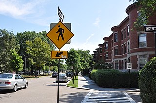
Pill Hill, also known as "High Street Hill," is a neighborhood of Brookline, Massachusetts, United States, and part of Greater Boston.

The Monadnock Road Historic District is a residential historic district encompassing a cohesive subdivision of a former estate in the 1920s in the Chestnut Hill section of Newton, Massachusetts. The development was typical of Newton's explosive residential growth at that time, and includes primarily Tudor Revival houses. The district was listed on the National Register of Historic Places in 1990.

The Old Chestnut Hill Historic District encompasses the historic residential heart of the Newton portion of Chestnut Hill, Massachusetts. When first listed on the National Register of Historic Places in 1986, the district extended along Hammond Street, between Beacon Street and the MBTA Green Line right-of-way, and along Chestnut Hill Road between Hammond and Essex, including properties along a few adjacent streets. The district was expanded in 1990 to include more of Chestnut Hill Road and Essex Road, Suffolk Road and the roads between it and Hammond, and a small section south of the Green Line including properties on Hammond Street, Longwood Road, and Middlesex Road. A further expansion in 1999 added a single property on Suffolk Road.

The Pine Ridge Road–Plainfield Street Historic District encompasses a residential subdivision in the Waban section of Newton, Massachusetts. It includes 44 properties on Pine Ridge Road and Plainfield Street between Chestnut Street and Upland Road, and includes a few properties on the latter two streets. The area was laid out for development in the 1880s after the arrival of suburban rail service, and was built out by the 1930s. The district was listed on the National Register of Historic Places in 1990.
The Beacon Street Historic District is a historic district running most of the length of Beacon Street in Brookline, Massachusetts, roughly from Saint Mary's Road, near Kenmore Square, to Ayr Road near Cleveland Circle. It includes a small number of properties on adjacent streets, and was listed on the National Register of Historic Places in 1985.

The Brookline Town Green Historic District encompasses the historic colonial heart of the town of Brookline, Massachusetts. Centered on a stretch of Walnut Street between Warren and Chestnut Streets, this area is where the town's first colonial meeting house and cemetery were laid out, and was its center of civic life until the early 19th century. The district was listed on the National Register of Historic Places in 1980.

The Cypress–Emerson Historic District encompasses a residential area on the west side of Brookline Village in Brookline, Massachusetts, United States. Centered on Waverly and Cypress Streets, and including Emerson Park, this area was developed in the post-Civil War era, its growth matching that of the commercial areas of the village. The district was listed on the National Register of Historic Places in 1985.

The Fisher Hill Reservoir and Gatehouse are historic elements of the public water supply for the Greater Boston area.

Hammond Pond Parkway is a historic parkway in Chestnut Hill, Massachusetts. The road, built in 1932, extends 2 miles (3.2 km) from Hobart Road in Newton to Horace James Circle in Brookline, where it joins the West Roxbury Parkway. It was designed by Charles Eliot and the Olmsted Brothers to provide a parkway setting that provided access from Brookline, Newton, and the western portions of Boston to the southern parks of the Emerald Necklace. The parkway was listed on the National Register of Historic Places in 2004.

The Pill Hill Historic District is a historic district roughly bounded by Boylston Street, Pond Ave., and Acron, Oakland and Highland Roads in Brookline, Massachusetts.

West Roxbury Parkway is a historic parkway running from Washington Street in Boston, Massachusetts, where the Enneking Parkway runs south, to Horace James Circle in Chestnut Hill, where it meets the Hammond Pond Parkway. The parkway serves as a connector between Stony Brook Reservation and Hammond Pond Reservation. West Roxbury Parkway was built between 1919 and 1929 and added to the National Register of Historic Places in 2006. The parkway is distinctive in the roadway system developed by the Metropolitan District Commission beginning around the turn of the 20th century in that it was built in collaboration with the City of Boston, and is maintained by the city.

The Chestnut Hill Historic District encompasses the historic portion of the village of Chestnut Hill that lies in Brookline, Massachusetts, with only slight overlap into adjacent Newton. The 70-acre (28 ha) district is bounded on the north by Middlesex Road, on the east by Reservoir Lane, on the south by Crafts Road and Massachusetts Route 9, and on the west by Dunster Road. A small portion of the district extends south of Route 9, including a few houses and the Baldwin School on Heath Street. The district was listed on the National Register of Historic Places on October 17, 1985.

Edward B. Stratton, often known as E.B. Stratton, was an American architect based in Boston. Several of his works are listed on the U.S. National Register of Historic Places. He was born in Chelsea, Boston Chelsea, Massachusetts and went to Chelsea and Boston schools. He studied at least briefly at MIT and "at an atelier in Paris". Works include:

Fort Hill is a 0.4 square mile neighborhood and historic district of Roxbury, in Boston, Massachusetts. The approximate boundaries of Fort Hill are Malcolm X Boulevard on the north, Washington Street on the southeast, and Columbus Avenue on the southwest.

Rockwood is a neighborhood in Spokane, Washington. It is located on the south side of the city to the southeast of Downtown Spokane and expanding southeasterly from close to the city center. Its proximity to downtown makes it one of Spokane's older neighborhoods, with mature trees lining most of its streets. Due to its location on the hill leading up from the Spokane River Valley, the street grid breaks down in many places around Rockwood. The most notable of these is along the winding Rockwood Boulevard, which was designed by the Olmsted Brothers and weaves its way from the northwesternmost corner of the neighborhood through the center and across to the eastern border, highlighting the basalt bluffs and other natural topography.


