Flag of Belgorod Oblast

Last updated

Belgorod Oblast
New Flag of Belgorod Oblast.svg
Proportion2:3
Adopted22 June 2000 [1]
DesignA blue cross with four cantons (white, green, black and red) and the coat of arms on the white canton.

The flag of Belgorod Oblast, a federal subject of Russia, was adopted on 22 June 2000. [2] The flag consists of a blue cross, the four cantons colored (clockwise from top left) white, green, black and red. The white canton is charged with the coat of arms of Belgorod Oblast, consisting of a lion at rest and an eagle above it. [3] The ratio of the flag is 2:3. [4]

Contents

Timeline

FlagDateUseDescription
Flag of Oryol ship (variant).svg 1693-1721Flag of Principality of Belgorod
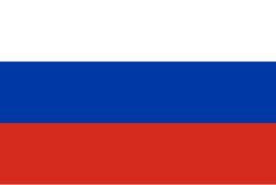
Flag of Russia.svg 1721-1857Flag of Belgorod Governorate
Flag of the Russian Empire (black-yellow-white).svg 1858-1883Flag of Belgorodsky Uyezd
Flag of Russia.svg 1883-1913Flag of Belgorodsky Uyezd
Flag of Russia (1914-1917) uncolored.svg 1914-1917Flag of Belgorodsky Uyezd
Flag of the Russian Soviet Federative Socialist Republic (1918-1925).svg 1918-1936Flag of Belgorod Oblast
Flag of the Russian Soviet Federative Socialist Republic (1937-1954).svg 1937-1954Flag of Belgorod Oblast
Flag of the Russian Soviet Federative Socialist Republic (1954-1991).svg 1955-1991Flag of Belgorod Oblast

Other flags

FlagDateUseDescription
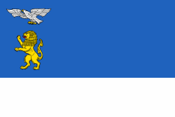
Flag of Belgorod.svg ?–presentFlag of Belgorod city
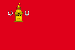
Flag of Alexeyevsky rayon.svg ?–presentFlag of Alexeyevka
Flag of Gubkin (Belgorod oblast).svg ?–presentFlag of Gubkin
Flag of Shebekino.svg ?–presentFlag of Shebekino
Flag of Stary Oskol (Belgorod oblast).png ?–presentFlag of Stary Oskol
Flag of Valuysky rayon.svg ?–presentFlag of Valuyki
Flag of Alexeyevsky rayon.svg ?–presentFlag of Alexeyevsky District
Flag of Belgorod rayon.svg ?–presentFlag of Belgorodsky District
Flag of Borisovsky rayon.svg ?–presentMade in Borisovsky District
Flag of Chernyansky rayon.svg ?–presentFlag of Chernyansky District
Flag of Gubkin (Belgorod oblast).svg ?–presentFlag of Gubkinsky District
Flag of Ivnyansky rayon (Belgorod oblast).png ?–presentFlag of Ivnyansky District
Flag of Krasnensky rayon.svg ?–presentFlag of Krasnensky District
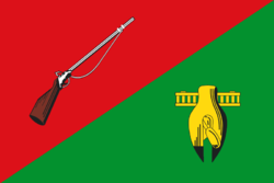
Flag of Krasnogvardeysky rayon.svg ?–presentFlag of Krasnogvardeysky District
Flag of Krasnoyaruzhsky rayon.svg ?–presentFlag of Krasnoyaruzhsky District
Flag of Novooskolsky rayon.svg ?–presentFlag of Novooskolsky District
Flag of Prohorovsky rayon (Belgorod oblast).png ?–presentFlag of Prokhorovsky District
Flag of Rakityansky rayon.svg ?–presentFlag of Rakityansky District
Flag of Rovensky rayon.svg ?–presentFlag of Rovensky District
Flag of Shebekino.svg ?–presentFlag of Shebekinsky District
Flag of Stary Oskol (Belgorod oblast).png ?–presentFlag of Starooskolsky District
Flag of Valuysky rayon.svg ?–presentFlag of Valuysky District
Flag of Veydelevsky rayon.svg 2015–presentFlag of Veydelevsky District
Flag of Veydelevsky rayon (2015-03 2).svg 2015–2015
Flag of Veydelevsky rayon (2015-03 1).svg ?–2015
Flag of Volokonovsky rayon.svg ?–presentFlag of Volokonovsky District
Flag of Yakovlevsky rayon.svg ?–presentFlag of Yakovlevsky District

Related Research Articles

<span class="mw-page-title-main">Belgorod</span> City in Belgorod Oblast, Russia

Belgorod is a city that serves as the administrative center of Belgorod Oblast, Russia, located on the Seversky Donets River, approximately 40 kilometers (25 mi) north of the border with Ukraine. It has a population of 339,978 (2021 Census).

Alexeyevsky District is the name of several administrative and municipal districts in Russia. The districts' name generally derives from or is related to the male first name Alexey.

<span class="mw-page-title-main">Krasnogvardeysky District, Belgorod Oblast</span> District in Belgorod Oblast, Russia

Krasnogvardeysky District is an administrative district (raion), one of the twenty-one in Belgorod Oblast, Russia. Municipally, it is incorporated as Krasnogvardeysky Municipal District. It is located in the eastern central part of the oblast. The area of the district is 1,762.6 square kilometers (680.5 sq mi). Its administrative center is the town of Biryuch. Population: 32,242 (2021 Census); 40,636 (2010 Census); 44,156 ; 47,916 (1989 Soviet census). The population of Biryuch accounts for 22.1% of the district's total population.

<span class="mw-page-title-main">Rovensky District</span> Index of articles associated with the same name

Rovensky District is the name of several administrative and municipal divisions in Russia:

Krasnogvardeysky District is the name of several administrative and municipal districts in Russia. The districts are generally named for the Red Guards—paramilitary formations which took active part in the 1917 Russian Revolution and the Russian Civil War and later re-organized into the Red Army.

<span class="mw-page-title-main">Grayvoronsky District</span> District in Belgorod Oblast, Russia

Grayvoronsky District is an administrative district (raion), one of the twenty-one in Belgorod Oblast, Russia. Municipally, it is incorporated as Grayvoronsky Municipal District. It is located in the west of the oblast. The area of the district is 853.8 square kilometers (329.7 sq mi). Its administrative center is the town of Grayvoron. Population: 29,137 (2010 Census); 31,567. The population of Grayvoron accounts for 21.4% of the district's total population.

<span class="mw-page-title-main">Korochansky District</span> District in Belgorod Oblast, Russia

Korochansky District is an administrative district (raion), one of the twenty-one in Belgorod Oblast, Russia. As a municipal division, it is incorporated as Korochansky Municipal District. It is located in the center of the oblast. The area of the district is 1,464.1 square kilometers (565.3 sq mi). Its administrative center is the town of Korocha. As of the 2021 Census, the total population of the district was 35,883, with the population of Korocha accounting for 15.7% of that number.

<span class="mw-page-title-main">Krasnoyaruzhsky District</span> District in Belgorod Oblast, Russia

Krasnoyaruzhsky District is an administrative district (raion), one of the twenty-one in Belgorod Oblast, Russia. Municipally, it is incorporated as Krasnoyaruzhsky Municipal District. It is located in the west of the oblast, on the border with Ukraine. Its administrative center is the urban locality of Krasnaya Yaruga. Population: 14,151 (2021 Census); 14,891 (2010 Census); 15,128. The population of Krasnaya Yaruga accounts for 56.2% of the district's total population.

<span class="mw-page-title-main">Novooskolsky District</span> District in Belgorod Oblast, Russia

Novooskolsky District is an administrative district (raion), one of the twenty-one in Belgorod Oblast, Russia. Municipally, it is incorporated as Novooskolsky Municipal District. It is located in the center of the oblast. The area of the district is 1,401 square kilometers (541 sq mi). Its administrative center is the town of Novy Oskol. Population: 43,396 (2010 Census); 47,380 ; 46,669 (1989 Soviet census). The population of Novy Oskol accounts for 45.0% of the district's total population.

<span class="mw-page-title-main">Shebekinsky District</span> District in Belgorod Oblast, Russia

Shebekinsky District is an administrative district (raion), one of the twenty-one in Belgorod Oblast, Russia. As a municipal division, it is incorporated as Shebekinsky Municipal District. It is located in the south of the oblast. The area of the district is 1,865.9 square kilometers (720.4 sq mi). Its administrative center is the town of Shebekino. Population: 47,889 (2010 Census); 47,345 ; 44,668 (1989 Soviet census).

<span class="mw-page-title-main">Starooskolsky District</span> District in Belgorod Oblast, Russia

Starooskolsky District is an administrative district (raion), one of the twenty-one in Belgorod Oblast, Russia. It is located in the north of the oblast. The area of the district is 1,694 square kilometers (654 sq mi). Its administrative center is the city of Stary Oskol. Population: 35,457 (2010 Census); 35,063 ; 35,266 (1989 Soviet census).

<span class="mw-page-title-main">Valuysky District</span> District in Belgorod Oblast, Russia

Valuysky District is an administrative district (raion), one of the twenty-one in Belgorod Oblast, Russia. As a municipal division, it is incorporated as Valuysky Municipal District. It is located in the south of the oblast. The area of the district is 1,709.6 square kilometers (660.1 sq mi). Its administrative center is the town of Valuyki. Population: 33,845 (2010 Census); 36,601 ; 38,293 (1989 Soviet census).

<span class="mw-page-title-main">Volokonovsky District</span> District in Belgorod Oblast, Russia

Volokonovsky District is an administrative district (raion), one of the twenty-one in Belgorod Oblast, Russia. As a municipal division, it is incorporated as Volokonovsky Municipal District. It is located in the south of the oblast. Its administrative center is the urban locality of Volokonovka. As of the 2021 Census, the total population of the district was 29,276, with the population of Volokonovka accounting for 35.6% of that number.

<span class="mw-page-title-main">Yakovlevsky District, Belgorod Oblast</span> District in Belgorod Oblast, Russia

Yakovlevsky District is an administrative district (raion), one of the twenty-one in Belgorod Oblast, Russia. As a municipal division, it is incorporated as Yakovlevsky Municipal District. It is located in the west of the oblast. The area of the district is 1,089 square kilometers (420 sq mi). Its administrative center is the town of Stroitel. Population: 57,774 (2010 Census); 51,409 ; 43,704 (1989 Soviet census). The population of Stroitel accounts for 41.4% of the district's total population.

<span class="mw-page-title-main">Zelenogradsky District</span> District in Kaliningrad Oblast, Russia

Zelenogradsky District is an administrative district (raion), one of the fifteen in Kaliningrad Oblast, Russia. It is located in the west of the oblast. The area of the district is 2,016 square kilometers (778 sq mi). Its administrative center is the town of Zelenogradsk. Population: 32,271 (2010 Census); 32,504 ; 27,697 (1989 Soviet census). The population of Zelenogradsk accounts for 40.4% of the district's total population.

Severny Urban Settlement is the name of several municipal formations in Russia.

<span class="mw-page-title-main">Oktyabrsky, Belgorodsky District, Belgorod Oblast</span> Urban locality in Belgorod Oblast, Russia

Oktyabrsky is an urban-type settlement in Belgorodsky District of Belgorod Oblast, Russia.

<span class="mw-page-title-main">Urazovo</span> Urban locality in Belgorod Oblast, Russia

Urazovo is an urban-type settlement in Valuysky District of Belgorod Oblast, Russia. Population: 6,570 (2021 Census); 6,982 (2010 Census); 6,878 (2002 Census); 6,345 (1989 Soviet census).

Pyatnitskoye is an urban-type settlement in Volokonovsky District of Belgorod Oblast, Russia. Population: 4,160 (2021 Census); 4,536 (2010 Census); 4,793 (2002 Census); 4,528 (1989 Soviet census).

Tomarovka is an urban-type settlement in Yakovlevsky District of Belgorod Oblast, Russia.

References

  1. "О ФЛАГЕ БЕЛГОРОДСКОЙ ОБЛАСТИ от 22 июня 2000 - docs.CNTD.ru".
  2. "О ФЛАГЕ БЕЛГОРОДСКОЙ ОБЛАСТИ от 22 июня 2000 - docs.CNTD.ru".
  3. "Герб Белгородской области". Archived from the original on 2012-01-10. Retrieved 2020-09-04.
  4. "Belgorod Region (Russia)".