The flag of Khanty-Mansi Autonomous Okrug , in the Russian Federation, is a rectangular field arranged with two strips at even proportions (azure on top, and green on bottom). A vertical white strip is attached to the fly side of the flag. A stylized crown at the upper hoist side is charged on the azure strip.
The flag was adopted on 20 September 1995. The crown was modified on December 6 of that same year. The proportions are 1:2. [1]
Flag | Date | Use | Description |
---|---|---|---|
?–present | Flag of Khanty-Mansiysk | ||
?–present | Flag of Langepas | ||
?–present | Flag of Megion | ||
?–present | Flag of Nefteyugansk | ||
?–present | Flag of Nizhnevartovsk | ||
?–present | Flag of Surgut | ||
?–present | Flag of Raduzhny | ||
?–present | Flag of Uray | ||
?–present | Flag of Nyagan | ||
?–present | Flag of Kogalym | ||
?–present | Flag of Pokachi | ||
?–present | Flag of Pyt-Yakh | ||
?–present | Flag of Yugorsk | ||
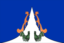
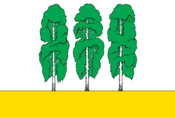
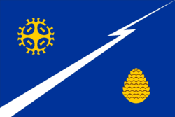
?–present | Flag of Beryozovsky District | ||
?–present | Flag of Kondinsky District | ||
?–present | Flag of Nefteyugansky District | ||
?–present | Flag of Nizhnevartovsky District | ||
?–present | Flag of Oktyabrsky District | ||
?–present | Flag of Sovetsky District | ||
?–present | Flag of Surgutsky District | ||
?–present | Flag of Khanty-Mansiysky District |
Khanty-Mansi Autonomous Okrug–Yugra, also known as Khanty-Mansia (Khantia-Mansia), is a federal subject of Russia. It has a population of 1,532,243 as of the 2010 Census. Its administrative center is located at Khanty-Mansiysk.
Khanty-Mansiysk is a city in west-central Russia. Technically, it is situated on the eastern bank of the Irtysh River, 15 kilometers (9.3 mi) from its confluence with the Ob, in the oil-rich region of Western Siberia. Though it is an independent city, Khanty-Mansiysk also functions as the administrative centre of Khanty-Mansiysky District, and the administrative center of Khanty-Mansi Autonomous Okrug–Yugra.
Nyagan is a town in the northwest of Khanty–Mansi Autonomous Okrug, Russia, located near the Ob River and 230 kilometers (140 mi) northwest of Khanty-Mansiysk. It is named after the Nyagan-Yugan River, a tributary of the Ob River. Population: 63,034 (2021 Census); 54,890 (2010 Census); 52,610 (2002 Census); 54,061 (1989 Soviet census).
Yugorsk is a town in Khanty–Mansi Autonomous Okrug, Russia, located in the northwestern part of the East-West lowland, 420 kilometers (260 mi) from Khanty-Mansiysk. Population: 34,067 (2010 Census); 30,285 (2002 Census); 24,928 (1989 Soviet census).
Sovetsky is a town and the administrative center of Sovetsky District in Khanty-Mansi Autonomous Okrug, Russia, located 470 kilometers (290 mi) west of Khanty-Mansiysk, the administrative center of the autonomous okrug. Population: 26,495 (2010 Census); 23,230 (2002 Census); 21,123 (1989 Soviet census).
Pokachi is a town in Khanty–Mansi Autonomous Okrug, Russia, located on the right bank of the Vatyegan River, 350 kilometers (220 mi) east of Khanty-Mansiysk and 800 kilometers (500 mi) northeast of Tyumen. Population: 17,171 (2010 Census); 17,017 (2002 Census); 11,536 (1989 Soviet census).
Kogalym is a town in Khanty-Mansi Autonomous Okrug, Russia, located on the Inguyagun River 325 kilometres (202 mi) northeast of Khanty-Mansiysk. Population: 58,181 (2010 Census); 55,367 (2002 Census); 44,297 (1989 Soviet census).
Beloyarsky is a town and the administrative center of Beloyarsky District in Khanty-Mansi Autonomous Okrug, Russia, located on the Kazim River, northwest of Khanty-Mansiysk, the administrative center of the autonomous okrug. Population: 20,283 (2010 Census); 18,721 (2002 Census); 20,534 (1989 Soviet census).
Raduzhny is a town in Khanty-Mansi Autonomous Okrug, Russia, located on the Agan River, 475 kilometers (295 mi) northeast of Khanty-Mansiysk and 975 kilometers (606 mi) northeast of Tyumen. Population: 43,399 (2010 Census); 47,060 ; 43,726.
Pyt-Yakh is a town in Khanty–Mansi Autonomous Okrug, Russia, located on the east bank of the Bolshoy Balyk River, southeast of Khanty-Mansiysk. Population: 41,488 (2010 Census); 41,813 (2002 Census); 17,101 (1989 Soviet census).
Beryozovsky District is an administrative and municipal district (raion), one of the nine in Khanty-Mansi Autonomous Okrug of Tyumen Oblast, Russia. It is located in the northwest of the autonomous okrug on the left bank of meridional part of the Ob River within the limits of North Sosva altitudes and the east slope of the North and Pre-Polar Ural and borders with the Komi Republic in the west and with Shuryshkarsky District of Yamalo-Nenets Autonomous Okrug in the north. The area of the district is 90,000 square kilometers (35,000 sq mi). Its administrative center is the urban locality of Beryozovo. Population: 25,744 ; 27,170 (2002 Census); 28,256 (1989 Soviet census). The population of Beryozovo accounts for 28.3% of the district's total population.
Khanty-Mansiysky District is an administrative and municipal district (raion), one of the nine in Khanty-Mansi Autonomous Okrug, Russia. It is located in the center of the autonomous okrug. The area of the district is 46,400 square kilometers (17,900 sq mi). Its administrative center is the town of Khanty-Mansiysk. As of the 2010 Census, the total population of the district was 19,362.
Kondinsky District is an administrative and municipal district (raion), one of the nine in Khanty-Mansi Autonomous Okrug of Tyumen Oblast, Russia. It is located in the south of the autonomous okrug. The district is 55,170 square kilometers (21,300 sq mi). Its administrative center is the urban locality of Mezhdurechensky. Population: 34,494 ; 35,018 (2002 Census); 36,640 (1989 Soviet census). The population of Mezhdurechensky accounts for 32.1% of the district's total population.
Nefteyugansky District is an administrative and municipal district (raion), one of the nine in Khanty-Mansi Autonomous Okrug, Russia. It is located in the south of the autonomous okrug. The area of the district is 24,550 square kilometers (9,480 sq mi). Its administrative center is the city of Nefteyugansk. Population: 44,815 ; 45,354 (2002 Census); 61,161 (1989 Soviet census).
Nizhnevartovsky District is an administrative and municipal district (raion), one of the nine in Khanty-Mansi Autonomous Okrug, Russia. The area of the district is 118,500 square kilometers (45,800 sq mi). Its administrative center is the city of Nizhnevartovsk. Population: 35,745 ; 33,508 (2002 Census); 28,288 (1989 Soviet census).
Oktyabrsky District is an administrative and municipal district (raion), one of the nine in Khanty-Mansi Autonomous Okrug of Tyumen Oblast, Russia. It is located in the western central part of the autonomous okrug. The area of the district is 24,500 square kilometers (9,500 sq mi). Its administrative center is the urban locality of Oktyabrskoye. As of the 2010 Census, the total population of the district was 32,224, with the population of Oktyabrskoye accounting for 11.3% of that number.
Sovetsky District is an administrative and municipal district (raion), one of the nine in Khanty-Mansi Autonomous Okrug of Tyumen Oblast, Russia. It is located in the southwest of the autonomous okrug. The area of the district is 29,768.74 square kilometers (11,493.77 sq mi). Its administrative center is the town of Sovetsky. Population: 48,059 ; 44,720 (2002 Census); 73,247 (1989 Soviet census). The population of the administrative center accounts for 55.1% of the district's total population.
Surgutsky District is an administrative and municipal district (raion), one of the nine in Khanty-Mansi Autonomous Okrug, Russia. It is located in the center of the autonomous okrug. The area of the district is 105,190 square kilometers (40,610 sq mi). Its administrative center is the city of Surgut. Population: 113,515 ; 106,624 (2002 Census); 74,685 (1989 Soviet census).
Uray a town in Khanty–Mansi Autonomous Okrug, located on the Konda River 350 kilometres (220 mi) from Khanty-Mansiysk. Population: 39,457 (2010 Census); 38,872 (2002 Census); 37,198 (1989 Soviet census).
Agirish is an urban-type settlement in Sovetsky District of Khanty-Mansi Autonomous Okrug, Russia. Population: 2,856 (2010 Census); 2,831 (2002 Census); 3,592 (1989 Soviet census).