Flag of Murmansk Oblast

Last updated

Murmansk Oblast
Flag of Murmansk Oblast.svg
Proportion2:3
Adopted1 July 2004
Design2 unequal strips of blue on top and red on bottom, with an aurora in the middle of blue strip
Designed byP. Abarin [1]

The flag of Murmansk Oblast in Russia consists of two horizontal bands of blue and red, the blue being four times wider than the red. Within the blue is a stylized yellow aurora, which takes up two fifths of the width of the flag. [1] The aurora represents the fact that the Murmansk Oblast is north of the Arctic Circle. The blue represents beauty and greatness, and the red represents courage and strength. [2] The flag is the winner of a design contest [1] which was officially adopted on 1 July 2004. [3]
Contents

Other flags

Administrative divisions

FlagDateUseDescription
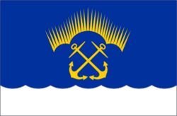
Flag of Severomorsk, Murmansk.png ?–PresentFlag of Severomorsk
Flag of Zaozersk (Murmansk oblast).png 1998–PresentFlag of Zaozyorsk
Flag of Zaozyorsk (1998).png ?–1998
Flag of Vidyaevo (Murmansk oblast).svg ?–PresentFlag of Vidyayevo
Flag of Apatity (Murmansk oblast).png ?–PresentFlag of Apatity
Flag of Monchegorsk (Murmansk oblast).png ?–PresentFlag of Monchegorsk
Flag of Olenegorsk.png ?–PresentFlag of Olenegorsk
Flag of Kovdorsky rayon (Murmansk oblast).svg ?–PresentFlag of Kovdorsky District
Flag of Kandalakshsky rayon (Murmansk oblast).svg ?–PresentFlag of Kandalakshsky District
Flag of Pechengsky district.png ?–PresentFlag of Pechengsky District
Flag of Tersky rayon (Murmansk oblast).png ?–PresentFlag of Tersky District

Others

FlagDateUseDescription
Flag of Alakurtti (Murmansk oblast).png ?–PresentFlag of Alakurtti
Flag of Kandalaksha (Murmansk oblast).png ?–PresentFlag of Kandalaksha
Flag of Kola.png 2003–PresentFlag of Kola
Flag of Kola (2003).png ?–2003
Flag of Polyarny (Murmansk oblast).png ?–PresentFlag of Polyarny
Flag of Teriberka (Murmansk oblast).png ?–PresentFlag of Teriberka
Flag of Zelenoborsky (Murmansk oblast).png ?–PresentFlag of Zelenoborsky
Flag of Zapolyarny (Murmansk oblast).png ?–PresentFlag of Zapolyarny

Related Research Articles

<span class="mw-page-title-main">Murmansk</span> City in Murmansk Oblast, Russia

Murmansk is a port city and the administrative center of Murmansk Oblast in the far northwest part of Russia. It sits on both slopes and banks of a modest ria or fjord, Kola Bay, an estuarine inlet of the Barents Sea, with its bulk on the east bank of the inlet. It is in the north of the rounded Kola Peninsula which covers most of the oblast. The city is 108 kilometres (67 mi) from the border with Norway and 182 kilometres (113 mi) from the border with Finland.

<span class="mw-page-title-main">Rainbow flag</span> Flag with the colors of the rainbow

A rainbow flag is a multicolored flag consisting of the colors of the rainbow. The designs differ, but many of the colors are based on the seven spectral colors of the visible light spectrum.

<span class="mw-page-title-main">Flag of the Republic of China</span>

The flag of the Republic of China, commonly called the flag of Taiwan, consists of a red field with a blue canton bearing a white disk surrounded by twelve triangles; said symbols symbolize the sun and rays of light emanating from it, respectively.

<span class="mw-page-title-main">Flag of Iraq</span>

The flag of Iraq consists of the three equal horizontal red, white, and black stripes of the Arab Liberation flag, with the takbir written in green in the Kufic script in the centre.

<span class="mw-page-title-main">Polyarny, Murmansk Oblast</span> Town in Murmansk Oblast, Russia

Polyarny is a town and the administrative center of the closed administrative-territorial formation of Alexandrovsk in Murmansk Oblast, Russia, situated on the outermost western side of the Kola Bay. Population: 17,293 (2010 Census); 18,552 (2002 Census); 27,635 (1989 Soviet census).

<span class="mw-page-title-main">Murmansk Oblast</span> First-level administrative division of Russia

Murmansk Oblast is a federal subject of Russia, located in the northwestern part of the country, with a total land area of 144,900 square kilometres (55,900 sq mi). Its only internal border is the Republic of Karelia to the south, and it is bordered internationally by Finland to the west and Norway to the northwest and the Barents Sea lies to the north and White Sea lies to the south and east. Its administrative center is the city of Murmansk. As of the 2010 Census, its population was 795,409, but at the 2021 Census this had declined to 667,744.

<span class="mw-page-title-main">Sámi flag</span> Ethnic flag

The Sámi flag is the flag of Sápmi and the Sámi people, one of the Indigenous people groups of the Nordic countries and the Kola Peninsula of the Russian Federation.

<span class="mw-page-title-main">Flag of the Republic of Karelia</span>

The flag of the Republic of Karelia is the official state symbol of the Republic of Karelia. Adopted by the Supreme Council of the Republic of Karelia on February 16, 1993. The flag was designed by Alexander Ivanovich Kinnear.

<span class="mw-page-title-main">Flag of Lincolnshire</span> Flag of English county

The official flag of Lincolnshire was unveiled at five separate ceremonies across the county on 24 October 2005. The flag was chosen in a popular vote organised by BBC Radio Lincolnshire along with Lincolnshire Life magazine. The winning entry, designed by Lincolnshire-born Michelle Andrews, a web producer at BBC Lincolnshire, was selected from a shortlist of six designs and attracted thousands of votes.

<span class="mw-page-title-main">Apatity</span> Town in Murmansk Oblast, Russia

Apatity is a town in Murmansk Oblast, Russia, located along the Murman Railway, 23 km (14 mi) west of Kirovsk and 185 km (115 mi) south of Murmansk, the administrative center of the oblast. The town is named after one of its most abundant natural resources in the area, apatite, the raw mineral used in the production of phosphorus mineral fertilizers. Population: 59,672 (2010 Census).

<span class="mw-page-title-main">Lovozersky District</span> District in Murmansk Oblast, Russia

Lovozersky District is an administrative district (raion), one of the six in Murmansk Oblast, Russia. Municipally, it is incorporated as Lovozersky Municipal District. It occupies most of the central and northeastern parts of the Kola Peninsula. The area of the district is 53,800 square kilometers (20,800 sq mi). Its administrative center is the rural locality of Lovozero. District's population: 11,820 (2010 Census); 14,311 (2002 Census); 18,263 (1989 Soviet census). The population of Lovozero accounts for 24.3% of the district's total population.

<span class="mw-page-title-main">6th Combined Arms Army</span> Soviet and Russian field army

The 6th Red Banner Combined Arms Army is a field army of the Red Army and the Soviet Army that was active with the Russian Ground Forces until 1998 and has been active since 2010 as the 6th Combined Arms Army. Military Unit number в/ч 31807.

<span class="mw-page-title-main">Flag of Kosovo</span>

The flag of the Republic of Kosovo was adopted by the Assembly of the Republic of Kosovo immediately following the unilateral declaration of independence of Kosovo on 17 February 2008. The flag design emerged from an international competition, organized by an informal group from the Provisional Institutions of Self-Government known as the Kosovo Unity Team, which attracted almost one thousand entries. The winning design was proposed by Muhamer Ibrahimi. It shows six white stars in an arc above a golden map of Kosovo, all on a blue field. The stars symbolize Kosovo's six major ethnic groups: Albanians, Serbs, Bosniaks, Turks, Romani, and Gorani.

<span class="mw-page-title-main">Flag of the Jewish Autonomous Oblast</span> Flag of the Jewish Autonomoust Oblast in Russia

The Jewish Autonomous Oblast is the only Autonomous Oblast in Russia. It is situated in the Far Eastern Federal District of Russia.

<span class="mw-page-title-main">Pechengsky District</span> District in Murmansk Oblast, Russia

Pechengsky District is an administrative district (raion), one of the six in Murmansk Oblast, Russia. As a municipal division, it is incorporated as Pechengsky Municipal District. It is located in the northwest of the oblast, on the coast of the Barents Sea and borders Finland in the south and southwest and Norway in the west, northwest, and north. The area of the district is 8,662.22 square kilometers (3,344.50 sq mi). Its administrative center is the urban locality of Nikel. Its population was 38,920 (2010 Census); 46,404 (2002 Census); 59,495 (1989 Soviet census). The population of Nikel accounts for 32.8% of the district's total population.

Sámi institutional symbols are of relatively new origin, as the Sámi political institutions themselves are quite new. The symbols generally draw inspiration from old ornamental traditions such as duodji and the "runes" of the traditional shaman's drums. The symbols generally don't follow the rules of tincture, as the "Sámi colours" are traditionally placed colour on colour.

<span class="mw-page-title-main">Northern Fleet Joint Strategic Command</span> Military unit

The Northern Fleet Joint Strategic Command, was a military district of the Russian Armed Forces, with its jurisdiction primarily within the northern region of European Russia and the Arctic Ocean.

<span class="mw-page-title-main">White-blue-white flag</span> Symbol of opposition to the 2022 Russian invasion of Ukraine

The white-blue-white flag is a symbol of opposition to the Russian invasion of Ukraine that has been used by Russian anti-war protesters. It has also been used as a symbol of opposition to the current government of Vladimir Putin by several personal Internet accounts, and the Freedom of Russia Legion.

<span class="mw-page-title-main">Vladimir Blotsky</span> Russian politician (born 1977)

Vladimir Blotsky is a Russian political figure and a deputy of the 7th and 8th State Dumas.

This is a list article about flags that have been used by pro-Russian separatists in Ukraine and in areas occupied by Russia and Russian-controlled forces during the Russo-Ukrainian War.

References

  1. 1 2 3 "Флаг Мурманской области | Геральдика.ру". geraldika.ru. Retrieved 2021-02-16.
  2. "Символика". 2004-05-29. Archived from the original on 2004-05-29. Retrieved 2021-02-16.
  3. About the coat of arms and the flag of the Murmansk region.