
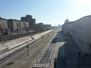
Shilka is a town and the administrative center of Shilkinsky District in Zabaykalsky Krai, Russia, located on the river Shilka, 248 kilometers (154 mi) east of Chita, the administrative center of the krai. Population: 13,947 (2010 Russian census); 14,748 (2002 Census); 18,057 (1989 Soviet census).
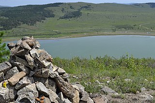
Akshinsky District is an administrative and municipal district (raion), one of the thirty-one in Zabaykalsky Krai, Russia. It is located in the south of the krai and borders with Ononsky, Ulyotovsky, and Kyrinsky Districts of Zabaykalsky Krai, as well as with Mongolia. The area of the district is 7,400 square kilometers (2,900 sq mi). Administrative center is the rural locality of Aksha. Population: 10,682 (2010 Russian census); 12,080 ; 14,695 (1989 Soviet census). The population of Aksha accounts for 36.9% of the district's total population.

Tungiro-Olyokminsky District is an administrative and municipal district (raion), one of the thirty-one in Zabaykalsky Krai, Russia. It is located in the northeast of the krai, and borders with Kalarsky District in the north, Mogochinsky District in the south, and with Tungokochensky District in the west. The area of the district is 42,900 square kilometers (16,600 sq mi). Its administrative center is the rural locality of Tupik. Population: 1,432 (2010 Russian census); 1,643 ; 1,899 (1989 Soviet census). The population of Tupik accounts for 67.8% of the district's total population. Other rural localities include Gulya and Srednyaya Olyokma.
Baleysky District is an administrative and municipal district (raion), one of the thirty-one in Zabaykalsky Krai, Russia. It is located in the southern central part of the krai, and borders Nerchinsky District in the north, Shelopuginsky District in the east, Borzinsky District in the south, and with Olovyanninsky District in the west. The area of the district is 5,000 square kilometers (1,900 sq mi). Its administrative center is the town of Baley. As of the 2010 Census, the total population of the district was 20,500, with the population of Baley accounting for 61.1% of that number.

Borzinsky District is an administrative and municipal district (raion), one of the thirty-one in Zabaykalsky Krai, Russia. It is located in the south of the krai, and borders with Olovyanninsky District in the north, Aleksandrovo-Zavodsky District in the east, Zabaykalsky District in the south, and with Ononsky District in the west. The area of the district is 9,000 square kilometers (3,500 sq mi). Its administrative center is the town of Borzya. Population: 51,647 (2010 Russian census); 25,095 ; 30,885 (1989 Soviet census). The population of Borzya accounts for 60.8% of the district's total population.

Kalarsky District is an administrative and municipal district (raion), one of the thirty-one in Zabaykalsky Krai, Russia. It is located in the north of the krai, and borders with Tungokochensky District in the south. The area of the district is 56,800 square kilometers (21,900 sq mi). Its administrative center is the rural locality of Chara. Population: 9,051 (2010 Russian census); 9,785 ; 20,942 (1989 Soviet census). The population of Chara accounts for 21.0% of the district's total population.

Krasnokamensky District is an administrative and municipal district (raion), one of the thirty-one in Zabaykalsky Krai, Russia. It is located in the southeast of the krai, and borders with Priargunsky District in the north, and with Zabaykalsky District in the west. The area of the district is 5,300 square kilometers (2,000 sq mi). Its administrative center is the town of Krasnokamensk. Population: 64,597 (2010 Russian census); 9,987 ; 71,037 (1989 Soviet census). The population of Krasnokamensk accounts for 86.2% of the district's total population.
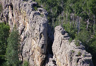
Kyrinsky District is an administrative and municipal district (raion), one of the thirty-one in Zabaykalsky Krai, Russia. It is located in the southwest of the krai, and borders with Ulyotovsky District in the north. The area of the district is 16,200 square kilometers (6,300 sq mi). Its administrative center is the rural locality of Kyra. Population: 13,650 (2010 Russian census); 16,016 ; 19,593 (1989 Soviet census). The population of Kyra accounts for 33.4% of the district's total population.

Mogochinsky District is an administrative and municipal district (raion), one of the thirty-one in Zabaykalsky Krai, Russia. It is located in the east of the krai and borders China in the east and south. The area of the district is 25,500 square kilometers (9,800 sq mi). Its administrative center is the town of Mogocha. As of the 2010 Census, the total population of the district was 25,508, with the population of Mogocha accounting for 52.0% of that number.

Nerchinsko-Zavodsky District is an administrative and municipal district (raion), one of the thirty-one in Zabaykalsky Krai, Russia. It is located in the east and southeast of the krai, and borders with Gazimuro-Zavodsky District in the north, and Kalgansky District in the south. The area of the district is 9,700 square kilometers (3,700 sq mi). Its administrative center is the rural locality of Nerchinsky Zavod. Population: 10,782 (2010 Russian census); 12,499 ; 15,605 (1989 Soviet census). The population of Nerchinsky Zavod accounts for 26.4% of the district's total population.

Nerchinsky District is an administrative and municipal district (raion), one of the thirty-one in Zabaykalsky Krai, Russia. It is located in the center of the krai, and borders with Tungokochensky District in the north, Chernyshevsky District in the east, Baleysky District in the south, and with Shilkinsky District in the west. The area of the district is 5,500 square kilometers (2,100 sq mi). Its administrative center is the town of Nerchinsk. Population: 28,455 (2010 Russian census); 30,694 ; 33,755 (1989 Soviet census). The population of Nerchinsk accounts for 52.6% of the district's total population.

Olovyanninsky District is an administrative and municipal district (raion), one of the thirty-one in Zabaykalsky Krai, Russia. It is located in the south of the krai, and borders with Baleysky District in the north, Borzinsky District in the south, and with Mogoytuysky District in the west. The area of the district is 6,300 square kilometers (2,400 sq mi). Its administrative center is the urban-type settlement) of Olovyannaya. Population: 43,494 (2010 Russian census); 49,426 ; 60,810 (1989 Soviet census). The population of Olovyannaya accounts for 19.3% of the district's total population.

Petrovsk-Zabaykalsky District is an administrative district (raion), one of the thirty-one in Zabaykalsky Krai, Russia. It is located in the southwest of the krai, and borders Khiloksky District in the east, Krasnochikoysky District in the south, and Bichursky District, Kizhinginsky District, Mukhorshibirsky District, Zaigrayevsky District of the Republic of Buryatia in the west and north. The area of the district is 8,700 square kilometers (3,400 sq mi). Its administrative center is the town of Petrovsk-Zabaykalsky. As of the 2010 Census, the total population of the district was 37,900, with the population of the administrative center accounting for 48.9% of that number.
Priargunsky District is an administrative and municipal district (raion), one of the thirty-one in Zabaykalsky Krai, Russia. It is located in the southeast of the krai, and borders with Kalgansky District in the north, and with Krasnokamensky District in the south. The area of the district is 5,100 square kilometers (2,000 sq mi). Its administrative center is the urban locality of Priargunsk. Population: 21,831 (2010 Russian census); 26,959 ; 29,120 (1989 Soviet census). The population of Priargunsk accounts for 33.8% of the district's total population.
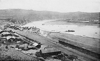
Sretensky District is an administrative and municipal district (raion), one of the thirty-one in Zabaykalsky Krai, Russia. It is located in the east of the krai, and borders with Mogochinsky District in the north, Gazimuro-Zavodsky District in the east, and with District in the west. The area of the district is 15,600 square kilometers (6,000 sq mi). Its administrative center is the town of Sretensk. Population: 23,311 (2010 Russian census); 27,524 ; 33,236 (1989 Soviet census). The population of Sretensk accounts for 29.4% of the district's total population.
Zabaykalsky District is an administrative and municipal district (raion), one of the thirty-one in Zabaykalsky Krai, Russia. It is located in the southeast of the krai, and borders with Borzinsky District in the north, Krasnokamensky District in the east, District in the south, and with District in the west. The area of the district is 5,100 square kilometers (2,000 sq mi). Its administrative center is the urban locality of Zabaykalsk. Population: 20,485 (2010 Russian census); 20,343 ; 22,121 (1989 Soviet census). The population of Zabaykalsk accounts for 57.5% of the district's total population.

Mogoytuysky District is an administrative and municipal district (raion) of Agin-Buryat Okrug of Zabaykalsky Krai, Russia, one of the thirty-one in the krai, and borders with Shilkinsky District in the north, Olovyanninsky District in the east, Ononsky District in the south, and with Aginsky District in the west. The area of the district is 6,300 square kilometers (2,400 sq mi). Its administrative center is the urban locality of Mogoytuy. Population: 27,463 (2010 Russian census); 27,386 ; 28,647 (1989 Soviet census). The population of Mogoytuy accounts for 37.3% of the district's total population.

Amazar is an urban locality in Mogochinsky District of Zabaykalsky Krai, Russia. Population: 2,374 (2010 Russian census); 2,641 (2002 Census); 3,521 (1989 Soviet census).
Bukachacha is an urban locality in Chernyshevsky District of Zabaykalsky Krai, Russia. Population: 2,359 (2010 Russian census); 3,525 (2002 Census); 7,941 (1989 Soviet census).

Zhireken is an urban locality in Chernyshevsky District of Zabaykalsky Krai, Russia. Population: 4,565 (2010 Russian census); 3,937 (2002 Census); 5,493 (1989 Soviet census).


