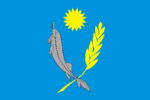
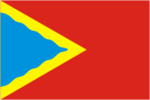
Flag of Astrakhan Oblast

Last updated
Flag of Astrakhan Oblast Flag of Astrakhan Oblast.svg
Flag of Astrakhan Oblast

The flag of Astrakhan Oblast , a federal subject of Russia, was adopted 19 December 2001. The flag is a crown (representing its status as an oblast) and scimitar (representing its influence from India) charge on a teal blue field. The ratio of the flag is 2:3. [1] [2]

Other flags

FlagDateUseDescription
Flag of Astrakhan.svg ?–presentFlag of Astrakhan city
Flag of Znamensk (Astrakhan oblast).png ?–presentFlag of Znamensk
Flag of Akhtubinsky district.svg ?–presentFlag of Akhtubinsky District
Flag of Chernoyarsky District.png ?–presentFlag of Chernoyarsky District
Flag of Kharabalinsky rayon (Astrakhan oblast).png ?–presentFlag of Kharabalinsky District
Flag of Krasnoyarsky rayon (Astrakhan oblast).png ?–presentFlag of Krasnoyarsky District
Flag of Limansky rayon (Astrakhan oblast).png ?–presentFlag of Limansky District
Flag of Narimanovsky District.png ?–presentFlag of Narimanovsky District
RUS Volodarskii raion flag.gif ?–presentFlag of Volodarsky District
RUS Enotaevskii raion flag.gif ?–presentFlag of Yenotayevsky District

Related Research Articles

<span class="mw-page-title-main">Astrakhan</span> Administrative centre of Astrakhan Oblast, Russia

Astrakhan is the largest city and administrative centre of Astrakhan Oblast in southern Russia. The city lies on two banks of the Volga, in the upper part of the Volga Delta, on eleven islands of the Caspian Depression, 60 miles from the Caspian Sea, with a population of 475,629 residents at the 2021 Census. At an elevation of 28 meters (92 ft) below sea level, it is the lowest city in Russia.

<span class="mw-page-title-main">Astrakhan Oblast</span> First-level administrative division of Russia

Astrakhan Oblast is a federal subject of Russia located in southern Russia. Its administrative center is the city of Astrakhan. As of the 2010 Census, its population was 1,010,073.

<span class="mw-page-title-main">Akhtubinsky District</span> District in Astrakhan Oblast, Russia

Akhtubinsky District is an administrative and municipal district (raion), one of the eleven in Astrakhan Oblast, Russia. It is located in the north of the oblast. The area of the district is 7,810 square kilometers (3,020 sq mi). Its administrative center is the town of Akhtubinsk Population : 29,326 (2010 Census); 31,963 ; 37,043 (1989 Census).

Kamyzyak is a town and the administrative center of Kamyzyaksky District in Astrakhan Oblast, Russia, located on the Kamyzyak River, 27 kilometers (17 mi) south of Astrakhan, the administrative center of the oblast. Population: 16,314 (2010 Census); 16,052 (2002 Census); 15,084 (1989 Census).

<span class="mw-page-title-main">Chernoyarsky District</span> District in Astrakhan Oblast, Russia

Chernoyarsky District is an administrative and municipal district (raion), one of the eleven in Astrakhan Oblast, Russia. It is located in the north of the oblast. The area of the district is 4,217.99 square kilometers (1,628.58 sq mi). Its administrative center is the rural locality of Chyorny Yar. As of the 2010 Census, the total population of the district was 20,220, with the population of Chyorny Yar accounting for 38.5% of that number.

<span class="mw-page-title-main">Ikryaninsky District</span> District in Astrakhan Oblast, Russia

Ikryaninsky District is an administrative and municipal district (raion), one of the eleven in Astrakhan Oblast, Russia. It is located in the south of the oblast. The area of the district is 1,950 square kilometers (750 sq mi). Its administrative center is the rural locality of Ikryanoye. As of the 2010 Census, the total population of the district was 47,759, with the population of Ikryanoye accounting for 21.0% of that number.

<span class="mw-page-title-main">Kamyzyaksky District</span> District in Astrakhan Oblast, Russia

Kamyzyaksky District is an administrative and municipal district (raion), one of the eleven in Astrakhan Oblast, Russia. It is located in the south of the oblast. The area of the district is 3,493 square kilometers (1,349 sq mi). Its administrative center is the town of Kamyzyak. As of the 2010 Census, the total population of the district was 48,647, with the population of Kamyzyak accounting for 33.5% of that number.

<span class="mw-page-title-main">Kharabalinsky District</span> District in Astrakhan Oblast, Russia

Kharabalinsky District is an administrative and municipal district (raion), one of the eleven in Astrakhan Oblast, Russia. It is located in the central and eastern parts of the oblast. The area of the district is 7,100 square kilometers (2,700 sq mi). Its administrative center is the town of Kharabali. Population: 41,176 (2010 Census); 40,955 ; 42,273 (1989 Census). The population of Kharabali accounts for 44.0% of the district's total population.

<span class="mw-page-title-main">Krasnoyarsky District, Astrakhan Oblast</span> District in Astrakhan Oblast, Russia

Krasnoyarsky District is an administrative and municipal district (raion), one of the eleven in Astrakhan Oblast, Russia. It is located in the southeast of the oblast. The area of the district is 5,260.48 square kilometers (2,031.08 sq mi). Its administrative center is the rural locality of Krasny Yar. As of the 2010 Census, the total population of the district was 35,615, with the population of Krasny Yar accounting for 33.2% of that number.

<span class="mw-page-title-main">Limansky District</span> District in Astrakhan Oblast, Russia

Limansky District is an administrative and municipal district (raion), one of the eleven in Astrakhan Oblast, Russia. It is located in the southwest of the oblast. The area of the district is 5,234 square kilometers (2,021 sq mi). Its administrative center is the urban locality of Liman. As of the 2010 Census, the total population of the district was 31,952, with the population of Liman accounting for 28.2% of that number.

<span class="mw-page-title-main">Narimanovsky District</span> District in Astrakhan Oblast, Russia

Narimanovsky District is an administrative and municipal district (raion), one of the eleven in Astrakhan Oblast, Russia. It is located in the southwest of the oblast. The area of the district is 6,100 square kilometers (2,400 sq mi). Its administrative center is the town of Narimanov. As of the 2010 Census, the total population of the district was 45,457, with the population of Narimanov accounting for 25.3% of that number.

<span class="mw-page-title-main">Privolzhsky District, Astrakhan Oblast</span> District in Astrakhan Oblast, Russia

Privolzhsky District is an administrative and municipal district (raion), one of the eleven in Astrakhan Oblast, Russia. It is located in the south of the oblast. The area of the district is 840.9 square kilometers (324.7 sq mi). Its administrative center is the rural locality of Nachalovo. Population: 43,647 (2010 Census); 38,649 ; 38,575 (1989 Census). The population of Nachalovo accounts for 12.5% of the district's total population.

<span class="mw-page-title-main">Volodarsky District, Astrakhan Oblast</span> District in Astrakhan Oblast, Russia

Volodarsky District is an administrative and municipal district (raion), one of the eleven in Astrakhan Oblast, Russia. It is located in the south of the oblast. The area of the district is 3,883 square kilometers (1,499 sq mi). Its administrative center is the rural locality of Volodarsky. Population: 47,825 (2010 Census); 47,351 ; 46,638 (1989 Census). The population of the administrative center accounts for 20.9% of the district's total population.

<span class="mw-page-title-main">Yenotayevsky District</span> District in Astrakhan Oblast, Russia

Yenotayevsky District is an administrative and municipal district (raion), one of the eleven in Astrakhan Oblast, Russia. It is located in the west of the oblast. The area of the district is 6,300 square kilometers (2,400 sq mi). Its administrative center is the rural locality of Yenotayevka. Population: 26,786 (2010 Census); 27,625 ; 29,093 (1989 Census). The population of Yenotayevka accounts for 28.4% of the district's total population.

<span class="mw-page-title-main">Ikryanoye</span> Rural locality in Astrakhan Oblast, Russia

Ikryanoye is a rural locality and the administrative center of Ikryaninsky District of Astrakhan Oblast, Russia. Population: 10,036 (2010 Census); 9,925 (2002 Census); 9,629 (1989 Census).

<span class="mw-page-title-main">Krasny Yar, Astrakhan Oblast</span> Rural locality and the administrative center of Krasnoyarsky District of Astrakhan Oblast, Russia

Krasny Yar is a rural locality and the administrative center of Krasnoyarsky District of Astrakhan Oblast, Russia. Population: 11,824 (2010 Census); 10,926 (2002 Census); 10,875 (1989 Census).

Nachalovo is a rural locality and the administrative center of Privolzhsky District of Astrakhan Oblast, Russia. Population: 5,451 (2010 Census); 4,830 (2002 Census); 3,922 (1989 Census).

<span class="mw-page-title-main">Volodarsky, Astrakhan Oblast</span> Rural locality in Astrakhan Oblast, Russia

Volodarsky is a rural locality and the administrative center of Volodarsky District of Astrakhan Oblast, Russia. Population: 10,005 (2010 Census); 9,553 (2002 Census); 9,326 (1989 Census).

Liman is an urban-type settlement and the administrative center of Limansky District of Astrakhan Oblast, Russia. Population: 9,024 (2010 Census); 8,899 (2002 Census); 9,185 (1989 Census).

<span class="mw-page-title-main">Duma of Astrakhan Oblast</span> Regional parliament of Astrakhan Oblast, Russia

The Duma of Astrakhan Oblast, formerly the State Duma of Astrakhan Oblast (2001–2010), is the regional parliament of Astrakhan Oblast, a federal subject of Russia. A total of 44 deputies are elected for five-year terms.

References

  1. "Закон Астраханской области от 19.12.2001 № 62/2001−ОЗ «О флаге и гербе Астраханской области»". Archived from the original on 2019-08-10. Retrieved 2021-09-09.
  2. Flags of the World