Proportion | 2:3 |
---|---|
Adopted | 28 November 1995 |
Design | White silhouette of Sakhalin Island and Kuril Islands on a faded turquoise field |
Designed by | Vitaliy Evgenievich Gomilevsky |
The flag of Sakhalin Oblast features a white silhouette of Sakhalin Island and the Kuril Islands on a faded turquoise field. [1] It was adopted on 28 November 1995.
Flag | Date | Use | Description |
---|---|---|---|
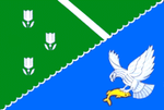
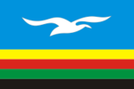
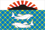
?–present | Flag of Yuzhno-Sakhalinsk | ||
?–present | Flag of Alexandrovsk-Sakhalinsky District | ||
?–present | Flag of Anivsky District | ||
?–present | Flag of Dolinsky District | ||
?–present | Flag of Kurilsky District | ||
?–present | Flag of Makarovsky District | ||
?–present | Flag of Nevelsky District | ||
?–present | Flag of Nogliksky District | ||
?–present | Flag of Okhinsky District | ||
?–present | Flag of Poronaysky District | ||
?–present | Flag of Severo-Kurilsky District | ||
?–present | Flag of Tomarinsky District | ||
?–present | Flag of Tymovsky District | ||
?–present | Flag of Uglegorsky District | ||
?–present | Flag of Kholmsky District | ||
?–present | Flag of Yuzhno-Kurilsky District |
The Sea of Okhotsk is a marginal sea of the western Pacific Ocean. It is located between Russia's Kamchatka Peninsula on the east, the Kuril Islands on the southeast, Japan's island of Hokkaido on the south, the island of Sakhalin along the west, and a stretch of eastern Siberian coast along the west and north. Its northeast corner is the Shelikhov Gulf. The sea is named for the port of Okhotsk, itself named for the Okhota River.
Sakhalin is an island in Northeast Asia. Its north coast lies 6.5 km (4.0 mi) off the southeastern coast of Khabarovsk Krai in Russia, while its southern tip lies 40 kilometres (25 mi) north of the Japanese island of Hokkaido. An island of the West Pacific, Sakhalin divides the Sea of Okhotsk to its east from the Sea of Japan to its southwest. It is administered as part of Sakhalin Oblast and is the largest island of Russia, with an area of 72,492 square kilometres (27,989 sq mi). The island has a population of roughly 500,000, the majority of whom are Russians. The indigenous peoples of the island are the Ainu, Oroks, and Nivkhs, who are now present in very small numbers.
Strait of Tartary or Gulf of Tartary is a strait in the Pacific Ocean dividing the Russian island of Sakhalin from mainland Asia, connecting the Sea of Okhotsk on the north with the Sea of Japan on the south. It is 632 km (393 mi) long, 7–23 km (4.3–14.3 mi) wide, and only 4 m (13 ft) deep at its shallowest point.
The Kuril Islands or Kurile Islands are a volcanic archipelago administered as part of Sakhalin Oblast in the Russian Far East. The islands stretch approximately 1,300 km (810 mi) northeast from Hokkaido in Japan to Kamchatka Peninsula in Russia, separating the Sea of Okhotsk from the north Pacific Ocean. There are 56 islands and many minor islets. The Kuril Islands consist of the Greater Kuril Chain and, at the southwest end, the parallel Lesser Kuril Chain. They cover an area of around 10,503.2 square kilometres (4,055.3 sq mi), with a population of roughly 20,000.
Sakhalin Oblast is a federal subject of Russia comprising the island of Sakhalin and the Kuril Islands in the Russian Far East. The oblast has an area of 87,100 square kilometers (33,600 sq mi). Its administrative center and largest city is Yuzhno-Sakhalinsk. As of the 2021 Census, the oblast has a population of 466,609.
Yuzhno-Sakhalinsk is a city and the administrative center of Sakhalin Oblast, Russia. It is located on Sakhalin Island in the Russian Far East, north of Japan. Gas and oil extraction as well as processing are amongst the main industries on the island. It was called Vladimirovka (Влади́мировка) from 1882 to 1905, then Toyohara during its period of Imperial Japanese control from 1905 to 1946. As of the 2010 Census, its population was 181,728.
Severo-Kurilsk is a town and the administrative center of Severo-Kurilsky District of Sakhalin Oblast, Russia, located in the northern part of the Kuril Islands, on the island of Paramushir. Population: 2,536 (2010 Census); 2,592 (2002 Census); 5,180 (1989 Soviet census).
Karafuto Prefecture, derived from the Japanese Karafuto Chō (樺太廳/樺太庁,からふとちょう), was established by the Empire of Japan in 1907 to govern the southern part of Sakhalin, referred to by Japan as Karafuto. This territory became part of the Empire of Japan in 1905 after the Russo-Japanese War, when the portion of Sakhalin south of 50°N was ceded by the Russian Empire under the Treaty of Portsmouth.
The Sakhalin-2 project is an oil and gas development in Sakhalin Island, Russia. It includes development of the Piltun-Astokhskoye oil field and the Lunskoye natural gas field offshore Sakhalin Island in the Okhotsk Sea, and associated infrastructure onshore. The project is managed and operated by Sakhalin Energy Investment Company Ltd..
Oroks, sometimes called Uilta, are a people in the Sakhalin Oblast in Russia. The Orok language belongs to the Southern group of the Tungusic language family. According to the 2002 Russian census, there were 346 Oroks living in Northern Sakhalin by the Okhotsk Sea and Southern Sakhalin in the district by the city of Poronaysk. According to the 2010 census there were 295 Oroks in Russia.
UTC+11:00 is an identifier for a time offset from UTC of +11:00. This time is used in:
The Sakhalin Husky is a critically endangered landrace and sled laika associated with Sakhalin Island and adjacent areas. They are also known Karafuto Ken, Sakhalin Laika, or Gilyak Laika. While bred primarily as a sled dog, Sakhalin Huskies are also used for hunting bear and fishing. In 1989, there were approximately 20 Sakhalin Huskies remaining on Sakhalin Island.
Kurilsk is a town and the administrative center of Kurilsky District of Sakhalin Oblast, Russia, located on the island of Iturup. Population: 2,070 (2010 Census); 2,233 (2002 Census); 2,699 (1989 Soviet census).
Yuzhno-Kurilsk is an urban locality and the administrative center of Yuzhno-Kurilsky District of Sakhalin Oblast, Russia. Population: 5,832 (2010 Census); 5,751 (2002 Census); 6,344 (1989 Soviet census). It is the largest settlement on the Kunashir Island of the Kuril Islands.
Sakhalin Koreans are Russian citizens and residents of Korean descent living on Sakhalin Island, who can trace their roots to the immigrants from the Gyeongsang and Jeolla provinces of Korea during the late 1930s and early 1940s, the latter half of the Japanese ruling era.
Sakhalin Energy Investment Company Ltd. is a consortium for developing the Sakhalin-2 oil and gas project with corporate head office in Yuzhno-Sakhalinsk. Roman Dashkov has been the Chief Executive Officer since 2013.
The Sakhalin Tunnel is an incomplete and currently indefinitely postponed construction project, which after completion would have connected the island of Sakhalin with mainland Russia via a tunnel of approximately 10 kilometres (6 mi) under the Nevelskoy Strait.
Sakhalin Railway is a division of the Far Eastern Railway that primarily serves Sakhalin Island. Due to its island location, the railway is the second isolated 1520mm gauge network in Russia, like the Norilsk railway. The only main connection to the mainland is the Vanino–Kholmsk train ferry. The management is located at Yuzhno-Sakhalinsk.
The Soviet invasion of South Sakhalin, also known as the Battle of Sakhalin, was the Soviet invasion of the Japanese portion of Sakhalin Island known as Karafuto Prefecture. The invasion was part of the Soviet–Japanese War, a minor campaign in the Asian Theatre during Second World War.
From 1264 to 1308, the Mongol Empire made several incursions into the island of Sakhalin off the east coast of Siberia to aid their Nivkh allies against the Ainu, who had been expanding north from Hokkaido. The Ainu put up a tenacious resistance, even launching a counter-attack on Mongol positions on the continent across the Strait of Tartary in 1297, but finally capitulated to the Mongol-led Yuan dynasty of China in 1308.