Flag of Irkutsk Oblast

Last updated
Flag of the Irkutsk Oblast
Flag of Irkutsk Oblast.svg
Proportion2:3
Adopted25 July 1997
Design3 bands of blue, white, blue; within the white, a black, stylized tiger holding a sable in its mouth, surrounded by branches of cedar

The flag of the Irkutsk Oblast depicts three vertical stripes in the ratio 1:2:1: blue on the hoist and fly and white in the middle. Within the white strip, a stylized black tiger-beaver hybrid (the same depicted on the oblast's coat of arms, known as a heraldic babr) is seen holding a sable in its mouth. These two are surrounded by branches of cedar. The blue represents the waters of Lake Baikal, while white represents purity, goodness, and honesty. The green of the cedar branches represents hope, joy, and abundance. [1] [2]

Contents

Origin of the babr

Initially, in Siberia, the word babr (бабр, derived from the Siberian Turkic borrowing of the word in Persian) signified a Siberian tiger, as opposed to the tigr (Russian : тигр) used in western Russia. It first appeared in the coat of arms of Yakutsk under the former, correct interpretation in 1642, later becoming the heraldic symbol of Irkutsk in 1690 after the transfer of the headquarters of the governors of Siberia. [3] However, officials in St. Petersburg were unaware of the word's meaning when modifying the coat of arms of Irkutsk in the late 1870s, and someone assumed it to be a misspelling of the Russian word bobr (бобр), meaning beaver. This then had to be reconciled with pre-existing heraldry depicting a tiger, resulting in a hybrid with the body and face of a tiger but the legs, feet, and tail of a beaver. [4] The error went unnoticed until 1997 when the coat of arms came up for review again, although due to its longstanding use under the erroneous definition, the current babr still more resembles it than the initial correct definition.

Other flags

FlagDateUseDescription
Flag of Irkutsk (Irkutsk oblast).svg ?–presentFlag of Irkutsk city
Flag of Ust-Orda Buryat Autonomous Okrug.svg 1 January 2008–presentFlag of the Ust-Orda Buryat Okrug
18 September 1997–1 January 2008 Flag of the Ust-Orda Buryat Autonomous Okrug
Flag of Ust-Orda Buryat Autonomous Okrug (07-1997).svg 17 July 1997–18 September 1997
Flag of Bratsk (Irkutsk oblast).png 2007–presentFlag of Bratsk
Flag of Bratsk (Irkutsk oblast) (2007).png ?–2007
Flag of Zima (Irkutsk oblast).gif ?–presentFlag of Zima
Flag of Sayansk (Irkutsk oblast).png ?–presentFlag of Sayansk
Flag of Svirsk (Irkutsk oblast).gif ?–presentFlag of Svirsk
Flag of Tulun.png ?–presentFlag of Tulun
Flag of Ussolie-Sibirskoye (Irkutsk oblast).png ?–presentFlag of Usolye-Sibirskoye
Flag of Ust-Ilimsk (Irkutsk oblast).png 2010?–presentFlag of Ust-Ilimsk
Flag of Cheremkhovo.svg ?–presentFlag of Cheremkhovo
Flag of Balagansky District.png ?–presentFlag of Balagansky District A horizontal bicolor of gold and green, with a double-headed eagle on the top and 3 triangles in the bottom.
Flag of Angarsk (2004).svg 2004?–presentFlag of Angarsky District
Flag of Bratsky rayon (Irkutsk oblast).png ?–presentFlag of Bratsky District
Flag of Alarsky District.png ?–presentFlag of Alarsky District
Flag of Zhigalovsky rayon (Irkutsk oblast).png ?–presentFlag of Zhigalovsky District
Flag of Bayandaevsky rayon (Irkutsk oblast).png ?–presentFlag of Bayandayevsky District
Flag of Zalarinsky rayon (Irkutsk oblast).png ?–presentFlag of Zalarinsky District
Flag of Bokhansky District.png ?–presentFlag of Bokhansky District
Flag of Ziminsky rayon (Irkutsk oblast).svg ?–presentFlag of Ziminsky District
Flag of Irkutsky rayon (Irkutsk oblast).png ?–presentFlag of Irkutsky District
Flag of Katangsky rayon (Irkutsk oblast).png ?–presentFlag of Katangsky District
Flag of Kazachinsko-Lensky rayon.svg ?–presentFlag of Kazachinsko-Lensky District
Flag of Kachugsky rayon (Irkutsk oblast).png ?–presentFlag of Kachugsky District
Flag of Kirensky rayon.svg ?–presentFlag of Kirensky District
Flag of Kuytunsky rayon (Irkutsk oblast).png ?–presentFlag of Kuytunsky District
Flag of Mamsko-Chuysky District.png ?–presentFlag of Mamsko-Chuysky District
Flag of Nizhneilimsky rayon (Irkutsk oblast).png ?–presentFlag of Nizhneilimsky District
Flag of Nizhneudinsky District.png ?–presentFlag of Nizhneudinsky District
Flag of Nukutsky District.png ?–presentFlag of Nukutsky District
Flag of Olhonsky rayon.png ?–presentFlag of Olkhonsky District
Flag of Osinsky District (Irkutsk Oblast).png ?–presentFlag of Osinsky District
Flag of Slyudyansky rayon (Irkutsk oblast).png ?–presentFlag of Slyudyansky District
Flag of Tayshetsky District.png ?–presentFlag of Tayshetsky District
Flag of Tulunsky rayon.png ?–presentFlag of Tulunsky District
Flag of Usolsky rayon (Irkutsk oblast).gif ?–presentFlag of Usolsky District
Flag of Ust-Ilimsky rayon (Irkutsk oblast).png ?–presentFlag of Ust-Ilimsky District
Flag of Ust-Kut rayon.gif ?–presentFlag of Ust-Kutsky District
Flag of Cheremkhovsky rayon.svg ?–presentFlag of Cheremkhovsky District
Flag of Chunsky rayon (Irkutsk oblast).gif ?–presentFlag of Chunsky District
Flag of Shelekhovsky District.png ?–presentFlag of Ekhirit-Bulagatsky District

Related Research Articles

<span class="mw-page-title-main">Irkutsk</span> City in Irkutsk Oblast, Russia

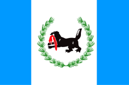
Irkutsk is the largest city and administrative center of Irkutsk Oblast, Russia. With a population of 617,473 as of the 2010 Census, Irkutsk is the 25th-largest city in Russia by population, the fifth-largest in the Siberian Federal District, and one of the largest cities in Siberia.

<span class="mw-page-title-main">Tayshet</span> Town in Irkutsk Oblast, Russia

Tayshet is a town and the administrative center of Tayshetsky District in Irkutsk Oblast, Russia, located 669 kilometers (416 mi) northwest of Irkutsk, the administrative center of the oblast. Population: 35,485 (2010 Census); 38,535 (2002 Census); 42,391 (1989 Census).

<span class="mw-page-title-main">Angarsk</span> City in Irkutsk Oblast, Russia

Angarsk is a city and the administrative center of Angarsky District of Irkutsk Oblast, Russia, located on the Kitoy River, 51 kilometers (32 mi) from Irkutsk, the administrative center of the oblast. Population: 221,296 (2021 Census); 233,567 (2010 Census); 247,118 (2002 Census); 265,835 (1989 Census).

<span class="mw-page-title-main">Usolye-Sibirskoye</span> Town in Irkutsk Oblast, Russia

Usolye-Sibirskoye is a town in Irkutsk Oblast, Russia, located on the left bank of the Angara River. Population: 76,047 (2010 Census); 90,161 (2002 Census); 106,496 (1989 Census).

<span class="mw-page-title-main">Nizhneudinsk</span> Town in Irkutsk Oblast, Russia

Nizhneudinsk is a town and the administrative center of Nizhneudinsky District of Irkutsk Oblast, Russia, located on the Uda River, 506 kilometers (314 mi) northwest of Irkutsk, the administrative center of the oblast. Population: 36,999 (2010 Census); 39,624 (2002 Census); 43,759 (1989 Census); 39,700 (1970).

<span class="mw-page-title-main">Cheremkhovo</span> Town in Irkutsk Oblast, Russia

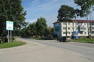
Cheremkhovo is a town in Irkutsk Oblast, Russia, located on the Trans-Siberian Railway.

<span class="mw-page-title-main">Ust-Kut</span> Town in Irkutsk Oblast, Russia

Ust-Kut is a town and the administrative center of Ust-Kutsky District in Irkutsk Oblast, Russia, located 961 kilometers (597 mi) from Irkutsk, the administrative center of the oblast. Located on a western loop of the Lena River, the town spreads out for over 20 kilometers (12 mi) along the left bank, near the point where the Kuta River joins from the west. Population: 45,375 (2010 Census); 49,951 (2002 Census); 61,165 (1989 Census).

<span class="mw-page-title-main">Zima (town)</span> Town in Irkutsk Oblast, Russia

Zima is a town in Irkutsk Oblast, Russia, located at the point where the Trans-Siberian Railway crosses the Oka River. Population: 32,508 (2010 Census); 34,899 (2002 Census); 41,814 (1989 Census).

<span class="mw-page-title-main">Slyudyanka</span> Town in Irkutsk Oblast, Russia

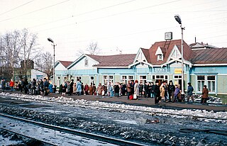
Slyudyanka is a town and the administrative center of Slyudyansky District of Irkutsk Oblast, Russia, located at the southern tip of Lake Baikal, 126 kilometers (78 mi) south of Irkutsk, the administrative center of the oblast. Population: 18,574 (2010 Census); 19,118 (2002 Census); 19,872 (1989 Census).

<span class="mw-page-title-main">Sayansk</span> Town in Irkutsk Oblast, Russia

Sayansk is a town in Irkutsk Oblast, Russia, located on the Oka River 270 kilometers (170 mi) northwest of Irkutsk. Population: 40,800 (2010 Census); 43,468 (2002 Census); 38,169 (1989 Census).

<span class="mw-page-title-main">Tulun</span> Town in Irkutsk Oblast, Russia

Tulun is a town in Irkutsk Oblast, Russia, located on the river Iya, 390 kilometers (240 mi) northwest of Irkutsk. Population: 44,611 (2010 Census); 51,848 (2002 Census); 52,903 (1989 Census).

<span class="mw-page-title-main">Coat of arms of the Jewish Autonomous Oblast</span> Coat of arms

The coat of arms of the Jewish Autonomous Oblast is the official coat of arms of the Jewish Autonomous Oblast in Russia. The coat of arms consists of an Amur tiger standing on four legs with the tail and the head turned upwards, of which the latter is facing the observer. This specific position and occurrence of the Amur tiger in the coat of arms symbolizes the history and development of the Oblast. The coat is a heraldic French shield and the background represents the color of the geographical characteristics of the Russian Far East; which includes taigas, hills, and meadows.

<span class="mw-page-title-main">Balagansky District</span> District in Irkutsk Oblast, Russia

Balagansky District is an administrative district, one of the thirty-three in Irkutsk Oblast, Russia. Municipally, it is incorporated as Balagansky Municipal District. The area of the district is 6,634.7 square kilometers (2,561.7 sq mi). Its administrative center is the urban locality of Balagansk. Population: 9,194 (2010 Census); 9,973. The population of Balagansk accounts for 44.7% of the district's total population.

<span class="mw-page-title-main">Bratsky District</span> District in Irkutsk Oblast, Russia

Bratsky District is an administrative district, one of the thirty-three in Irkutsk Oblast, Russia. Municipally, it is incorporated as Bratsky Municipal District. It is located in the northwest of the oblast. The area of the district is 33,660 square kilometers (13,000 sq mi). Its administrative center is the city of Bratsk. Population: 56,878 (2010 Census); 65,240 ; 76,945 (1989 Census).

<span class="mw-page-title-main">Nizhneilimsky District</span> District in Irkutsk Oblast, Russia

Nizhneilimsky District is an administrative district, one of the thirty-three in Irkutsk Oblast, Russia. Municipally, it is incorporated as Nizhneilimsky Municipal District. The area of the district is 36,823 square kilometers (14,217 sq mi). Its administrative center is the town of Zheleznogorsk-Ilimsky. Population: 55,096 (2010 Census); 63,727 ; 77,291 (1989 Census).

<span class="mw-page-title-main">Shelekhovsky District</span> District in Irkutsk Oblast, Russia

Shelekhovsky District is an administrative district, one of the thirty-three in Irkutsk Oblast, Russia. Municipally, it is incorporated as Shelekhovsky Municipal District. It is located in the south of the oblast. The area of the district is 2,020 square kilometers (780 sq mi). Its administrative center is the town of Shelekhov. Population: 14,435 (2010 Census); 11,836.

Balagansk is an urban locality and the administrative center of Balagansky District, Irkutsk Oblast, Russia. It is located on the left bank of the Angara River, downstream from Svirsk and 285 kilometres (177 mi) by road northwest of Irkutsk and to the southeast of Sayansk. Population: 4,109 (2010 Census); 4,307 (2002 Census); 4,136 (1989 Census).

Alexeyevsk is an urban locality in Kirensky District of Irkutsk Oblast, Russia. Population: 2,529 (2010 Census); 3,164 (2002 Census); 3,685 (1989 Census).

Artyomovsky is an urban locality in Bodaybinsky District of Irkutsk Oblast, Russia. Population: 1,539 (2010 Census); 2,186 (2002 Census); 3,773 (1989 Census).

Atagay is an urban locality in Nizhneudinsky District of Irkutsk Oblast, Russia. Population: 1,740 (2010 Census); 1,853 (2002 Census); 4,177 (1989 Census).

References

  1. Закон Иркутской области от 16.07.1997 № 30-ОЗ «О гербе и флаге Иркутской области», принят постановлением Законодательного собрания Иркутской области от 25.06.1997 № 11/2-ЗС, вступил в силу 20.09.1997
  2. "Вексиллография: Флаг Иркутской области". Vexillographia. Archived from the original on 2020-10-21. Retrieved 2010-05-05.
  3. П. П. фон-Винклер. (1899). Гербы городов, губерний, областей и посадов Российской Империи, внесенные в Полное Собрание законов с 1649 по 1900 год (Издание книготорговца Ив. Ив. Иванова не указаны экз ed.). СПб.: Типография И.М. Комелова, Пряжка д.3. Дозволено цензурою. С.-Петербург, 20 Июля, 1899 года.
  4. Оленин Р. М., Карманов В. В. (1999). История гербовой символики Приозерья. К 270-летию официального утверждения Корелъского и Кексголъмского гербов, созданных Франциско Санти. 1729 г.