
The Richmond District is a neighborhood in the northwest corner of San Francisco, California, developed initially in the late 19th century. It is sometimes confused with the city of Richmond, which is 20 miles (32 km) northeast of San Francisco; accordingly, the neighborhood usually is referred to as "the Richmond."
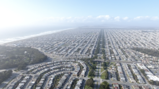
The Sunset District is a neighborhood located in the southwest quadrant of San Francisco, California, United States.
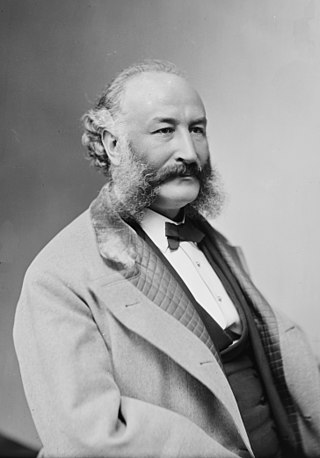
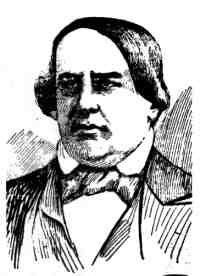
Adolph Heinrich Joseph Sutro was a German-American engineer, politician and philanthropist who served as the 24th mayor of San Francisco from 1895 until 1897. Born a German Jew, he moved to Virginia City, Nevada and made a fortune at the Comstock Lode. Several places in San Francisco bear his name in remembrance of his life and contributions to the city.

The Sutro Baths was a large, privately owned public saltwater swimming pool complex in the Lands End area of the Outer Richmond District in western San Francisco, California.
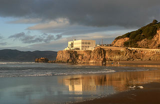
Ocean Beach is a beach on the west coast of San Francisco, California, United States, bordering the Pacific Ocean. It is adjacent to Golden Gate Park, the Richmond District, and the Sunset District. The Great Highway runs alongside the beach, and the Cliff House and the site of the former Sutro Baths sit at the northern end. The beach is a part of the Golden Gate National Recreation Area, which is administered by the National Park Service. It is accessible via Muni Metro at the Judah and La Playa station.
Cole Valley is a small neighborhood in San Francisco, California. It borders Golden Gate Park to the north, Haight-Ashbury to the northeast, The Castro to the east, and Twin Peaks to the south. Near Kezar Stadium, Cole Valley is the smallest neighborhood in the city.

Geary Boulevard is a major east–west 5.8-mile-long (9 km) thoroughfare in San Francisco, California, United States, beginning downtown at Market Street near Market Street's intersection with Kearny Street, and running westbound through downtown, the Civic Center area, the Western Addition, and running for most of its length through the predominantly residential Richmond District. Geary Boulevard terminates near Sutro Heights Park at 48th Avenue, close to the Cliff House above Ocean Beach at the Pacific Ocean. At 42nd Avenue, Geary intersects with Point Lobos Avenue, which takes through traffic to the Cliff House, Ocean Beach and the Great Highway. It is a major commercial artery through the Richmond District; it is lined with stores and restaurants, many of them catering to the various immigrant groups who live in the area. The boulevard borders Japantown between Fillmore and Laguna Streets.

Forest Hill is a neighborhood in San Francisco, California. Forest Hill is one of eight master-planned residence parks in San Francisco. Forest Hill is located near the middle of the City of San Francisco, southeast of the Inner Sunset and northeast of West Portal. Boundaries are roughly Seventh Avenue/Laguna Honda Boulevard to the north and east, Taraval Street to the south, and 14th Avenue to the west.

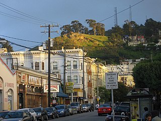
Mount Sutro is a hill in central San Francisco, California. It was originally named Mount Parnassus.

Mount Davidson is the highest natural point in San Francisco, California, with an elevation of 928 feet (283 m). It is located near the geographical center of the city, south of Twin Peaks and Portola Drive and to the west of Diamond Heights and Glen Park. It dominates the southeastern view from most of Portola Drive. It is one of San Francisco's many hills and one of its original "Seven Hills".
The University of California, San Francisco Medical Center is a research and teaching hospital in San Francisco, California, and is the medical center of the University of California, San Francisco. It is affiliated with the UCSF School of Medicine.

The Golden Gate National Recreation Area (GGNRA) is a U.S. National Recreation Area protecting 82,116 acres (33,231 ha) of ecologically and historically significant landscapes surrounding the San Francisco Bay Area. Much of the park is land formerly used by the United States Army. GGNRA is managed by the National Park Service and is the second-most visited unit of the National Park system in the United States, with more than 15.6 million visitors in 2022. It is also one of the largest urban parks in the world, with a size two-and-a-half times that of the consolidated city and county of San Francisco.
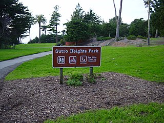
Sutro Heights Park is an historic public park in the Outer Richmond District of western San Francisco, California. It is within the Golden Gate National Recreation Area and the Sutro Historic District.
Forest Knolls may refer to:

Oak Knoll is the southernmost neighborhood in Pasadena, California. It is bordered by Oak Knoll Circle to the north, Old Mill Road to the south, South Oak Knoll Avenue and South Oakland Avenue to the west, and the San Marino border to the east.

Lands End is a park in San Francisco within the larger Golden Gate National Recreation Area. It is also the geographic name of a specific promontory next to the Pacific Ocean on the northwest side of the park. The park is in large part a rocky and windswept shoreline at the mouth of the Golden Gate, situated between the Sutro District and Lincoln Park and abutting Fort Miley Military Reservation. Numerous hiking trails follow the former railbeds of the Ferries and Cliff House Railway along the cliffs and also down to the shore.

Mount Olympus is a hill located on Upper Terrace in the Buena Vista neighborhood of San Francisco. It was once considered to mark the geographical center of the city, and was topped off by a statue given by Adolph Sutro, the Triumph of Light, now lost. Only the statue's pedestal remains, and the view from the top is obstructed by trees and condominiums.
Rancho San Miguel was a 4,443-acre (17.98 km2) Mexican land grant in present-day San Francisco County, California. The land grant was given in 1845 by Governor Pío Pico to José de Jesús Noé. It included what is now known as Eureka Valley, and extended past Mount Davidson almost to present-day Daly City; it encompassed the present-day San Francisco neighborhoods of Noe Valley, the Castro, Glen Park, Diamond Heights and St. Francis Wood.

