
The Old Cambridge Historic District is a historic district encompassing a residential neighborhood of Cambridge, Massachusetts that dates to colonial times. It is located just west of Harvard Square, and includes all of the properties on Brattle Street west of Mason Street to Fresh Pond Parkway, all of the properties on Mason Street and Elmwood Avenue, and nearby properties on Craigie Street. The district includes five National Historic Landmarks: Elmwood, the Reginald A. Daly House, the Oliver Hastings House, the Mary Fiske Stoughton House, and the Longfellow House–Washington's Headquarters National Historic Site, as well as several other houses listed separately on the National Register. The district follows the general route of the Watertown Path, an early colonial road that supposedly followed a Native American trail. This portion of the way became known as Tory Row during the American Revolution, because many of the fine mansions lining it were owned by Loyalists. In the 19th and early 20th centuries it continued by a fashionable location, and now features a number of architecturally significant buildings. It includes 215 contributing buildings and one other contributing sites over an area of 52 acres (21 ha). One included building is the Cambridge Historical Society's offices, which are in the NRHP-listed Hooper-Lee Nichols House, located at 159 Brattle Street.

The Gardner Uptown Historic District is a historic district encompassing the former civic heart of Gardner, Massachusetts. The 65-acre (26 ha) area includes the old town common, an early cemetery, and a modest number of non-residential buildings among a larger number of houses. The area was the center of civic life from the incorporation of Gardner in 1785 until municipal functions were moved to West Gardner beginning in the late 1920s. The district was listed on the National Register of Historic Places in 1999.

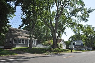
The Acushnet Heights Historic District is a predominantly residential historic district in central New Bedford, Massachusetts. It encompasses a densely-built urban area about 20 acres (8.1 ha) in size, which was developed as a working-class area, beginning in the 1860s, for the many workers in the city's factories. The district was listed on the National Register of Historic Places in 1989. It abuts the North Bedford Historic District, which is just to the south, and includes the following separately-listed properties: the Union Street Railway Carbarn, the Bradford Smith Building, and the Dawson Building.

The Heath Center Historic District encompasses a rural village with predominantly 18th- and 19th-century structures in Heath, a small agricultural town in hills of northwestern Franklin County, Massachusetts, United States. The district is centered on the junction of several roads, around which the center of the town grew. South Road arrives from the south, East Main Street and Bray Road from the east, Ledge Road from the north, and West Main Street from the west.

The Main Street Historic District encompasses the civic core of Greenfield, Massachusetts, the county seat of Franklin County, Massachusetts. The district includes several blocks of Main Street extending roughly from Chapman Street in the west to Franklin Street in the east, as well as a number of properties facing the common along Bank Row, south of Main Street, and is architecture reflective of the city's 19th-century growth as a major crossroads and county seat. The district includes the town hall, county courthouse, several 19th century bank buildings, and three properties previously listed on the National Register of Historic Places: the Garden Theater Block, the Leavitt-Hovey House, and the 1915 Post Office building. The district was listed on the National Register of Historic Places in 1988.

The Montague Center Historic District encompasses the well-preserved 19th century village center of Montague, Massachusetts. Montague Center, one of the town's five villages, is the civic heart of the town, and was also an active industrial area in the 19th century. The district was listed on the National Register of Historic Places in 2001.

The New Salem Common Historic District encompasses the historic town center of New Salem, Massachusetts. Located on South Main Street, it includes the town common and most of its civic and institutional buildings. Most buildings in the district date to the 18th and 19th centuries. The district was listed on the National Register of Historic Places in 1978.
The Elm Street Historic District is a rural historic district in southern Hatfield, Massachusetts. It encompasses a landscape that has seen agricultural use since 17th century colonial days, including fields now used for tobacco farming, and historic properties located along five roads: Elm Street, Scotland Road, Sunset Road, Brook Hollow Road, and Little Neponset Road. The district is bounded on its south by the Connecticut River, on its east and north by the Mill River, with a small portion of land border in the northeast which cuts off a large meander in the river. This section, near the junction of Elm and Prospect Streets, is also where this district abuts the Mill-Prospect Street Historic District, which runs north along Prospect Street, and its eastern boundary abuts the Hatfield Center Historic District. Its western boundary is roughly a north-south line in the area of the junction of Elm and Dwight Streets.

The Federal Street District is a residential and civic historic district in Salem, Massachusetts, United States. It is an expansion of an earlier listing of the Essex County Court Buildings on the National Register of Historic Places in 1976. In addition to the former county court buildings included in the earlier listing, the district expansion in 1983 encompasses the entire block of Federal Street between Washington and North Streets. It includes buildings from 32 to 65 Federal Street, as well as the Tabernacle Church at 50 Washington Street.

The Common Historic District is a historic district encompassing the civic and institutional heart of Reading, Massachusetts. The district is centered on the town common, at the intersection of Main and Salem Streets. The common has been communally owned since at least 1737, with the original burying ground to the north. In 1769 the area's first meeting house was built, giving the area a sense of identity separate from portions of Reading that would later be set off as Wakefield and North Reading. Since then the area has become a focal point for religious and civic institutions in the town.

The Common District encompasses the main civic center of Wakefield, Massachusetts. It is centered on the historic town common, just south of Lake Quannapowitt, which was laid in 1644, when it became the heart of Old Reading. The area was separated from Reading as South Reading in 1818, and renamed Wakefield in 1868. The 25 acre district includes the buildings that line the common on Common Street and Main Street, which include the town hall, public library, YMCA, post office, and several churches. It was listed on the National Register of Historic Places in 1990.

The Brookline Town Green Historic District encompasses the historic colonial heart of the town of Brookline, Massachusetts. Centered on a stretch of Walnut Street between Warren and Chestnut Streets, this area is where the town's first colonial meeting house and cemetery were laid out, and was its center of civic life until the early 19th century. The district was listed on the National Register of Historic Places in 1980.

The Strathmore Road Historic District is a residential historic district on Strathmore Road and Clinton Path in Brookline, Massachusetts. It consists of six brick apartment blocks, four of which lie on Strathmore Road, and two of which lie on Clinton Path. The two streets form a loop just south of the westernmost portion of Beacon Street, and abutting the MBTA Green Line yard at Cleveland Circle. The district is reflective of the area's growth as a commuter suburb following the development of the rail line along Beacon Street, and was listed on the National Register of Historic Places in 1985.

St. Marks Presbyterian Church is a historic African-American Presbyterian church in Rogersville, Tennessee. Its building was added to the list of National Register of Historic Places in March 10, 2006.

Elias Carter (1781-1864) was an American architect whose first church design, at Brimfield, Massachusetts, was completed in 1805. He was born in 1781 to Timothy and Sarah (Walker) Carter in Ward, a village of Auburn, Massachusetts. His father, a builder, died when he was three, and the family moved to Hardwick when his mother remarried, to a farmer there. He followed in his father's profession, working in the American South for a time before returning to central Massachusetts. He was responsible for the construction of a number of churches in central Massachusetts, which an early biographer described as "typical white steepled churches of New England". His most influential design appears to have been the church in Templeton, Massachusetts, which inspired the design of at least two others. He also built houses throughout central Massachusetts, as well as a wing of the Westborough State Hospital, and played a role in the construction of the New Hampshire state insane asylum.

The Town Center Historic District encompasses the historic village center of South Hampton, New Hampshire. Centered around the Barnard Green, the town common, on New Hampshire Route 107A, it includes architectural reminders of the town's growth and change over time. The district was listed on the National Register of Historic Places in 1983.

The Thetford Hill Historic District encompasses the well-preserved 19th-century village center of Thetford Hill in Thetford, Vermont. Developed between 1792 and about 1860 and located at what is now the junction of Vermont Route 113 and Academy Road, it includes mainly residential buildings, as well as several buildings of Thetford Academy and the 1785-88 Thetford Meetinghouse, one of the state's oldest churches in continuous use. The district was listed on the National Register of Historic Places in 1988.

The Pearl Street Historic District of Burlington, Vermont encompasses part of the city's first major east-west transportation arteries, which developed from a fashionable residential area in the early 19th century to its present mixed use. It contains one of the city's highest concentrations of early Federal period architecture, as well as a number of fine Queen Anne and Colonial Revival houses. It was listed on the National Register of Historic Places in 1984.

The Watertown Center Historic District encompasses the historic village center of Watertown, Connecticut. It exhibits architectural and historic changes from the early 1700s into the 20th century. It is roughly bounded by Main, Warren, North, Woodbury, Woodruff, and Academy Hill Roads, and was listed on the National Register of Historic Places in 2001.

The Main and Franklin Streets Historic District is an historic district encompassing most of two city blocks in downtown Worcester, Massachusetts. Roughly bounded by Main, Franklin, Federal, Portland, and Salem Streets, the district includes a well-preserved concentration of commercial buildings constructed during Worcester's economic height in the late 19th and early 20th centuries. The district was listed on the National Register of Historic Places in 2022.


