Franklin Springs, Georgia

Last updated

Franklin Springs, Georgia
Franklin-Springs-pedestrian-bridge-ga.jpg
Pedestrian bridge over US 29; entrance to Emmanuel University on the left
Franklin County Georgia Incorporated and Unincorporated areas Franklin Springs Highlighted.svg
Location in Franklin County and the state of Georgia
Coordinates: 34°17′5″N83°8′36″W / 34.28472°N 83.14333°W / 34.28472; -83.14333
CountryUnited States
State Georgia
County Franklin
Area
[1]
  Total2.20 sq mi (5.69 km2)
  Land2.18 sq mi (5.64 km2)
  Water0.02 sq mi (0.05 km2)
Elevation
817 ft (249 m)
Population
 (2020)
  Total1,155
  Density530.06/sq mi (204.64/km2)
Time zone UTC−5 (Eastern (EST))
  Summer (DST) UTC−4 (EDT)
ZIP code
30639
Area code 706
FIPS code 13-31320 [2]
GNIS feature ID0331767 [3]
Website www.cityoffranklinsprings.com

Franklin Springs is a city in Franklin County, Georgia, United States. The population was 952 at the 2010 census, [4] up from 762 in 2000. Emmanuel University is located here.

Contents

History

Franklin Springs began in the 19th century as a resort spa, [5] with the city incorporating in 1924. [6]

The Franklin Springs Institute opened there in 1919 as a high school, eventually shifting to postsecondary education and changing its name to Emmanuel College in 1939.

On September 16, 2004, a magnitude 2 tornado moved north across the town of Franklin Springs, damaging or destroying numerous structures along its 3-mile path. [7] The city government building and the fire and police stations incurred significant damage, as did approximately 25 residences. [8] Franklin County Emergency Management reported 10 chicken houses, some housing as many as 30,000 chickens and valued at more than $100,000 each, were destroyed. [9] This was part of the Hurricane Ivan tornado outbreak.

Geography

Franklin Springs is located in southeastern Franklin County at 34°17′5″N83°8′36″W / 34.28472°N 83.14333°W / 34.28472; -83.14333 (34.284598, -83.143402). [10] It is bordered to the east by Royston. U.S. Route 29 passes through the center of the city, leading east 2 miles (3 km) to the center of Royston and southwest 28 miles (45 km) to Athens. Carnesville, the Franklin County seat, is 9 miles (14 km) to the northwest via Georgia State Route 145.

According to the United States Census Bureau, the city of Franklin Springs has a total area of 2.2 square miles (5.7 km2), of which 0.02 square miles (0.05 km2), or 0.82%, is water. [4]

Demographics

Historical population
CensusPop.Note
1930 75
1940 11654.7%
1950 18256.9%
1960 27852.7%
1970 50180.2%
1980 79759.1%
1990 475−40.4%
2000 76260.4%
2010 95224.9%
2020 1,15521.3%
U.S. Decennial Census [11]

As of the census [2] of 2000, there were 762 people, 208 households, and 133 families residing in the city. The population density was 363.6 inhabitants per square mile (140.4/km2). There were 227 housing units at an average density of 108.3 per square mile (41.8/km2). The racial makeup of the city was 89.90% White, 6.82% African American, 1.71% Asian, 0.92% from other races, and 0.66% from two or more races. Hispanic or Latino of any race were 1.44% of the population.

There were 208 households, out of which 23.1% had children under the age of 18 living with them, 58.2% were married couples living together, 4.3% had a female householder with no husband present, and 35.6% were non-families. 30.3% of all households were made up of individuals, and 16.8% had someone living alone who was 65 years of age or older. The average household size was 2.34 and the average family size was 2.93.

In the city, the age distribution of the population shows 11.2% under the age of 18, 44.1% from 18 to 24, 13.3% from 25 to 44, 16.5% from 45 to 64, and 15.0% who were 65 years of age or older. The median age was 22 years. For every 100 females, there were 76.0 males. For every 100 females age 18 and over, there were 75.8 males.

The median income for a household in the city was $45,714, and the median income for a family was $61,500. Males had a median income of $30,156 versus $24,792 for females. The per capita income for the city was $15,321. None of the families and 3.9% of the population were living below the poverty line, including no under eighteens and 8.2% of those over 64.

Related Research Articles

<span class="mw-page-title-main">Madison County, Georgia</span> County in Georgia, United States

Madison County is a county located in the northeastern part of the U.S. state of Georgia. As of the 2020 census, the population was 30,120. The county seat is Danielsville. The county was created on December 5, 1811. The county's largest city is Comer with a population of 1,200.

<span class="mw-page-title-main">Jackson County, Georgia</span> County in Georgia, United States

Jackson County is a county located in the northeastern part of the U.S. state of Georgia. As of the 2020 census, the population was 75,907. The county seat is Jefferson.

<span class="mw-page-title-main">Franklin County, Georgia</span> County in Georgia, United States

Franklin County is a county located in the northeastern part of the U.S. state of Georgia. As of the 2020 census, the population was 23,424. The county seat is Carnesville. On February 25, 1784, Franklin and Washington became Georgia's eighth and ninth counties, with Franklin named in honor of patriot Benjamin Franklin.

<span class="mw-page-title-main">Clarke County, Georgia</span> County in Georgia, United States

Clarke County is located in the northeastern part of the U.S. state of Georgia. As of the 2020 census, the population was 128,671. Its county seat is Athens, with which it is a consolidated city-county.

<span class="mw-page-title-main">Bowman, Georgia</span> City in Georgia, United States

Bowman is a city in Elbert County, Georgia, United States. As of the 2020 census, the city had a population of 872.

<span class="mw-page-title-main">Canon, Georgia</span> City in Georgia, United States

Canon is a city in Franklin and Hart counties in the U.S. state of Georgia. The population was 804 at the 2010 census.

<span class="mw-page-title-main">Gumlog, Georgia</span> Census-designated place in Georgia, United States

Gumlog is an unincorporated lakeside community and census-designated place in Franklin County, Georgia, United States. The population was 2,146 at the 2010 census.

<span class="mw-page-title-main">Lavonia, Georgia</span> City in Georgia, United States

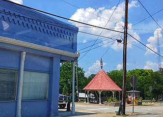
Lavonia is a city in Franklin and Hart Counties, Georgia, United States. The population was 2,156 at the 2010 census, up from 1,827 at the 2000 census.

<span class="mw-page-title-main">Royston, Georgia</span> City in Georgia, United States

Royston is a city in Franklin, Hart, and Madison counties in the U.S. state of Georgia. The population was 2,649 at the 2020 census.

<span class="mw-page-title-main">Hartwell, Georgia</span> City in Georgia, United States

Hartwell is a city in Hart County, Georgia, United States. The population was 4,469 at the 2010 census. The city is the county seat of Hart County.

<span class="mw-page-title-main">Arcade, Georgia</span> City in Georgia, United States

Arcade is a city in Jackson County, Georgia, United States. As of the 2020 census it had a population of 1,884.

<span class="mw-page-title-main">Commerce, Georgia</span> City in Georgia, United States

Commerce is a city in Jackson County, Georgia, 70 miles (110 km) northeast of Atlanta. As of the 2020 census, the city had a population of 7,387.

<span class="mw-page-title-main">Jefferson, Georgia</span> City in Georgia, United States

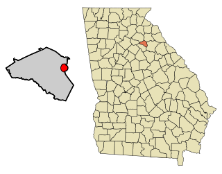
Jefferson is a city in Jackson County, Georgia, United States. The population was 9,432 at the 2010 census, up from 3,825 at the 2000 census. As of 2019 the estimated population was 12,032. The city is the county seat of Jackson County.

<span class="mw-page-title-main">Nicholson, Georgia</span> City in Georgia, United States

Nicholson is a city in Jackson County, Georgia, United States. The population was 1,696 at the 2010 census, up from 1,247 at the 2000 census.

<span class="mw-page-title-main">Pendergrass, Georgia</span> City in Georgia, United States

Pendergrass is a city in Jackson County, Georgia, United States. The population was 1692 at the time of the 2020 census.

<span class="mw-page-title-main">Colbert, Georgia</span> City in Georgia, United States

Colbert is a city in Madison County and Oglethorpe County, Georgia, United States. The population was 630 at the 2020 census.

<span class="mw-page-title-main">Danielsville, Georgia</span> City in Georgia, United States

Danielsville is a city in Madison County, Georgia, United States. The population was 654 at the 2020 census, up from 560 in 2010. The city is the county seat of Madison County.

<span class="mw-page-title-main">Hull, Georgia</span> City in Georgia, United States

Hull is a city in Madison County, Georgia, United States. The population was 230 at the 2020 census, up from 198 in 2010.

<span class="mw-page-title-main">Ila, Georgia</span> City in Georgia, United States

Ila is a city in Madison County, Georgia, United States. The population was 350 at the 2020 census.

<span class="mw-page-title-main">Winterville, Georgia</span> City in Georgia, United States

Winterville is a village in Clarke County, Georgia, United States. The population was 1,122 at the 2010 census.

References

  1. "2020 U.S. Gazetteer Files". United States Census Bureau. Retrieved December 18, 2021.
  2. 1 2 "U.S. Census website". United States Census Bureau . Retrieved January 31, 2008.
  3. "US Board on Geographic Names". United States Geological Survey. October 25, 2007. Retrieved January 31, 2008.
  4. 1 2 "Geographic Identifiers: 2010 Census Summary File 1 (G001), Franklin Springs city, Georgia". American FactFinder. U.S. Census Bureau. Archived from the original on February 13, 2020. Retrieved April 28, 2016.
  5. "County History". Franklin County. Archived from the original on April 17, 2017. Retrieved December 30, 2018.
  6. Kraków, Kenneth K. (1975). Georgia Place-Names: Their History and Origins (PDF). Macon, GA: Winship Press. p. 88. ISBN   0-915430-00-2.
  7. Shearer,Lee. "Feeling Ivan's Ire", September 17, 2004 | Athens Banner-Herald (GA).
  8. Franklin Springs, GA Natural Disasters and Weather Extremes. USA.com
  9. Johnson, Joe."Hardest-hit counties, Athens turn to cleanup" September 18, 2004 | Athens Banner-Herald (GA)
  10. "US Gazetteer files: 2010, 2000, and 1990". United States Census Bureau. February 12, 2011. Retrieved April 23, 2011.
  11. "Census of Population and Housing". Census.gov. Retrieved June 4, 2015.