Lavonia, Georgia

Last updated

Lavonia, Georgia
Georgia - Lavonia - Main Street (34990261486).jpg
Main Street, Lavonia, Georgia, May 2017
Motto(s): 
"Home to Land of Spirit",
"Big Time Small Town"
Franklin County Georgia Incorporated and Unincorporated areas Lavonia Highlighted.svg
Location in Franklin County and the state of Georgia
Coordinates: 34°26′10″N83°6′23″W / 34.43611°N 83.10639°W / 34.43611; -83.10639
Country United States
State Georgia
Counties Franklin, Hart
Government
  MayorCharles L Cawthon
Area
[1]
  Total4.53 sq mi (11.73 km2)
  Land4.51 sq mi (11.67 km2)
  Water0.02 sq mi (0.06 km2)
Elevation
853 ft (260 m)
Population
 (2020)
  Total2,143
  Density475.59/sq mi (183.61/km2)
Time zone UTC-5 (Eastern (EST))
  Summer (DST) UTC-4 (EDT)
ZIP code
30553
Area code 706
FIPS code 13-45460 [2]
GNIS feature ID0316687 [3]
Website www.lavoniaga.gov

Lavonia is a city in Franklin and Hart Counties, Georgia, United States. The population was 2,156 at the 2010 census, [4] up from 1,827 at the 2000 census.

Contents

Geography

Lavonia is located in northeastern Franklin County at 34°26′10″N83°6′23″W / 34.43611°N 83.10639°W / 34.43611; -83.10639 (34.436055, -83.106270). [5] A small portion of the town extends southeast into Hart County.

According to the United States Census Bureau, the city has a total area of 4.6 square miles (11.9 km2), of which 0.02 square miles (0.06 km2), or 0.53%, is covered by water. [4]

The city lies along Interstate 85, 53 miles (85 km) southwest of Greenville, South Carolina, and 94 miles (151 km) northeast of Atlanta.

History

The Cherokee people were indigenous to the area in which Lavonia is located. A sophisticated tribe that typically dwelled in cabins by the 18th century, the Cherokee joined with the British during the American Revolution. When the American colonists prevailed, their land was issued as bounty land to those who had fought in the revolution. As a result, European Americans began to move into the Lavonia area during the 1780s.

The founding of the town of Lavonia came as the result of the expansion of the railroad in northeast Georgia. A railroad line known as the Elberton-Airline Railroad desired another station further to the north. In a move typical for the time, businessmen in the area determined to build a town around the new railroad station. Upon division of the area into town lots and completion of all necessary legal procedures, the town of Lavonia was incorporated in 1880. [6] The community was named after Lavonia Hammond Jones, the wife of a railroad official. [7]

Transportation

Major highways

Airports

Demographics

Historical population
CensusPop.Note
1880 72
1890 283293.1%
1900 699147.0%
1910 1,712144.9%
1920 1,644−4.0%
1930 1,511−8.1%
1940 1,66710.3%
1950 1,7665.9%
1960 2,08818.2%
1970 2,044−2.1%
1980 2,024−1.0%
1990 1,840−9.1%
2000 1,827−0.7%
2010 2,15618.0%
2020 2,143−0.6%
U.S. Decennial Census [8]

2020 census

Lavonia Racial Composition [9]
RaceNum.Perc.
White 1,39565.1%
Black or African American 49222.96%
Native American 50.23%
Asian 100.47%
Pacific Islander 100.06%
Other/Mixed 803.73%
Hispanic or Latino 1617.51%

As of the 2020 United States Census, there were 2,143 people, 1,029 households, and 676 families residing in the city.

2000 census

As of the census [2] of 2000, there were 1,827 people, 777 households, and 519 families residing in the city. The population density was 470.0 inhabitants per square mile (181.5/km2). There were 882 housing units at an average density of 226.9 per square mile (87.6/km2). The racial makeup of the city was 69.24% White, 28.95% African American, 0.11% Native American, 0.11% Asian, 0.38% from other races, and 1.20% from two or more races. Hispanic or Latino of any race constituted 0.88% of the population.

There were 777 households, out of which 28.4% had children under the age of 18 living with them, 43.5% were married couples living together, 18.3% had a female householder with no husband present, and 33.1% were non-families. 30.5% of all households were made up of individuals, and 16.3% had someone living alone who was 65 years of age or older. The average household size was 2.35 and the average family size was 2.92.

In the city, the population was spread out, with 25.4% under the age of 18, 8.4% from 18 to 24, 25.1% from 25 to 44, 22.9% from 45 to 64, and 18.2% who were 65 years of age or older. The median age was 38 years. For every 100 females, there were 80.2 males. For every 100 females age 18 and over, there were 75.4 males.

The median income for a household in the city was $24,286, and the median income for a family was $28,464. Males had a median income of $29,250 versus $21,328 for females. The per capita income for the city was $12,876. About 28.1% of families and 29.7% of the population were below the poverty line, including 42.6% of those under age 18 and 23.0% of those age 65 or over. Lavonia was the main place for trains to stop.

Library

The Lavonia Carnegie Library is located in the city of Lavonia and named after philanthropist Andrew Carnegie. Established in 1911, the one-story Renaissance Revival-style building is important as a local landmark and has continued to be used as a library throughout its history. [10] Lavonia is the smallest city in the entire United States with an original Carnegie Library building. [11]

Arts and culture

Sports

Lavonia is home to Lavonia Speedway, a 3/8-mile dirt oval. It is home to several different annual races such as the Buck Simmons Memorial, Rusty Jordan Memorial, and Charlie Mize Memorial. It also played host to an annual event with the World of Outlaws Late Model Series every single year from the years 2018 to 2021 as well as a one-off event in 2014 however after the event was rained out in 2022 they did not pick the date back up for 2023 and nothing has been announced for the future.

Notable people

Related Research Articles

<span class="mw-page-title-main">Walker County, Georgia</span> County in Georgia, United States

Walker County is a county located in the northwestern part of the U.S. state of Georgia. As of the 2020 census, the population was 67,654, down from 68,756 in 2010. The county seat is LaFayette. The county was created on December 18, 1833, from land formerly belonging to the Cherokee Indian Nation.
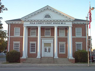
<span class="mw-page-title-main">Polk County, Georgia</span> County in Georgia, United States

Polk County is a county located in the northwestern part of the U.S. state of Georgia. As of the 2020 census, the population was 42,853. The county seat is Cedartown. The county was created on December 20, 1851, by an act of the Georgia General Assembly and named after James K. Polk, the eleventh President of the United States.

<span class="mw-page-title-main">Hart County, Georgia</span> County in Georgia, United States

Hart County is a county located in the northeastern part of the U.S. state of Georgia. As of the 2020 census, the population was 25,828. The county seat is Hartwell.

<span class="mw-page-title-main">Franklin County, Georgia</span> County in Georgia, United States

Franklin County is a county located in the northeastern part of the U.S. state of Georgia. As of the 2020 census, the population was 23,424. The county seat is Carnesville. On February 25, 1784, Franklin and Washington became Georgia's eighth and ninth counties, with Franklin named in honor of patriot Benjamin Franklin.
<span class="mw-page-title-main">Heflin, Alabama</span> City in Alabama, United States

Heflin is a city and the county seat of Cleburne County, Alabama, United States. At the 2020 census, the population was 3,431. It is located approximately halfway between Birmingham and Atlanta along Interstate 20.

<span class="mw-page-title-main">Zolfo Springs, Florida</span> Town in the state of Florida, United States

Zolfo Springs is a town in Hardee County, Florida, United States. It is part of the Florida Heartland region. The population was 1,737 at the 2020 census.

<span class="mw-page-title-main">Leisure City, Florida</span> Census-designated place in Florida

Leisure City is an unincorporated community and census-designated place (CDP) in Miami-Dade County, Florida, United States, that includes the smaller, older community of Modello in its northwestern section. The CDP is most notable for the Coral Castle Museum, located in the Modello area. It is located in the Miami metropolitan area of South Florida. The population was 26,324 at the 2020 census, up from 22,655 in 2010.

<span class="mw-page-title-main">Gumlog, Georgia</span> Place in Georgia, United States

Gumlog is an unincorporated lakeside community and census-designated place in Franklin County, Georgia, United States. The population was 2,146 at the 2010 census.

<span class="mw-page-title-main">Martin, Georgia</span> Town in Georgia, United States

Martin is a town in Stephens and Franklin counties in the U.S. state of Georgia. The population was 381 at the 2010 census, up from 311 in 2000.

<span class="mw-page-title-main">Royston, Georgia</span> City in Georgia, United States

Royston is a city in Franklin, Hart, and Madison counties in the U.S. state of Georgia. The population was 2,649 at the 2020 census.

<span class="mw-page-title-main">Union Point, Georgia</span> City in Georgia, United States

Union Point is a city in Greene County, Georgia, United States. As of the 2020 census, the city population was 1,597.

<span class="mw-page-title-main">Buchanan, Georgia</span> City in Georgia, United States

Buchanan is a city and the county seat of Haralson County, Georgia, United States. The population was 1,104 at the 2010 census, up from 941 at the 2000 census.

<span class="mw-page-title-main">Bowersville, Georgia</span> Town in Georgia, United States

Bowersville is a town in Hart County, Georgia, United States. As of the 2020 census, the town had a population of 444.

<span class="mw-page-title-main">Tunnel Hill, Georgia</span> City in Georgia, United States

Tunnel Hill is a city in northwest Whitfield County and southern Catoosa County, Georgia, United States. It is part of the Dalton Metropolitan Statistical Area. The population was 963 at the 2020 census. The city is named for the Chetoogeta Mountain Tunnel, a 1,497-foot (456 m) railroad tunnel built in the late 1840s.

<span class="mw-page-title-main">Caldwell, Kansas</span> City in Sumner County, Kansas

Caldwell is a city in Sumner County, Kansas, United States. As of the 2020 census, the population of the city was 1,025.

<span class="mw-page-title-main">Sonora, Kentucky</span> City in Kentucky, United States

Sonora is a home rule-class city in Hardin County, Kentucky, United States. The population was 565 as of the 2020 Census, up from 513 from the 2010 census,. It is included in the Elizabethtown, Kentucky Metropolitan Statistical Area.

<span class="mw-page-title-main">Cresson, Pennsylvania</span> Borough in Pennsylvania, United States

Cresson is a borough in Cambria County, Pennsylvania, United States. Cresson is 80 miles (130 km) east of Pittsburgh. It is above 2,000 feet (600 m) in elevation. Lumber, coal, and coke yards were industries that had supported the population, which numbered 1,470 in 1910. The borough is part of the Johnstown Metropolitan Statistical Area, although state and local sources list it as part of the Altoona area due to being much closer to that city. The population of Cresson at the 2010 census was 1,711.
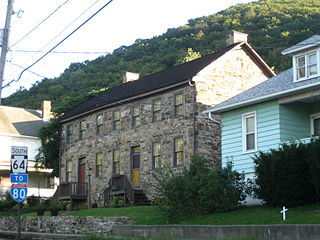
<span class="mw-page-title-main">Mill Hall, Pennsylvania</span> Borough in Pennsylvania, United States

Mill Hall is a borough in Clinton County, Pennsylvania, United States. The population was 1,613 at the 2010 census.

<span class="mw-page-title-main">Wayne Township, Schuylkill County, Pennsylvania</span> Township in Pennsylvania, United States

Wayne Township is a township in Schuylkill County, Pennsylvania, United States. The population was 5,226 at the 2020 census. The township includes the village of Reedsville which contains a medium size state police barracks. Children from this township attend schools in the Blue Mountain School District. The township is divided by north-to-south PA Route 183 which serves as a highway connecting Schuylkill and Berks Counties. The Schuylkill County Fairgrounds are located in the township off east-to-west PA Route 895. 183 and 895 meet in the Census Designated Place of Summit Station.
<span class="mw-page-title-main">Alberta, Virginia</span> Town in Virginia, United States

Alberta is a town in Brunswick County, Virginia, United States. The population was 302 at the 2020 census. It is home to the Christanna Campus of Southside Virginia Community College.

References

  1. "2020 U.S. Gazetteer Files". United States Census Bureau. Retrieved December 18, 2021.
  2. 1 2 "U.S. Census website". United States Census Bureau . Retrieved January 31, 2008.
  3. "US Board on Geographic Names". United States Geological Survey. October 25, 2007. Retrieved January 31, 2008.
  4. 1 2 "Geographic Identifiers: 2010 Census Summary File 1 (G001), Lavonia city, Georgia". American FactFinder. U.S. Census Bureau. Archived from the original on February 13, 2020. Retrieved April 28, 2016.
  5. "US Gazetteer files: 2010, 2000, and 1990". United States Census Bureau. February 12, 2011. Retrieved April 23, 2011.
  6. Marie H. Williams, ed. Lavonia: Gem of the Piedmont. Hartwell, GA: Hurley Printing, 1977.[ need quotation to verify ]
  7. Krakow, Kenneth K. (1975). Georgia Place-Names: Their History and Origins (PDF). Macon, GA: Winship Press. p. 130. ISBN   0-915430-00-2.
  8. "Census of Population and Housing". Census.gov. Retrieved June 4, 2015.
  9. "Explore Census Data". data.census.gov. Retrieved December 7, 2021.
  10. "History of the Library". www.athenslibrary.org. Retrieved March 31, 2017.
  11. "Franklin County Tax Assessor's Office". QPublic. Retrieved July 12, 2020.
  12. "Omer Clyde Aderhold". University of Georgia College of Agricultural and Environmental Sciences . Retrieved January 10, 2023.
  13. "Education: Shame in Georgia". TIME . January 20, 1961. Retrieved January 10, 2023.