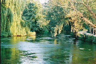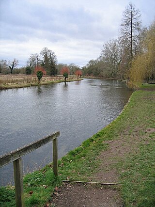
The River Test is a chalk stream in Hampshire in the south of England. It rises at Ashe near Basingstoke and flows southwards for 40 miles (64 km) to Southampton Water. Settlements on the Test include the towns of Stockbridge and Romsey. The river's valley gives its name to the local government district of Test Valley. Below the village of Longparish, the river is broadly followed by the Test Way, a long-distance footpath.

Test Valley is a local government district with borough status in Hampshire, England, named after the valley of the River Test. The council is based in the borough's largest town of Andover. The borough also contains the town of Romsey and numerous villages and surrounding rural areas. A small part of the borough at its southern end lies within the New Forest National Park, and part of the borough north of Andover lies within the North Wessex Downs, a designated Area of Outstanding Natural Beauty.

The A272 is a road in southeast England. It follows an approximate east–west route from near Heathfield, East Sussex to the city of Winchester, Hampshire.
Abbotts Ann is a village in the parish of the same name, approximately 2 miles (3.2 km) south-west of Andover, Hampshire, England. The population of the civil parish at the 2011 Census, including Little Ann and Red Post Bridge, was 2,566.

Amport is a village and civil parish in the Test Valley district of Hampshire, England, a few miles west of Andover. It incorporates the small hamlet of East Cholderton and has a population of about 1,200.

The River Anton is a chalk stream in Hampshire in south east England. It rises in Andover and flows southwards for approximately 8 miles (13 km) to meet the River Test near Chilbolton. The principal tributary of the Anton, the Pillhill Brook, joins the river at Upper Clatford.

The River Dever is a chalk stream in Hampshire in the south of England. It rises at West Stratton near Micheldever and flows westwards for 11 mi (18 km) to meet the River Test at Wherwell.

Chilbolton is a village and civil parish in Hampshire, England, near to Stockbridge. It is situated 18 miles (29 km) north of Southampton and four miles (6.4 km) south of Andover. Its most notable feature is the Chilbolton Observatory situated on the disused RAF Chilbolton airfield. The parish church of St Mary the Less dates back to the 12th century, on the site of an earlier wooden church. The River Test runs through Chilbolton Common.

Wherwell is a village on the River Test in Hampshire, England. The name may derive from its bubbling springs resulting in the Middle Ages place name “Hwerwyl” noted in AD 955, possibly meaning “kettle springs” or “cauldron springs.” Pronunciation of the name has ranged from “Hurrell” to “Wer-rel” to present-day “Wher-well.”
The Fullerton Junction to Hurstbourne Line was a 6-mile railway line which ran between Fullerton Junction and Hurstbourne in Hampshire, UK. It was also known as the Longparish Branch and by the nickname of Nile Valley Railway.

Goodworth Clatford is a village located in Hampshire, England. It is south of the town of Andover in the valley of the River Anton. The neighbouring village to the north is Upper Clatford, to the south, Fullerton.

Rewe is a village and civil parish in the county of Devon in England. It lies on the river Culm, 5 miles (8 km) north of the city of Exeter and 9 miles (14 km) south of the town of Tiverton. Rewe is a linear village, with most of its buildings lying along the A396 road about 1 mile (1.6 km) north of the larger village of Stoke Canon. The Reading to Plymouth railway line also passes through the village, but there has never been a station here; the nearest operating station is Exeter St Davids. Before its closure, Stoke Canon station was the nearest.
Over Wallop is a small village and civil parish in the Test Valley district of Hampshire, England. The village lies close to the border with Wiltshire, approximately 5.1 miles (8.2 km) northwest of Stockbridge.

Leckford is a village and civil parish in Hampshire, England. It lies on the eastern bank of the River Test just to the south of its confluence with the River Anton, to the east of Longstock and south of Chilbolton.
Cottonworth is a small village in the Test Valley district of Hampshire, England. The village lies on the A3057 road between Andover and Romsey. According to the PostOffice the 2011 Census population was included in the civil parish of Wherwell. Its nearest town is Andover, which lies approximately 4 miles (6.5 km) north from the village.

Newton Stacey is a hamlet in the Barton Stacey civil parish in the Test Valley district of Hampshire, England. Its nearest town is Stockbridge, which lies approximately 4.5 miles (7.3 km) south-west from the hamlet.

Plaitford is a small village and former civil parish, now in the parish of Melchet Park and Plaitford, in the Test Valley district of Hampshire, England. Its nearest town is Romsey, which lies approximately 4.9 miles (7.8 km) east from the village; the large village of West Wellow is immediately west of Plaitford. In 1931 the parish had a population of 195.
South Harewood is a hamlet and civil parish in the Test Valley district of Hampshire, England. At the 2011 Census the population according to the Post Office was included in the civil parish of Wherwell. Its nearest town is Andover, which lies approximately 2.5 miles (5.7 km) north-west from the hamlet.
Wherwell Wood is a hamlet in the civil parish of Wherwell in the Test Valley district of Hampshire, England. It lies approximately 2.7 miles (4.4 km) south from Andover, its nearest town. The hamlet is named after Wherwell Wood, a large wood containing 511 acres (207 ha) of woodland and plantations.

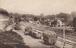
Wherwell railway station served the village of Wherwell, Hampshire, England, from 1885 to 1956 on the Fullerton to Hurstbourne Line.


