Related Research Articles

Carroll County is a county located in the U.S. state of Arkansas. As of the 2020 census, the population was 28,260. The county has two county seats, Berryville and Eureka Springs. Carroll County is Arkansas's 26th county, formed on November 1, 1833, and named after Charles Carroll, the last surviving signer of the United States Declaration of Independence.

Gateway is a town in Benton County, Arkansas, United States. The population was 436 at the 2020 census, up from 405 in 2010. It is part of the Northwest Arkansas region. The town's name reflects its situation as the "gateway" to and from Arkansas.

Eureka Springs is a city in Carroll County, Arkansas, United States, and one of two county seats for the county. It is located in the Ozark Mountains of northwest Arkansas, near the border with Missouri. As of the 2020 census, the city population was 2,166.
Carrollton is an unincorporated community in Carroll County, Arkansas, United States. Once designated the county seat, it had a population near the 10,000 mark in the 1850s. It has now 30 residents and a historically significant past.

War Eagle is an unincorporated community in Benton County, Arkansas, United States. It is the location of War Eagle Bridge, which carries CR 98 over War Eagle Creek and is listed on the National Register of Historic Places.
Cabanal is a community in Carroll County in northwest Arkansas, United States. The community is located on Arkansas Highway 21, south of Berryville and north of Metalton. The site is along a north flowing tributary to Osage Creek below and west of Gage Mountain at an elevation of 1,306 ft (398 m).
Marble is an unincorporated community in northeastern Madison County, Arkansas, United States. The community is located on U.S. Route 412 and the southwest bank of the Kings River.
Coin is an unincorporated community in eastern Carroll County, Arkansas, United States.
Gobbler is an unincorporated community in southern Carroll County, Arkansas, United States. The community is located at the intersection of U.S. Route 412 and Arkansas Highway 103, approximately ten miles south of Green Forest. The location is on a ridge between the headwaters of Piney Creek to the northwest and a small tributary to Osage Creek to the southeast at an elevation of 1,657 ft (505 m).
Rule is an unincorporated community in Carroll County, Arkansas, United States. The community is located on Arkansas Highway 103 on the banks of Osage Creek and about four miles south of Green Forest.
Denver is a community in Carroll County in northwest Arkansas, United States. Denver is located on the east bank of Long Creek near the confluence of Dry Creek with Long Creek and approximately one mile west of the Carroll-Boone county line. The community is accessed by county road from Arkansas Highway 396, which passes about 1.5 miles to the north. Farewell is about three miles to the west.
Farewell is a community in Carroll County in northwest Arkansas, United States. The community is on Arkansas Highway 311, northeast of Green Forest. The community of Denver lies on the banks of Long Creek approximately three miles to the east. The community of Yocum is three miles northwest on Arkansas Highway 103.
Yocum is a community in Carroll County in northwest Arkansas, United States. The community is located on Arkansas Highway 103 and the west bank of Yocum Creek. The site is three miles southeast of Oak Grove and six miles north of Green Forest.
Metalton is an unincorporated community in southern Carroll County, Arkansas, United States. The community is located on Arkansas Highway 21 between Cabanal to the north and Omega to the south. The communities of Rudd and Gobbler lie to the southeast along Arkansas Highway 103. The community lies near the intersection of Piney Creek with its tributary Cedar Creek. The community sits at an elevation of 1,345 ft (410 m).
Piney Creek is a stream in southern Carroll County of the U.S. state of Arkansas. It is a tributary to the Kings River.
Osage is an unincorporated community in Carroll County, in the U.S. state of Arkansas. The community is on the south side of Osage Creek at the junction of Osage and Kenner Creeks. U.S. Route 412 (US 412) passes on the north side of Osage Creek.
Winona Springs is an extinct town in southwest Carroll County, in the U.S. state of Arkansas.
Drakes Creek is an unincorporated community in Madison County, in the U.S. state of Arkansas.
Osage Creek is a stream in Newton, Boone, and Carroll counties of northern Arkansas. It is a tributary of the Kings River.
References
- ↑ U.S. Geological Survey Geographic Names Information System: Gaskins (historical)
- ↑ Eureka Springs, Arkansas, 7.5 Minute Topographic Quadrangle, USGS, 1972
- ↑ History of Benton, Washington, Carroll, Madison, Crawford, Franklin, and Sebastian Counties, Arkansas. Higginson Book Company. 1889. p. 395.
Municipalities and communities of Carroll County, Arkansas, United States | ||
|---|---|---|
| Cities | 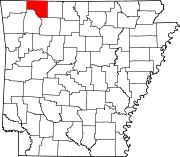 | |
| Towns | ||
| Townships | ||
| Unincorporated communities | ||
| Ghost towns | ||
| Footnotes | ‡This populated place also has portions in an adjacent county or counties | |
36°26′43″N93°44′36″W / 36.44528°N 93.74333°W
| | This article about a location in Carroll County, Arkansas is a stub. You can help Wikipedia by expanding it. |