Packard Springs Township | |
|---|---|
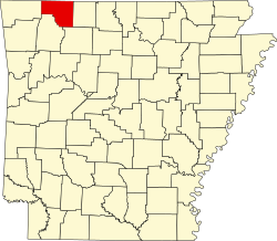
 Packard Springs Township Location in Arkansas | |
| Coordinates: 36°20′26.99″N93°48′15.23″W / 36.3408306°N 93.8042306°W | |
| Country | |
| State | |
| County | Carroll |
| Area | |
• Total | 35.705 sq mi (92.48 km2) |
| • Land | 32.761 sq mi (84.85 km2) |
| • Water | 2.944 sq mi (7.62 km2) |
| Population (2020) | |
• Total | 595 |
| • Density | 22.44/sq mi (8.66/km2) |
| Time zone | UTC-6 (CST) |
| • Summer (DST) | UTC-5 (CDT) |
| Area code | 479 |
Packard Springs Township is one of twenty-one current townships in Carroll County, Arkansas, USA. [1] As of the 2020 census, its total population was 595.