According to the United States Census Bureau, the town has a total area of 0.54 square miles (1.4km2), of which 0.35 square miles (0.9km2) is land and 0.19 square miles (0.5km2), or 33.16%, is water.[4]
As of the census[7] of 2000, there were 95 people, 37 households, and 27 families residing in the town. The population density was 271.0 inhabitants per square mile (104.6/km2). There were 43 housing units at an average density of 122.7 per square mile (47.4/km2). The racial makeup of the town was 96.84% White, 2.11% from other races, and 1.05% from two or more races. 2.11% of the population were Hispanic or Latino of any race.
There were 37 households, of which 29.7% had children under the age of 18 living with them, 62.2% were married couples living together, 5.4% had a female householder with no husband present, and 27.0% were non-families. 21.6% of all households were made up of individuals, and 8.1% had someone living alone who was 65 years of age or older. The average household size was 2.57 and the average family size was 2.81.
In the town, the population was spread out, with 27.4% under the age of 18, 5.3% from 18 to 24, 23.2% from 25 to 44, 29.5% from 45 to 64, and 14.7% who were 65 years of age or older. The median age was 42 years. For every 100 females, there were 97.9 males. For every 100 females age 18 and over, there were 97.1 males.
The median income for a household in the town was $23,438, and the median income for a family was $25,417. Males had a median income of $25,417 versus $26,250 for females. The per capita income for the town was $11,665. There were 13.0% of families and 16.2% of the population living below the poverty line, including no one under the age of eighteen and none of those over 64.
In popular culture
Castle Rogue's Manor on the shores of Table Rock Lake
The climate is characterized by relatively high temperatures and evenly distributed precipitation throughout the year. The Köppen Climate Classification subtype for this climate is "Cfa" (Humid Subtropical Climate).[8]
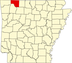
↑ General Highway Map, Carroll County, Arkansas(PDF) (Map). 1:62500. Cartography by Planning and Research Division. Arkansas State Highway and Transportation Department. April 9, 2010. Archived from the original(PDF) on January 15, 2018. Retrieved June 29, 2013.
This page is based on this Wikipedia article Text is available under the CC BY-SA 4.0 license; additional terms may apply. Images, videos and audio are available under their respective licenses.