References
- 1 2 U.S. Geological Survey Geographic Names Information System: Metalton, Arkansas
- ↑ Arkansas Atlas & Gazetteer, DeLorme, 2nd ed., 2004, p. 23 ISBN 0-89933-345-1
- ↑ History of Metalton
Municipalities and communities of Carroll County, Arkansas, United States | ||
|---|---|---|
| Cities | 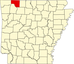 | |
| Towns | ||
| Townships | ||
| Unincorporated communities | ||
| Ghost towns | ||
| Footnotes | ‡This populated place also has portions in an adjacent county or counties | |
36°13′23″N93°31′48″W / 36.22306°N 93.53000°W
| | This article about a location in Carroll County, Arkansas is a stub. You can help Wikipedia by expanding it. |