Green Forest, Arkansas

Last updated

Green Forest, Arkansas
Carroll County Arkansas Incorporated and Unincorporated areas Green Forest Highlighted 0528600.svg
Location of Green Forest in Carroll County, Arkansas.
Coordinates: 36°20′05″N93°25′51″W / 36.33472°N 93.43083°W / 36.33472; -93.43083
Country United States
State Arkansas
County Carroll
Government
  MayorDon McNeely [1]
Area
[2]
  Total2.46 sq mi (6.38 km2)
  Land2.46 sq mi (6.38 km2)
  Water0.00 sq mi (0.00 km2)
Elevation
[3]
1,335 ft (407 m)
Population
 (2020)
  Total2,972
  Density1,205.68/sq mi (465.59/km2)
Time zone UTC-6 (Central (CST))
  Summer (DST) UTC-5 (CDT)
ZIP code
72638
Area code 870
FIPS code 05-28600
GNIS feature ID2403736 [3]
Website greenforestar.net

Green Forest is a city in Carroll County, Arkansas, United States. The population was 2,972 at the 2020 census. [4]

Contents

Geography

According to the United States Census Bureau, the city has a total area of 5.9 km2 (2.3 mi2), all land.

Demographics

Historical population
CensusPop.Note
1880 34
1900 469
1910 63535.4%
1920 86836.7%
1930 745−14.2%
1940 7551.3%
1950 738−2.3%
1960 1,03840.7%
1970 1,35430.4%
1980 1,60918.8%
1990 2,05027.4%
2000 2,71732.5%
2010 2,7611.6%
2020 2,9727.6%
U.S. Decennial Census [5]

2020 census

Green Forest racial composition [6]
RaceNumberPercentage
White (non-Hispanic)1,21840.98%
Black or African American (non-Hispanic)80.27%
Native American 120.4%
Asian 33311.2%
Pacific Islander 732.46%
Other/Mixed 1153.87%
Hispanic or Latino 1,21340.81%

As of the 2020 United States census, there were 2,972 people, 928 households, and 651 families residing in the city.

2010 census

At the 2010 census there were 3,271 people, 1072 households, and 977 families living in the city. The population density was 458.1/km2 (1,187.4/mi2). There were 1,146 housing units at an average density of 176.4/km2 (457.1/mi2). The racial makeup of the city was 64.3% White, 0.40% Black or African American, 1.07% Native American, 0.48% Asian, 0.37% Pacific Islander, 12.37% from other races, and 2.76% from two or more races. 33.20% of the population were Hispanic or Latino of any race. [7] Of the 1072 households 37.4% had children under the age of 18 living with them, 51.9% were married couples living together, 13.1% had a female householder with no husband present, and 30.2% were non-families. 23.2% of households were one person and 11.2% were one person aged 65 or older. The average household size was 2.82 and the average family size was 3.27.

The age distribution was 28.6% under the age of 18, 12.7% from 18 to 24, 30.8% from 25 to 44, 15.8% from 45 to 64, and 12.1% 65 or older. The median age was 30 years. For every 100 females, there were 96.9 males. For every 100 females age 18 and over, there were 96.0 males.

The median household income was $23,750 and the median family income was $26,765. Males had a median income of $18,886 versus $16,686 for females. The per capita income for the city was $10,720. About 16.7% of families and 22.1% of the population were below the poverty line, including 23.7% of those under age 18 and 23.5% of those age 65 or over.

Education

Public education

Elementary and secondary school students may attend Green Forest School District which includes all three of the Green Forest Elementary School, Green Forest Intermediate School, and Green Forest Middle School, consecutively, which leads to graduation from Green Forest High School.

Public libraries

The Green Forest Public Library is a branch library of the Carroll And Madison Library System. The library opened in 1935. [8]

Transportation

Roadways

Transit

Notable people

Early History

The first known settler in the area was John Scott, “a maker of sheep and cowbells,” who was also briefly the postmaster and named the town Scott's Prairie after himself. First Baptist Church was built from logs in 1854 and was the local school. The Methodist Church opened in 1857.

In June 1861, up to 5,000 Confederate soldiers led by Brig. Gen. James H. McBride set up camp in and around town, prompting Yankees in November 1863 under Maj. Austin A. King to burn the town to the ground. However, the Skirmish of Yocum Creek resulted in the only known casualties between Southern defenders and a Union patrol evacuating northern sympathizers, who were not exactly popular after the Yankees burned down Berryville, too.

The town was rebuilt and a new post office opened in 1867 with John Grim as postmaster. When clearing land on his farm, Grim had left a grove of shade trees untouched, which his neighbors dubbed “Green Forest” -- or according to some accounts "Grim's Forest."

By 1889 the town had a cotton gin operated by J. R. Hanby. The Green Forest Tribune began publication in 1889. A three-story school was built in 1893, replacing an earlier thirty-by-twenty-five-foot schoolhouse.

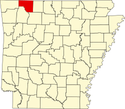
After Eureka Springs succeeded in dividing the county into two judicial districts, claiming the western district as its own, Green Forest proposed becoming the county seat for the eastern district, but was outvoted by larger Berryville.

In 1901, the St. Louis and North Arkansas Railroad built a rail line connecting Eureka Springs to Harrison. Stores and businesses sprang up around the Green Forest railroad depot. On September 20, 1902, a fire destroyed several businesses around the depot, including the Stone Hotel, Dr. Morrow’s Drug Store, W. L. Crow’s Store, and the printing offices of Crow & Pyron.

A new school building was erected in 1905, costing $5,000 to construct and $900 to furnish. The school was never used, though, as it was destroyed by fire on August 8, 1905. Another new school was quickly built, financed by 70 property owners who pledged two dollars for every $100 of property they owned, according to the Carroll County assessments.

Around that time, traveling preacher Lester Sumrall held a six-week revival. It was interrupted by an angry farmer in the middle of the sermon one night, who called out a neighbor who'd been cavorting with the farmer’s wife. The farmer shot the neighbor dead in front of the congregation. According to Sumrall's autobiography, the altar call drew quite a response that night, resulting in the founding of today's First Assembly of God.

In 1906, Willis Wood and Will Huttig of Kansas City along with engineer E. S. W. Drought and government assayer H. S. Mohun, drilled a 140-foot well and reported finding gold. Prospective investors hurried to profit, but it turned out the drillers were crooks -- no gold.

By 1927, the town's businesses included the First National Bank of Green Forest, chartered in 1901, several grocery stores, a marble and granite works, a wood milling company, a blacksmith, a hardware company, a tomato cannery, a telephone company, a bakery, a feed mill and a car dealership in what had been the Hanby cotton gin. It later became Tanner’s Hardware, the Country Rooster Cafe and now is Grace Baptist Church on the Square.

Most of the businesses around the train depot were destroyed along with the town of Denver in a 1927 tornado. Main Street survived, but the business district around the depot was devastated and not rebuilt. Denver, Arkansas, never recovered. The destroyed Green Forest train station was patched together with the old depot at Urbanette.

Today's restored Green Forest train station next to the soccer and baseball fields at the city park still has Urbanette markings on the big cargo door.

The public library opened in 1935.

Green Forest is the birthplace and childhood home of the late Cosmopolitan magazine publisher Helen Gurley Brown. It is also the birthplace of Baptist missionary David Crockett Graham, who also studied Chinese culture as an anthropologist. [11]

Related Research Articles

<span class="mw-page-title-main">Carroll County, Arkansas</span> County in Arkansas, United States

Carroll County is a county located in the U.S. state of Arkansas. As of the 2020 census, the population was 28,260. The county has two county seats, Berryville and Eureka Springs. Carroll County is Arkansas's 26th county, formed on November 1, 1833, and named after Charles Carroll, the last surviving signer of the United States Declaration of Independence.

<span class="mw-page-title-main">Springtown, Arkansas</span> Town in Arkansas, United States

Springtown is a town in Benton County, Arkansas, United States. The population was 83 at the 2020 census. It is part of the Northwest Arkansas region.

<span class="mw-page-title-main">Alpena, Arkansas</span> Town in Arkansas, United States

Alpena is a town in Boone and Carroll counties in the U.S. state of Arkansas. The population was 374 at the 2020 census.

<span class="mw-page-title-main">South Lead Hill, Arkansas</span> Town in Arkansas, United States

South Lead Hill is a town in Boone County, Arkansas, United States. The population was 102 at the 2010 census. It is part of the Harrison Micropolitan Statistical Area.

<span class="mw-page-title-main">Berryville, Arkansas</span> City in Arkansas, United States

Berryville is a city in Carroll County, Arkansas, United States. The population was 5,682 at the 2020 census. making it the largest city in Carroll County. Along with Eureka Springs, it is one of the two county seats of Carroll County.

<span class="mw-page-title-main">Oak Grove, Carroll County, Arkansas</span> Town in Arkansas, United States

Oak Grove is a town in Carroll County, Arkansas, United States. The population was 386 at the 2020 census.

<span class="mw-page-title-main">Okolona, Arkansas</span> Town in Arkansas, United States

Okolona is a town near the western edge of Clark County, Arkansas, United States. The population was 147 at the 2010 census.

<span class="mw-page-title-main">Greenway, Arkansas</span> City in Arkansas, United States

Greenway is a city in eastern Clay County, Arkansas, United States. The population was 209 at the 2010 census.

<span class="mw-page-title-main">McDougal, Arkansas</span> City in Arkansas, United States

McDougal is a city in Clay County, Arkansas, United States. The population was 186 at the 2010 census.

<span class="mw-page-title-main">Pollard, Arkansas</span> City in Arkansas, United States

Pollard is a city in Clay County, Arkansas, United States. The population was 222 at the 2010 census.

<span class="mw-page-title-main">Winchester, Arkansas</span> Town in Arkansas, United States

Winchester is a small town in northeast Drew County, Arkansas, United States. The population was 167 at the 2010 census, declining from its 20th-century high of 279 in 1980.

<span class="mw-page-title-main">Weldon, Arkansas</span> Town in Arkansas, United States

Weldon is a town in Jackson County, Arkansas, United States. The population was 75 at the 2010 census.

<span class="mw-page-title-main">St. Paul, Arkansas</span> Town in Arkansas, United States

St. Paul is a town in Madison County, Arkansas, United States. The population was 111 at the 2020 census. It is on the edge of the Northwest Arkansas region.

<span class="mw-page-title-main">Roe, Arkansas</span> Town in Arkansas, United States

Roe is a town in Monroe County, Arkansas, United States. Located at the junction of U.S. Route 79 and Arkansas Highway 33, the population was 68 at the 2020 census, down from 114 in 2010.

<span class="mw-page-title-main">Norman, Arkansas</span> Town in Arkansas, United States

Norman is a town in Montgomery County, Arkansas, United States. It was known as Womble until 1925. The population was 303 at the 2020 census, down from 378 in 2010.

<span class="mw-page-title-main">Rosston, Arkansas</span> Town in Arkansas, United States

Rosston is a town in south-central Nevada County, Arkansas, United States. The population was 265 at the 2000 census. It is part of the Hope Micropolitan Statistical Area.

<span class="mw-page-title-main">Wickes, Arkansas</span> City in Arkansas, United States

Wickes is a city in Polk County, Arkansas, United States. The population was 754 at the 2010 census.

<span class="mw-page-title-main">O'Kean, Arkansas</span> Town in Arkansas, United States

O'Kean is a town in Randolph County, Arkansas, United States. The population was 192 at the 2020 census.

<span class="mw-page-title-main">Traskwood, Arkansas</span> City in Arkansas, United States

Traskwood is a city in Saline County, Arkansas, United States. The population was 518 at the 2010 census. It is part of the Little Rock–North Little Rock–Conway Metropolitan Statistical Area.

<span class="mw-page-title-main">Goshen, Arkansas</span> City in Arkansas, United States

Goshen is a city in Washington County, Arkansas, United States. The population was 2,102 at the 2020 census. It is part of the Northwest Arkansas region. According to Business Insider, it is the “most educated” city in the state of Arkansas.

References

  1. "Mayor". Green Forest AR. Retrieved November 15, 2023.
  2. "2020 U.S. Gazetteer Files". United States Census Bureau. Retrieved October 29, 2021.
  3. 1 2 U.S. Geological Survey Geographic Names Information System: Green Forest, Arkansas
  4. "Explore Census Data". data.census.gov. Retrieved December 22, 2021.
  5. "Census of Population and Housing". Census.gov. Retrieved June 4, 2015.
  6. "Explore Census Data". data.census.gov. Retrieved January 1, 2022.
  7. "U.S. Census website". United States Census Bureau . Retrieved January 31, 2008.
  8. "History, Green Forest Library". Carroll and Madison Library System. Retrieved December 31, 2012.
  9. Scanlon, Jennifer (2009). Toff, Nancy (ed.). Bad Girls Go Everywhere: The Life of Helen Gurley Brown . Oxford University Press. p.  1. ISBN   978-0-19-534205-5.
  10. Kyong-McClain, Jeff. "David Crockett (D.C.) Graham". The Encyclopedia of Arkansas History & Culture. Central Arkansas Library System. Retrieved November 9, 2012.
  11. "History". Green Forest Chamber of Commerce. Retrieved July 16, 2024.