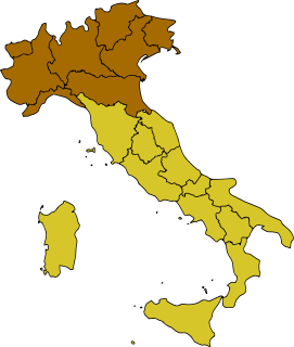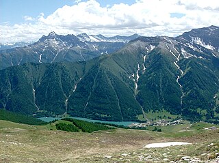
Italy is located in southern Europe and comprises the long, boot-shaped Italian Peninsula, the southern side of Alps, the large plain of the Po Valley and some islands including Sicily and Sardinia. Corsica, although belonging to the Italian geographical region, has been a part of France since 1769. Italy is part of the Northern Hemisphere. Two of the Pelagie islands are located on the African continent.

Piedmont is a region in northwest Italy, one of the 20 regions of the country. It borders the Liguria region to the south, the Lombardy and Emilia-Romagna regions to the east and the Aosta Valley region to the northwest; it also borders Switzerland to the northeast and France to the west. It has an area of 25,402 km2 (9,808 sq mi) making it the second largest region of Italy after Sicily and a population of 4,322,805 as of 30 June 2020. The capital of Piedmont is Turin.

The Graian Alps are a mountain range in the western part of the Alps.

The Trebbia is a river predominantly of Liguria and Emilia Romagna in northern Italy. It is one of the four main right-bank tributaries of the river Po, the other three being the Tanaro, the Secchia and the Panaro.

Lake Maggiore or Verbano is a large lake located on the south side of the Alps. It is the second largest lake in Italy and the largest in southern Switzerland. The lake and its shoreline are divided between the Italian regions of Piedmont and Lombardy and the Swiss canton of Ticino. Located halfway between Lake Orta and Lake Lugano, Lake Maggiore extends for about 65 kilometres between Locarno and Arona.

The Province of Parma is a province in the Emilia-Romagna region of Italy. Its largest town and capital is the city of Parma.

Monte Rosa is a mountain massif in the eastern part of the Pennine Alps. It is between Italy's and Switzerland's (Valais). Monte Rosa is the second highest mountain in the Alps and western Europe, after Mont Blanc.

Monte Viso or Monviso is the highest mountain of the Cottian Alps. It is located in Italy close to the French border. Monte Viso is well known for its pyramid-like shape and, because it is higher than all its neighbouring peaks by about 500 m, it can be seen from a great distance, including from the Piedmontese plateau, the Langhe, the Theodulpass in the Zermatt ski area and the summits of the Mont Blanc massif. On a very clear day it can be seen from the spires of Milan Cathedral.

Northern Italy is a geographical and cultural region in the northern part of Italy. Non-administrative, it consists of eight administrative Regions in northern Italy: Aosta Valley, Piedmont, Liguria, Lombardy, Emilia-Romagna, Veneto, Friuli-Venezia Giulia and Trentino-Alto Adige/Südtirol. As of 2014, its population was 27,801,460. Rhaeto-Romance and Gallo-Italic languages are spoken in the region, as opposed to the Italo-Dalmatian languages spoken in the rest of Italy. The Venetian language is sometimes considered to be part of the Italo-Dalmatian languages, but some major publications such as Ethnologue and Glottolog define it as Gallo-Italic.

The Oltrepò Pavese is an area of the Province of Pavia, in the north-west Italian region of Lombardy, which lies to the south of the river Po. It is oltre (‘beyond’) the Po, when considered from the provincial capital Pavia and in general from the rest of Lombardy.

The prehistory of Italy began in the Paleolithic period, when the Homo species colonized the Italian territory for the first time, and ended in the Iron Age, when the first written records appeared in the Insular Italy.

The Valle Po is a valley of the Cottian Alps in the province of Cuneo, Piedmont, northern Italy.

The Lanzo Valleys is a group of valleys in the north-west of Piedmont in the Metropolitan City of Turin, Italy.

Varaita Valley is a valley in south-west of Piedmont, in the Province of Cuneo - Italy.

The Garda Mountains, occasionally also the Garda Hills, are an extensive mountain range of the Southern Limestone Alps in northern Italy.

Val Grande National Park is a protected area located in Piedmont, in the north of Italy, at the border with Switzerland. It is most notable for landscapes of the High Alps.

Punta Sulè is a 3,384 m a.s.l.mountain of the Graian Alps, located in Italy.

Corno Bussola is a 3,023 metres high peak on the Italian side of the Pennine Alps.

The Punta Leynir is a 3,238 metres high mountain belonging to the Italian side of Graian Alps.

Lombardy is an administrative region of Italy that is split into four geographic regions — mountains, alpine forest, and the upper and lower plains south of the Po river. These are crossed and dotted by dozens of rivers and lakes, the latter of which include some of the largest in Italy. The territory is the fourth largest in Italy by surface area with 24,000 square kilometres (9,300 sq mi).


