
Hardwick is a town in Worcester County, Massachusetts, United States, about 20 miles (32 km) west of the city of Worcester. It had a population of 2,667 at the 2020 census. It includes the villages of Hardwick, Gilbertville, Wheelwright and Old Furnace.
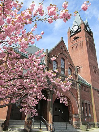
Ware is a town in Hampshire County, Massachusetts, United States. The population was 10,066 as of 2020. It is part of the Springfield, Massachusetts Metropolitan Statistical Area.

Peace Dale is a village in the town of South Kingstown, Rhode Island. Together with the village of Wakefield, it is treated by the U.S. Census as a component of the census-designated place identified as Wakefield-Peacedale, Rhode Island.

Gilbertville is an unincorporated village in the town of Hardwick, Worcester County, Massachusetts, United States, about 20 miles west of the city of Worcester. The Gilbertville Historic District and Ware–Hardwick Covered Bridge, which traverses the Ware River, are within the village. The ZIP Code for Gilbertville is 01031.
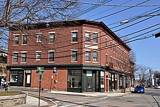
Newton Upper Falls is one of the thirteen villages within the city of Newton in Middlesex County, Massachusetts, United States.
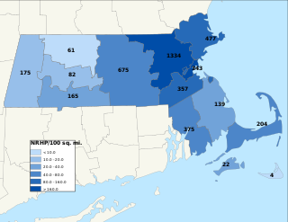
This is a list of properties and districts in Massachusetts listed on the National Register of Historic Places. There are over 4,300 listings in the state, representing about 5% of all NRHP listings nationwide and the second-most of any U.S. state, behind only New York. Listings appear in all 14 Massachusetts counties.

Massachusetts Route 32 is a state highway in the U.S. state of Massachusetts. The highway runs 60.66 miles (97.62 km) from the Connecticut state line in Monson, where the highway continues as Connecticut Route 32, north to the New Hampshire state line in Royalston, where the highway continues as New Hampshire Route 32. Route 32 connects several towns on the eastern edge of Western Massachusetts. The highway serves Palmer in eastern Hampden County, Ware in eastern Hampshire County, and Barre and Athol in northwestern Worcester County. Route 32 intersects major east–west routes including U.S. Route 20 and the Massachusetts Turnpike in Palmer, Route 9 in Ware, and US 202 and Route 2 in Athol. The highway has an alternate route, Route 32A, through Hardwick and Petersham.

The Ware River is a 35.4-mile-long (57.0 km) river in central Massachusetts. It has two forks, its West Branch, which begins in Hubbardston, Massachusetts, and its East Branch, which begins in Westminster, Massachusetts. The Ware River flows southwest through the middle of the state, joins the Quaboag River at Three Rivers, Massachusetts, to form the Chicopee River on its way to the Connecticut River.

North Uxbridge is a village and a post office in the town (township) of Uxbridge in Worcester County, Massachusetts, United States. The postal zip code is 01538. It is classified as a community or populated place located at latitude 42.088 and longitude -71.641 and the elevation is 266 feet (81 m). North Uxbridge appears on the Uxbridge U.S. Geological Survey Map. Worcester County is in the Eastern time zone and observes DST. North Uxbridge is located about 36 miles WSW of Boston, and 15 miles SE of Worcester. The town meeting in 1885 set aside North Uxbridge as a "special district", since its population had exceeded 1000 people. North Uxbridge appeared to be a separate Census tract in the 1960 census with a population of 1882. In 2013, an Uxbridge DIY show, The Garage, with Steve Butler, went worldwide from Steve's garage in North Uxbridge.
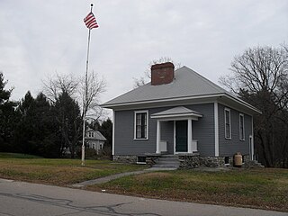
Ironstone is an historic village,, in the township of Uxbridge, Massachusetts, United States. It derived its name from plentiful bog iron found here which helped Uxbridge to become a center for three iron forges in the town's earliest settlement. South Uxbridge has historic sites, picturesque weddings, hospitality, industrial and distribution centers, and the new Uxbridge High School. This community borders North Smithfield, and Burrillville, Rhode Island, and Millville, Massachusetts. South Uxbridge receives municipal services from Uxbridge, for fire, police, EMS, School district, public works, and other services. There is a South Uxbridge fire station of the Uxbridge fire department. Worcester's Judicial District includes Uxbridge District Court. Ironstone appears on the Blackstone U.S. Geological Survey Map. Worcester County is in the Eastern time zone and observes DST.

Ware–Hardwick Covered Bridge is a historic covered bridge spanning the Ware River on Old Gilbertville Road and Bridge Street in Ware and Hardwick, Massachusetts. It is one of a small number of surviving 19th-century covered bridges in the state. The bridge was built in 1886, extensively rebuilt in 1986–1987, and was closed in 2002 due to structural issues and a limited carrying capacity. The bridge reopened in October 2010 and no longer has a weight limit according to MassDOT. It was listed on the National Register of Historic Places in 1986.

Hardwick Village Historic District is a historic district on Petersham, Barre, Greenwich, Ruggles Hill and Gilbertville Roads in Hardwick, Massachusetts. It was added to the National Register of Historic Places in 1991.
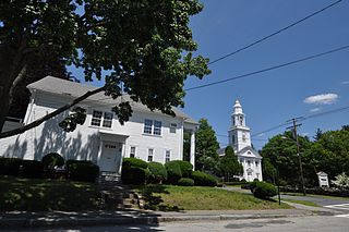
Church Street Historic District is a historic district roughly on Church Street between Park Ave. and Highland St. in Ware, Massachusetts. This mainly residential area includes some of Ware's finest late 19th century houses and a well-preserved collection of Greek Revival houses. The area was developed primarily in response to the growth of industry to the south. The district was listed on the National Register of Historic Places in 1983.

The Ware Millyard Historic District encompasses a 19th-century mill complex and industrial mill village in the town of Ware, Massachusetts. It is roughly bounded by South Street, the Ware River, Upper Dam Complex, Park Street, Otis Avenue and Church Street. The area includes surviving mill buildings, the oldest of which date to the 1840s, and a collection of tenement-style housing built for the millworkers, built between 1845 and the 1880s.
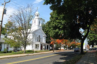
The Ludlow Village Historic District encompasses part of a historic mill village, and the economic center of the town of Ludlow, Massachusetts beginning in the later years of the 19th century. The area started to take over from Ludlow Center as the center of economic importance with the arrival of jute mills on the Chicopee River. The district is roughly bounded by Winsor, Sewall and State Sts. and the Chicopee River. It was listed on the National Register of Historic Places in 1993.
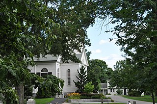
The Newton Lower Falls Historic District encompasses the historic colonial village center of Newton Lower Falls, on the west side of Newton, Massachusetts. This area lies north of Washington Street, along Concord and Grove Streets, between Washington and Hagar Streets. The district was listed on the National Register of Historic Places in 1986.

The Red Mill is a 4-story grist mill located along the South Branch Raritan River at 56 Main Street in Clinton, New Jersey. It was built c. 1810 as an industrial mill. It has served several roles, including a wool processing plant, a peach basket factory, and a textile mill. Historically known as the David McKinney Mill, it was added to the National Register of Historic Places on January 8, 1974 for its significance in agriculture and commerce. In 1995, it was also listed as a contributing property of the Clinton Historic District. It is now part of the Red Mill Museum Village, an open-air museum previously known as the Clinton Historical Museum.
East Hardwick is an unincorporated village in the town of Hardwick, Vermont, United States. It is part of what is known as the Northeast Kingdom (NEK) of Vermont. The community is located on the Lamoille River and along Vermont Route 16, 16 miles (26 km) west-northwest of St. Johnsbury. East Hardwick has a post office with ZIP code 05836, which opened on October 10, 1810. According to a 1937 WPA Federal Writers Project Guidebook, East Hardwick is a "side hill village spilling from the level of a plateau down a sharp incline in the valley of the Lamoille. It is surrounded by rich farm lands, Maple groves and forests."
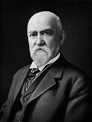
Eugene C. Gardner (1836–1915) was an American architect and author of Springfield, Massachusetts. Gardner was noted both for the architectural influence of his extensive practice as well as his writings on the American home. Gardner was the most notable architect of Springfield.


