Glenahiry Gleann na hUidhre (Irish) | |
---|---|
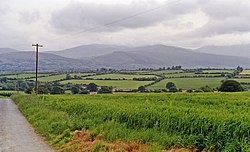
![]() Glenahiry countryside, Ballydonagh townland | |
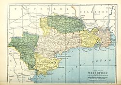
![]() Barony map of County Waterford, 1900; Glenahiry is coloured yellow, in the north. | |
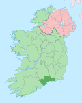
Sovereign state | Ireland |
Province | Munster |
County | Waterford |
Area | |
• Total | 157.58 km2 (60.84 sq mi) |
Glenahiry (Irish : Gleann na hUidhre) [1] is a barony in County Waterford, Ireland. [2] [3]
Glenahiry barony is derived from the Irish for "valley of the River Nier", which is called An Uidhir ("dun, brown") in Irish. [4] The Nier joins the River Suir at Ballymakee. [5]
Glenahiry is located in northern County Waterford, east of the River Suir and west of the Comeragh Mountains. The Nier Valley Woodlands are a Special Area of Conservation. [6]
Glenahiry was the ancient territory of the Mac Cairbre (Carbery). [7] [8] [9]
Glenahiry was established as a barony by 1672.[ citation needed ]
Below is a list of settlements in Glenahiry barony: