An impact crater is a depression in the surface of a solid astronomical body formed by the hypervelocity impact of a smaller object. In contrast to volcanic craters, which result from explosion or internal collapse, impact craters typically have raised rims and floors that are lower in elevation than the surrounding terrain. Impact craters are typically circular, though they can be elliptical in shape or even irregular due to events such as landslides. Impact craters range in size from microscopic craters seen on lunar rocks returned by the Apollo Program to simple bowl-shaped depressions and vast, complex, multi-ringed impact basins. Meteor Crater is a well-known example of a small impact crater on Earth.

Manicouagan Reservoir is an annular lake in central Quebec, Canada, covering an area of 1,942 km2 (750 sq mi). The lake island in its centre is known as René-Levasseur Island, and its highest point is Mount Babel. The structure was created 214 (±1) million years ago, in the Late Triassic, by the impact of a meteorite 5 km (3 mi) in diameter. The lake and island are clearly seen from space and are sometimes called the "eye of Quebec". The lake has a volume of 137.9 km3 (33.1 cu mi).

Acraman impact structure is a deeply eroded impact crater in the Gawler Ranges of South Australia. Its location is marked by Lake Acraman, a circular ephemeral playa lake about 20 kilometres (12 mi) in diameter. The discovery of the impact structure and independent discovery of its ejecta were first reported in the journal Science in 1986. The evidence for impact includes the presence of shatter cones and shocked quartz in shattered bedrock on islands within Lake Acraman.
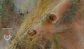
The Arkenu structures, also known as the Arkenu craters, are a pair of prominent circular geological structures in eastern Libya. The structures are approximately 10 kilometres (6.2 mi) and 6.8 kilometres (4.2 mi) in diameter, and lie about 70 kilometres (43 mi) west of Jabal Arkanu on the eastern margin of the al-Kufrah Basin.
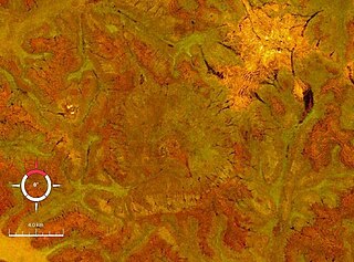
Connolly Basin is a 9 km-diameter impact crater located in the Gibson Desert of central Western Australia. It lies adjacent to the Talawana Track 45 km west of the junction with the Gary Highway, but is difficult to access due to the remoteness of the area. It was originally thought to be a diapir ; an impact origin was first proposed in 1985.,

Dalgaranga crater is a small meteorite impact crater located on Dalgaranga pastoral station 75 km (47 mi) northwest of Mount Magnet in Western Australia. It is only 24 m (79 ft) in diameter and 3 m (9.8 ft) deep, making it Australia's smallest impact crater. Though discovered in 1921, it was not reported in the scientific literature until 1938. The bedrock at the site is weathered Archaean granite of the Yilgarn Craton. The discovery of fragments of mesosiderite stony-iron meteorite around the crater confirms an impact origin, making this crater unique as the only one known to have been produced by a mesosiderite projectile.
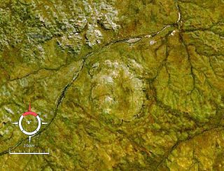
Foelsche is a partly buried impact structure, the eroded remnant of a former impact crater. It is situated about 85 km southeast of Borroloola in the Northern Territory, Australia, and named after the nearby Foelsche River. Although little of it is exposed at the surface, and no crater shaped topography is evident, the circular nature of the feature is obvious on aeromagnetic images, a factor that led to its discovery.

Goyder is an impact structure, the eroded remnant of a former impact crater. It is situated in Arnhem Land in the Northern Territory, Australia, and was named after the nearby Goyder River. The impact occurred into Mesoproterozoic sedimentary rocks of the McArthur Basin. The deformed area is exposed at the surface and marked by a 3 km diameter ring of fractured and faulted sandstone, which is interpreted as the eroded relic of a central uplift ; the original crater rim, long since removed by erosion, being estimated at approximately 9–12 km diameter. Evidence for an impact origin includes the presence of shatter cones and shocked quartz in outcrops of deformed sandstone at the center of the site.
Kelly West is a deeply eroded impact crater situated in the central Northern Territory, Australia. It was discovered during Government geological mapping and first reported in 1973, the evidence for impact coming principally from an abundance of shatter cones at the site.

Lawn Hill ‘crater’ refers to an Ordovician impact structure, the eroded remnant of a former impact crater, situated approximately 220 km north-north-west of Mount Isa in northwestern Queensland, Australia. The site is marked by an 18 km diameter ring of dolomite hills. The origin of this circular feature was uncertain until the discovery of shatter cones and shocked quartz from uplifted rocks at the centre was reported in 1987.

Liverpool is a meteorite impact crater situated in Arnhem Land within the Northern Territory, Australia. It was named after the nearby Liverpool River. Liverpool is remote and difficult to access. The crater has a raised, near-circular rim averaging about 1.6 km in diameter. It was first noticed by geologists during reconnaissance geological mapping in the 1960s, and although an impact origin was considered possible, this was not confirmed until a more detailed study was undertaken in 1970.

Mount Toondina crater is an impact structure, the eroded remnant of a former impact crater, located in northern South Australia in the locality of Allandale Station about 24 km (15 mi) south of the town of Oodnadatta. Mount Toondina is the high point of a circular topographic feature rising out of an otherwise relatively flat desert area of the Eromanga Basin. An impact origin was first suggested in 1976, challenging the earlier diapir hypothesis, and strongly supported by subsequent studies. A geophysical survey using gravity methods indicates an internal structure typical of complex impact craters, including an uplifted centre, and suggests that the original crater was about 3–4 km in diameter. The crater must be younger than the Early Cretaceous age of the rocks in which it is situated, but otherwise is not well dated. It has clearly undergone significant erosion since the impact event.

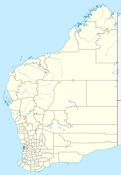
Shoemaker is an impact structure, the deeply eroded remnant of a former impact crater, situated in arid central Western Australia, about 100 km (62 mi) north-northeast of Wiluna. It is named in honour of planetary geologist Eugene Shoemaker.
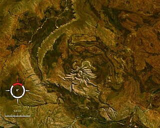
Spider is an impact structure, the deeply eroded remnant of a former impact crater, situated in the Kimberley region of northern Western Australia, 18 km east of the Mount Barnett Roadhouse on the Gibb River Road. Due to very rugged terrain the site is effectively inaccessible. The name is derived from the visually striking spider-like radiating ridges of quartzite prominently visible from the air or on satellite images.

Veevers crater is an impact crater located on a flat desert plain between the Great Sandy and Gibson Deserts in the centre of the state of Western Australia.

Woodleigh is a large meteorite impact structure (astrobleme) in Western Australia, centred on Woodleigh Station east of Shark Bay, Gascoyne region. A team of four scientists at the Geological Survey of Western Australia and the Australian National University, led by Arthur J. Mory, announced the discovery in the 15 April 2000 issue of Earth and Planetary Science Letters.
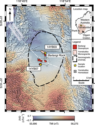
The Yarrabubba impact structure is the eroded remnant of an impact crater, situated in the northern Yilgarn Craton near Yarrabubba Station between the towns of Sandstone and Meekatharra, Mid West Western Australia. With an age of 2.229 billion years, it is the oldest known impact structure on Earth.
The Diamantina River ring feature is a geomorphic feature that consists of a conspicuous near-360° circular drainage pattern that forms the headwaters of the Diamantina River. It is centred near the Woodstock Station west of Winton, Channel Country, Central West Queensland. This geomorphic feature coincides with a potassium–thorium–uranium radiometric signature that is associated with exposed clay-rich sedimentary rocks of the Cretaceous Winton Formation, high-uranium elevated Cenozoic duricrust surfaces, and high-thorium elevated sediment eroded from the Cenozoic weathering profile. The Diamantina River ring feature is one of several circular crustal structures of diverse origin that have been mapped within Australia. These circular crustal structures include geologic structures such as tectonic domes, circular granite intrusions, volcanic calderas and ring structures, salt domes, impact structures and morphological drainage rings of unknown origin.

