Godfrey Road, Florida

Last updated
Godfrey Road, Florida
Broward County Florida Incorporated and Unincorporated areas Godfrey Road Highlighted.svg
Location of Godfrey Road
Coordinates: 26°17′37″N80°13′23″W / 26.29361°N 80.22306°W / 26.29361; -80.22306 Coordinates: 26°17′37″N80°13′23″W / 26.29361°N 80.22306°W / 26.29361; -80.22306
Country Flag of the United States.svg  United States
State Flag of Florida.svg  Florida
County   Broward
Area
  Total0.2 sq mi (0.6 km2)
  Land0.2 sq mi (0.6 km2)
  Water0.0 sq mi (0.0 km2)
Population
 (2000)
  Total172
  Density795.7/sq mi (307.2/km2)
Time zone UTC-5 (Eastern (EST))
  Summer (DST) UTC-4 (EDT)
FIPS code 12-26237 [1]

Godfrey Road is a former census-designated place (CDP) in Broward County, Florida, United States. The population was 172 at the 2000 census. Godfrey Road was annexed by the city of Parkland, Florida in 2006.

Contents

Geography

Godfrey Road is located at 26°17′37″N80°13′23″W / 26.29361°N 80.22306°W / 26.29361; -80.22306 (26.293686, -80.223003). [2]

According to the United States Census Bureau, the CDP has a total area of 0.6 km2 (0.2 mi2), all land.

Demographics

As of the census [1] of 2000, there were 172 people, 55 households, and 49 families residing in the CDP. The population density was 301.9/km2 (795.7/mi2). There were 55 housing units at an average density of 96.5/km2 (254.4/mi2). The racial makeup of the CDP was 85.47% White (84.3% were Non-Hispanic White,) [3] 0.58% African American, 0.58% Native American, 9.30% from other races, and 4.07% from two or more races. Hispanic or Latino of any race were 7.56% of the population.

There were 55 households, out of which 29.1% had children under the age of 18 living with them, 85.5% were married couples living together, 3.6% had a female householder with no husband present, and 9.1% were non-families. 7.3% of all households were made up of individuals, and 1.8% had someone living alone who was 65 years of age or older. The average household size was 3.04 and the average family size was 3.12.

In the CDP, the population was spread out, with 22.7% under the age of 18, 8.1% from 18 to 24, 19.8% from 25 to 44, 37.2% from 45 to 64, and 12.2% who were 65 years of age or older. The median age was 45 years. For every 100 females, there were 95.5 males. For every 100 females age 18 and over, there were 101.5 males.

The median income for a household in the CDP was $80,966, and the median income for a family was $83,163. Males had a median income of $30,536 versus $27,386 for females. The per capita income for the CDP was $22,319. None of the population or families were below the poverty line.

As of 2000, English accounted for 84.00% of all residents, while Spanish was the mother tongue of 16.00% of the population. [4]

Related Research Articles

Hiland Park, Florida Unincorporated Place in Florida, United States

Hiland Park is a former census-designated place (CDP) in Bay County, Florida, United States. The population was 999 at the 2000 census. Most of the area is now part of the city of Lynn Haven. It is part of the Panama City–Lynn Haven–Panama City Beach Metropolitan Statistical Area.

Nobleton, Florida Census-designated place in Florida, United States

Nobleton is an unincorporated community and census-designated place (CDP) in Hernando County, Florida, United States. The population was 282 at the 2010 census, up from 160 at the 2000 census.

Windsor, Indian River County, Florida Census-designated place in Florida, United States

Windsor, formerly known as North Beach, is a gated community and census-designated place (CDP) on Orchid Island in Indian River County, Florida, United States. The population was 256 at the 2010 census. It is part of the Sebastian–Vero Beach Metropolitan Statistical Area.

Fort Myers Shores, Florida Census-designated place in Florida, United States

Fort Myers Shores is an unincorporated community and census-designated place (CDP) in Lee County, Florida, United States. The population was 5,487 at the 2010 census. It is part of the Cape Coral-Fort Myers, Florida Metropolitan Statistical Area.

North River Shores, Florida CDP in Florida, United States

North River Shores is a census-designated place (CDP) in Martin County, Florida, United States. The population was 3,101 at the 2000 census. It is part of the Port St. Lucie Metropolitan Statistical Area.

Lake Lucerne, Florida Neighborhood of Miami Gardens in Miami-Dade, Florida, United States

Lake Lucerne is a neighborhood in Miami Gardens, Florida. It is formerly a census-designated place. The population was 9,132 at the time of the 2000 United States census.

Opa-locka North, Florida Neighborhood of Miami Gardens in Miami-Dade, Florida, United States

Opa-locka North is a neighborhood in Miami Gardens, Florida, United States. It was formerly a census-designated place. The population was 6,224 at the 2000 census.

North Key Largo, Florida CDP in Florida, United States

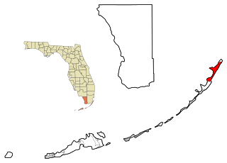
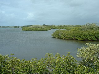
North Key Largo is a census-designated place (CDP) in Monroe County, Florida, United States. The population was 1,244 at the 2010 census. It includes two private clubs, the Ocean Reef Club and the Key Largo Anglers Club and is reached from the mainland via the Card Sound Bridge.

Tavernier, Florida Census-designated place & Unincorporated community in Florida, United States

Tavernier is a census-designated place (CDP) and unincorporated community in Monroe County, Florida, United States on Key Largo, the largest island in the upper Florida Keys. Tavernier's population was 2,173 at the 2000 census.

Dunes Road is a former census-designated place (CDP) in Palm Beach County, Florida, United States. The population was 391 at the 2000 census.

Fremd Village-Padgett Island was a census-designated place (CDP) in Palm Beach County, Florida, United States. The population was 2,264 at the 2000 census.

High Point was a census-designated place (CDP) in Palm Beach County, Florida, United States. The population was 2,191 at the 2000 census. The CDP was removed from the 2010 census. Although it is still unincorporated, it is within Delray Beach's "future annexation area."

Kings Point, Florida unincorporated place in Florida, United States

Kings Point is a census-designated place (CDP) in Palm Beach County, Florida, United States. The population was 12,207 as of the 2000 census.

Lake Belvedere Estates is a census-designated place (CDP) in Palm Beach County, Florida, United States. The population was 1,525 at the 2000 census.

Lake Harbor, Florida CDP in Florida, United States

Lake Harbor is a census-designated place (CDP) in Palm Beach County, Florida, United States. The population was 195 at the 2000 census. It located along the southern banks of Lake Okeechobee, at the beginning of the Miami Canal. John Stretch Park is also located alongside the north end of Lake Harbor and the lake.

Mission Bay, Florida unincorporated place in Florida, United States

Mission Bay is a census-designated place (CDP) located in an unincorporated area in west Boca Raton in Palm Beach County, Florida, United States. The population was 2,926 at the 2000 census.

Schall Circle is a census-designated place (CDP) in Palm Beach County, Florida, United States. The population was 965 at the 2000 census.

Villages of Oriole, Florida unincorporated place in Florida, United States

Villages of Oriole was a census-designated place (CDP) in Palm Beach County, Florida, United States. The population was 4,758 at the 2000 census.

Glencoe, Florida CDP in Florida, United States

Glencoe is a census-designated place (CDP) in Volusia County, Florida, United States. The population was 2,582 at the 2010 census.

Lawson Heights, Pennsylvania CDP in Pennsylvania, United States

Lawson Heights is a census-designated place (CDP) in Unity Township, Westmoreland County, Pennsylvania, United States. The population was 2,339 at the 2000 census.

References

  1. 1 2 "U.S. Census website". United States Census Bureau . Retrieved 2008-01-31.
  2. "US Gazetteer files: 2010, 2000, and 1990". United States Census Bureau. 2011-02-12. Retrieved 2011-04-23.
  3. "Demographics of Godfrey Road, FL". MuniNetGuide.com. Archived from the original on 2008-04-28. Retrieved 2007-11-18.
  4. "MLA Data Center Results for Godfrey Road, Florida". Modern Language Association . Retrieved 2007-11-18.