
Central Christian College of Kansas is a private evangelical Christian college in McPherson, Kansas, United States. Central Christian is affiliated with the Free Methodist Church.

Korenica is a village in Lika, Croatia, located in the municipality of Plitvička Jezera, on the D1 road between Plitvice and Udbina. According to 2011 census it has 1,766 residents. It is the seat of the Plitvička Jezera Municipality.
Beden Brook, also Bedens Brook, Beden's Brook, or Beeden's Brook, is a tributary of the Millstone River in central New Jersey in the United States.
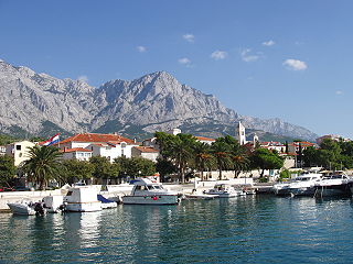
Baška Voda is a village and a municipality in Croatia in the Split-Dalmatia County.
Kambadur is a village in Anantapur district of the Indian state of Andhra Pradesh. It is the headquarters of Kambadur mandal in Kalyandurg revenue division.

The Château Sainte-Marie is a castle dating from the second half of the 16th century, modified and altered during the 19th century, in the commune of Longages in the Haute-Garonne département of France.
Melikgyugh is a village in the Aparan Municipality of the Aragatsotn Province of Armenia.

Nurnus, is a village in the Kotayk Province of Armenia.
Hendersons Store is an unincorporated community in Nelson County, Virginia, United States.

Malojloj is a census-designated place located within the larger village of Inarajan, in the United States territory of Guam. It is specifically located within the hills north of the central Inarajan.
Trnjane is a village in the municipality of Negotin, Serbia. According to the 2002 census, the village has a population of 479 people.
Donji Vrbljani is a village in the municipality of Ribnik, Republika Srpska, Bosnia and Herzegovina.

Oneida Township is one of the twenty-one townships of Tama County, Iowa, United States.
Brodar is a village in the municipality of Višegrad, Bosnia and Herzegovina.
26°44′36″N84°49′41″E

Rukkirahu is a small, uninhabited island in the Baltic Sea belonging to the country of Estonia.
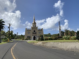
Inalåhan is a village located on the southeastern coast of the United States territory of Guam. The village's original Chamoru name, Inalåhan, was altered when transliterated during Spanish control of the island.
Orašje is a village in the municipality of Varvarin, Serbia. According to the 2002 census, the village has a population of 698 people.
Leskovac is a village situated in Knić municipality in Serbia.

Untersberg-Arena is a football stadium in Grödig, Austria. It is home to SV Grödig and FC Liefering.
