
Katra is a city and Tehsil in the Reasi district of the Indian union territory of Jammu and Kashmir, situated at the foot of the Trikuta Mountains, where the shrine of Vaishno Devi is located. Katra is located 24 km from the town of Reasi, 42 km (26 mi) from the city of Jammu and around 685 km (426 mi) north of the national capital New Delhi and is the base for pilgrims visiting the Mata Vaishno Devi Temple.

Udhampur (ˌʊd̪ʱəmpur) is a city and a municipal council in Udhampur district in the Indian union territory of Jammu and Kashmir. It is the headquarters of Udhampur District. Named after Raja Udham Singh, it serves as the district capital and the Northern Command headquarters of the Indian Army. A Forward Base Support Unit (FBSU) of the Indian Air Force is also stationed here. Udhampur is used by the Armed Forces as a transit point between Jammu and Srinagar when travelling by road on National Highway 1A, which has since been renamed as National Highway 44.

Doda is a town and a notified area committee in Doda district in the Indian union territory of Jammu and Kashmir. Doda has an average elevation of 1,107 metres (3,632 ft).

Zangla is a village in Zanskar tehsil of Kargil district, in the Indian union territory of Ladakh. It is located 262 km (163 mi) southeast of Kargil city, the district headquarters, and 32 km (20 mi) northeast of Padum, the headquarters of Zanskar. An ancient ruined palace, known as Zangla Fort or Zangla Khar is located on a hilltop 1 km (0.62 mi) outside the village, believed to be 11th-century. The Buddhist nunnery in Zangla contains some impressive paintings.

Banihal is a town and a notified area committee, near Ramban town in Ramban district in the Indian union territory of Jammu and Kashmir. It is a rural and hilly area with Kamirwah being one of the most prominent hills. It is located about 35 km (22 mi) away from Qazigund of Anantnag district on NH 44. However, the distance between Banihal and Qazigund is only 18 km by train on the new railway line which is much shorter than the road. The most common language spoken in the region is Kashmiri; Urdu, Hindi, Gujjari, Pahari and English are other familiar languages.

Bijbehara (Urdu pronunciation:[biːd͡ʒbɪɦɑːɽɑː], known as Vejibror in Kashmiri, is a town and a notified area committee in Anantnag district of the Indian administered union territory of Jammu and Kashmir. It is located on NH 44, and jehlum bank. Bijbehara town is also known as "Town of Chinars" because of a number of Chinars there especially two Chinar gardens. Bijbehara is the home to oldest chinar tree in the region. The town is situated about 45 km from the summer capital of union territory of Jammu and Kashmir, Srinagar.
Chanani or Chenani is a town and tehsil in the Udhampur district, in the Indian union territory of Jammu and Kashmir. It is governed by a notified area council. Before 1947, it was an internal jagir ruled by a Chandel (Rajput) ruler in the princely state of Jammu and Kashmir. This Town has further gained importance after getting the Asia's longest tunnel from chenani to nasari.
Handwara is a town in Kupwara district of Jammu and Kashmir, India. It is located on Baramulla-Handwara National Highway NH-701 and is governed by a municipal committee.

Kishtwar is a town, municipality and administrative headquarter of the Kishtwar district in the Indian-administered Jammu and Kashmir. The district was carved out of the Doda district in 2007. and is located in the Jammu division. The town of Kishtwar is situated at a distance of 209.5 km (130.2 mi) from the summer capital of Srinagar, and 211.5 km (131.4 mi) from the winter capital of Jammu. A large ground locally called as Chowgan ground is located in the heart of the town.
Kud is a town and a notified area committee in Udhampur district in the Indian union territory of Jammu and Kashmir. It is about 10 km from the popular tourist place Patnitop and is famous for a local sweet known as "Desi Ghee Patisa" another name of the sweet made up of milk products. Desi Ghee is a milk product and patisa is known as Papdi.
Kokernag is a sub-district town and a notified area committee in Breng Valley, Anantnag district in the Indian union territory of Jammu and Kashmir. The place is known for its botanical gardens, pristine freshwater springs, and rainbow trout farm. It is 25.3 km from Anantnag District via NH244. It is one of the most popular weekend getaways from the state capital of Srinagar.
Kulgam, known as Kolgom in Kashmiri, is a town, an administrative division and capital of the Kulgam district in the Indian union territory of Jammu and Kashmir. It is located at a distance of 67 km (42 mi) from the summer state capital of Jammu and Kashmir, Srinagar. The city is divided into 16 electoral wards that has a population of 23,584, of which 12,605 are males while 10,979 are females.
Kupwara is a city, District headquarter and a municipal council in Kupwara district in the Indian union territory of Jammu and Kashmir.

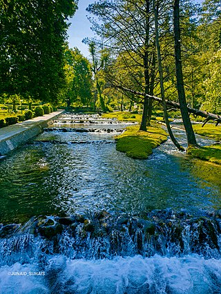
Pahalgam, known as Pahalgom is a town and a notified area committee, near Anantnag city in the Anantnag district of the Indian-administered union territory of Jammu and Kashmir. It is a popular tourist destination and hill station. Its lush green meadows and pristine waters attract thousands of tourists from all over the world each year. It is located 45 kilometres (28 mi) from Anantnag on the banks of Lidder River at an altitude of 7,200 feet (2,200 m). Pahalgam is the headquarters of one of the eleven tehsils of Anantnag district.

Qazigund, also known as Gateway Of Kashmir, is a town and in the union territory of Jammu and Kashmir, India. Qazigund is located at 33.59°N 75.16°E. It has an average elevation of 1670 m (5478 feet) above mean sea level.
Ramban is a town in Ramban district of Jammu and Kashmir, India, which is the district headquarters of Ramban district. It lies on the banks of the Chenab river in Chenab Valley on the National Highway-1A at about 120 km from Jammu and about 130 km from Srinagar, making it almost the central point on the Jammu-Srinagar National Highway.
Ramban district is an administrative district in the Jammu division of Indian-administered Jammu and Kashmir in the disputed Kashmir region. It is located in a valley surrounded the Pir Panjal range. It was carved out as a separate district from erstwhile Doda district in 2007. It is located in the Jammu division. The district headquarters are at Ramban town, which is located midway between Jammu and Srinagar along the Chenab river in the Chenab valley on National Highway-44, approximately 151 km from Jammu and Srinagar.
Ramsoo is a village and municipality in Ramban district of the Indian union territory of Jammu and Kashmir. The town is located 22 kilometres from the district headquarters Ramban.
Ghagwal is a town and Panchayat in Samba district in the Jammu division of the Indian union territory of Jammu and Kashmir. The town is located 15 kilometres from district headquarters Samba. River Baein flows from east side of Ghagwal. Famous 1750 years old, Narsingh Dham Mandir is situated in Middle of Ghagwal and is also known as "Heart of Ghagwal". Before 2006 Ghagwal was part of Kathua District of Jammu Division. Ghagwal Town is Also Headquarter of Tehsil and Sub Division Office of Ghagwal. Govt. Degree College, Ghagwal is currently functional in Temporary Building.
Chanderkot is a village panchayat located in Ramban district in the Indian state of Jammu-Kashmir.

