Bandipore or Bandipora is the headquarters of district of Bandipore in the union territory of Jammu and Kashmir, India. It is located on the northern banks of Wullar Lake—the second-largest freshwater lake in Asia. From baramulla the gateway of bandipora is Kehnusa where bandipora starts The kehnusa village has its two parts on the banks of wular zurimanz and Bangladesh the new tourist attraction.From kehnusa to Bandipora the distanceis 15 km.Also highest Mountain peak of Kashmir Valley Mt Harmukh is in Bandipora.Bandipora has a terraced garden similar to that of Nishat Bagh in Srinagar. Bandipora is bound by mountains on three sides and by Wular Lake on the fourth. As per folklore, the name of Bandipora originated either from Bund of Wular as Bund e pur, from the local folk-singing bands (bāṇd) as Baand e pur or from the enclosed (band) geographical location as Bandh e pur.
Handwara is a town in Kupwara district of Jammu and Kashmir, India. It is located on Baramulla-Handwara National Highway NH-701 and is governed by a municipal committee.
Kupwara is a city, District headquarter and a municipal council in Kupwara district in the Indian union territory of Jammu and Kashmir.

Kupwara district is an administrative district of Indian-administered Jammu and Kashmir in the disputed Kashmir region. It is one of the 10 districts located in the Kashmir Valley Division of Indian administered Kashmir. The Pohru River and Mawar river are two main rivers in the district. Both of them meet Jhelum river in Baramulla district.
Sumbal is a town and a notified area committee in the Bandipora district of the Indian union territory of Jammu and Kashmir. Sumbal is 19 kilometres away from Srinagar. The surrounding parts of sumbal consist of many villages like Nowgam, shadipora, Shahtulpora, Shilwat, Shiganpora, Inderkote. This area has one of the significant Shia population in Kashmir. The place is rich in literature and agriculture. Sumbal is situated on the bank of the river Jhelum and is adjacent to the Manasbal lake. There are also many notable figures from this area including Kashmir's first Muslim lady pilot Iram Habibi and many other personalities particularly poets. The zalpora village of Sumbal joins two districts, Bandipora and Baramulla which serves as another route to connect the districts Kupwara and Baramulla to Srinagar. Sumbal city is divided into 13 wards, for which elections are held every 5 years.
Chitterkote is a small village in tehsil Karnah in Kupwara district in the Indian union territory of Jammu and Kashmir. The village is located 75 kilometres (47 mi) from district headquarters Kupwara and 8 kilometres (5.0 mi) from tehsil headquarters Tangdhar.
Karnah is an administrative tehsil in the Kupwara district of the Indian union territory of Jammu and Kashmir. It is 78 kilometres (48 mi) from the town of Kupwara, the district headquarter, and is the largest tehsil of the district by area.
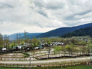
Nathipora is a village in the Bomai block in Sopore tehsil, in the Baramulla District of Jammu and Kashmir, India.

Sogam Lolab is a municipality situated in the Kupwara district of the Kashmir Valley, in the Indian union territory of Jammu and Kashmir. Sogam Lolab is the home of many administrative offices for the area and acts as Sub-District. The town falls within the jurisdiction of Lolab Valley. It is separated by Nagmarg Meadows from Bandipora district to east. Sogam is at an altitude of 1,589 metres (5,213 ft) above the sea level and has a population of about 16,166 with literacy rate of about 79.61%.
Diver Anderbugh is a village situated in the Lolab Valley, Kupwara, Jammu and Kashmir, India. The village is combination of two places, Diver and Anderbugh. The site is connected to the village of Anderbugh. It is situated 25 kilometres (16 mi) away from district headquarter Kupwara.
Tangdhar is a village located in Kupwara district of the Indian union territory of Jammu and Kashmir. The village is located at a distance of 67 kilometres (42 mi) from the district headquarters Kupwara. It is a forward village along the Line of Control (LoC). With Neelum valley to its north and Leepa to the south, Tangdhar is surrounded by Pakistan administered Kashmir from three sides. Tangdhar sector is popular for infiltrations and ceasefire violations from Pakistan.
Teetwal is a small border-village in Jammu and Kashmir, India. It is situated on the banks of the Kishanganga River in Kupwara district, 82 km (51 mi) from the district headquarters of Kupwara and close to the Line of Control with Pakistani-administered Kashmir. Teetwal is connected to the rest of India via Tangdhar.
Kralpora is a Tehsil and a village in Kupwara district of the Indian administered union territory of Jammu and Kashmir. The village is located just 15 kilometres from district headquarters Kupwara town.
Kalarooch, also known as Kalaroos, is a pass of Kupwara district in the union territory of Jammu and Kashmir, India. It is surrounded by mountains which increases its beauty. The village is located 11 km (6.8 mi) from district headquarters Kupwara.
Trehgam is a town in Kupwara district of the Indian union territory of Jammu and Kashmir. The village is located at a distance of 7 km (4.3 mi) from district headquarters Kupwara town. Trehgam has recently been carved out as the sixth constituency of District Kupwara.
Bagati Kani Pora or B.K. Pora is a village and municipality in Budgam district of the Indian union territory of Jammu and Kashmir.
Marh is a village and municipality in Jammu district of the Indian union territory of Jammu and Kashmir. The village is located 26 kilometres from district headquarters Jammu.
Yigoban is a small village in Kupwara district of the Indian union territory of Jammu and Kashmir.
Watter Khani is a village in Kupwara district of the Indian union territory of Jammu and Kashmir. The village is located at a distance of 7 kilometres (4.3 mi) from district headquarters Kupwara town.
Kigam is a village in Kupwara district of the Indian union territory of Jammu and Kashmir. The village is located at a distance of 9 kilometres (5.6 mi) from district headquarters Kupwara town.

