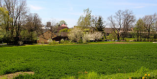
Beşdəli is a village in the Zangilan Rayon of Azerbaijan.

Młodawin Górny is a village in the administrative district of Gmina Zapolice, within Zduńska Wola County, Łódź Voivodeship, in central Poland. It lies approximately 6 kilometres (4 mi) east of Zapolice, 5 km (3 mi) south of Zduńska Wola, and 43 km (27 mi) south-west of the regional capital Łódź.

Wrzask is a village in the administrative district of Gmina Stryków, within Zgierz County, Łódź Voivodeship, in central Poland. It lies approximately 8 kilometres (5 mi) north-west of Stryków, 16 km (10 mi) north-east of Zgierz, and 21 km (13 mi) north of the regional capital Łódź.

Góra Motyczna is a village in the administrative district of Gmina Żyraków, within Dębica County, Subcarpathian Voivodeship, in south-eastern Poland. It lies approximately 3 kilometres (2 mi) north-west of Żyraków, 7 km (4 mi) north-west of Dębica, and 46 km (29 mi) west of the regional capital Rzeszów.

Olbrachcice is a village in the administrative district of Gmina Wodzisław, within Jędrzejów County, Świętokrzyskie Voivodeship, in south-central Poland. It lies approximately 9 kilometres (6 mi) north-east of Wodzisław, 9 km (6 mi) south of Jędrzejów, and 43 km (27 mi) south-west of the regional capital Kielce.

Podlesie is a village in the administrative district of Gmina Radoszyce, within Końskie County, Świętokrzyskie Voivodeship, in south-central Poland. It lies approximately 4 kilometres (2 mi) north-east of Radoszyce, 15 km (9 mi) south-west of Końskie, and 33 km (21 mi) north-west of the regional capital Kielce.

Nowy Jawor is a village in the administrative district of Gmina Pawłów, within Starachowice County, Świętokrzyskie Voivodeship, in south-central Poland. It lies approximately 3 kilometres (2 mi) south of Pawłów, 12 km (7 mi) south of Starachowice, and 35 km (22 mi) east of the regional capital Kielce.

Marianki is a village in the administrative district of Gmina Stromiec, within Białobrzegi County, Masovian Voivodeship, in east-central Poland. It lies approximately 3 kilometres (2 mi) south of Stromiec, 11 km (7 mi) east of Białobrzegi, and 67 km (42 mi) south of Warsaw.

Sułkowice is a village in the administrative district of Gmina Chynów, within Grójec County, Masovian Voivodeship, in east-central Poland. It lies approximately 3 kilometres (2 mi) north of Chynów, 18 km (11 mi) north-east of Grójec, and 33 km (21 mi) south of Warsaw.
Klusek is a village in the administrative district of Gmina Pokrzywnica, within Pułtusk County, Masovian Voivodeship, in east-central Poland.

Jędrychowice is a village in the administrative district of Gmina Branice, within Głubczyce County, Opole Voivodeship, in south-western Poland, close to the Czech border. It lies approximately 6 kilometres (4 mi) north-east of Branice, 12 km (7 mi) south of Głubczyce, and 64 km (40 mi) south of the regional capital Opole.

Vitkovo is a village in the municipality of Aleksandrovac, Serbia. According to the 2002 census, the village has a population of 488 people.

Gornje Brijanje is a village in the municipality of Bojnik, Serbia. According to the 2002 census, the village has a population of 509 people.

Barič is a village in the municipality of Golubac, Serbia. According to the 2002 census, the village has a population of 464 people.

Gradac is a village in the municipality of Foča, Republika Srpska, Bosnia and Herzegovina.

Mirjanovići is a village in the municipality of Foča, Republika Srpska, Bosnia and Herzegovina.

Mala Drenova is a village in the municipality of Trstenik, Serbia. According to the 2002 census, the village has a population of 735 people.
Célony is a village close to Aix-en-Provence in France.

The Muma River is a right tributary of the Han River in the Yangtze river basin of northern China. It has a length of 128 kilometres (80 mi) and a drainage area of 2,782 square kilometres (1,074 sq mi). It originates in and flows entirely within Xixiang County of Shaanxi Province. The annual average flow is 45 cubic metres per second (1,600 cu ft/s). It has a natural drop of 1,613 metres (5,292 ft) and water reserves of 90,000 kilowatts. It arises near the border with Sichuan Province at 32°45′23″N107°22′15″E, flows northwest and debouches into the Han River at 33°05′47″N107°56′51″E.

Tuyyq, also known as Tuyuk, is a town in Almaty Region, southeast Kazakhstan. It lies at an altitude of 1,938 m (6,358 ft).


