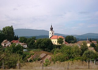
Dugopolje is a municipality in Croatia in the Split-Dalmatia County.
Abzakovo is a rural locality and the administrative center of Abzakovsky Selsoviet, Beloretsky District of the Republic of Bashkortostan, Russia.
Černé Voděrady is a village in the Central Bohemian Region of the Czech Republic. On the date July 3, 2006 it has 293 inhabitants. First written notice about village is from year 1291. The municipality lies at an altitude of 425 metres and covers an area of 13.14 km².

Gęsice is a village in the administrative district of Gmina Domaniów, within Oława County, Lower Silesian Voivodeship, in south-western Poland. Prior to 1945 it was in Germany.

Çovdar is a village in the Kalbajar Rayon of Azerbaijan.

Zabłocie is a village in the administrative district of Gmina Zagnańsk, within Kielce County, Świętokrzyskie Voivodeship, in south-central Poland. It lies approximately 4 kilometres (2 mi) south of Zagnańsk and 9 km (6 mi) north-east of the regional capital Kielce.

Beszyce is a village in the administrative district of Gmina Koprzywnica, within Sandomierz County, Świętokrzyskie Voivodeship, in south-central Poland. It lies approximately 6 kilometres (4 mi) west of Koprzywnica, 20 km (12 mi) south-west of Sandomierz, and 71 km (44 mi) south-east of the regional capital Kielce.
Straszków is a village in the administrative district of Gmina Kościelec, within Koło County, Greater Poland Voivodeship, in west-central Poland.

Mokre is a village in the administrative district of Gmina Czersk, within Chojnice County, Pomeranian Voivodeship, in northern Poland. It lies approximately 6 kilometres (4 mi) north of Czersk, 31 km (19 mi) north-east of Chojnice, and 74 km (46 mi) south-west of the regional capital Gdańsk.

Dapeng Fortress or Dapengsuocheng is a walled village in the subdistrict Dapeng, district Longgang, Shenzhen, Guangdong province, China. The village lies 55 kilometers from the center of Shenzhen.
Łumpia is a village in the administrative district of Gmina Świątki, within Olsztyn County, Warmian-Masurian Voivodeship, in northern Poland.
Wałpusz is a village in the administrative district of Gmina Szczytno, within Szczytno County, Warmian-Masurian Voivodeship, in northern Poland.

Sladinac is a village in the municipality of Golubac, Serbia. According to the 2002 census, the village has a population of 191 people.

Vinište is a village in the municipality of Konjic, Bosnia and Herzegovina.

Castelnaudary is a railway station in Castelnaudary, Occitanie, France. The station opened on 22 April 1857 and is on the Bordeaux–Sète line. It is at the southern end of the town, about a 5–10-minute walk from the centre. The station is served by Intercités and TER (local) services operated by the SNCF.

Popšica is a village in the municipality of Svrljig, Serbia. According to the 2002 census, the village has a population of 155 people.

Künövşə is a village in the Siazan Rayon of Azerbaijan. The village forms part of the municipality of Yuxarı Ələz.

Paežeriai Manor is a former residential manor in Paežeriai village, Šiauliai District Municipality, near Nelinda lake.

Mátraderecske is a village in Heves County, Northern Hungary Region, Hungary.

Mana Parbat III is a mountain of the Garhwal Himalaya in Uttarakhand India. Mana Parbat III standing majestically at 6,730 metres (22,080 ft). It is 43th highest located entirely within the Uttrakhand. Nanda Devi, is the highest mountain in this category. It is located 2.1 km ESE of Mana Parbat I 6,771 metres (22,215 ft) and 1.4 km north west lies Pilapani Parbat 6,796 metres (22,297 ft). On the south side lies the Chandra Parbat I 6,739 metres (22,110 ft) and Bhgirathi Massif on the south west side.


