
Ayerbe is a town in the Hoya de Huesca comarca, in the autonomous community of Aragon in Spain.

Kukowo is a village in the administrative district of Gmina Bargłów Kościelny, within Augustów County, Podlaskie Voivodeship, in north-eastern Poland. It lies approximately 12 kilometres (7 mi) north-west of Bargłów Kościelny, 19 km (12 mi) west of Augustów, and 86 km (53 mi) north of the regional capital Białystok.
Kobusy is a village in the administrative district of Gmina Ciechanowiec, within Wysokie Mazowieckie County, Podlaskie Voivodeship, in north-eastern Poland. The village has a population of 110. It lies approximately 10 kilometres (6 mi) east of Ciechanowiec, 27 km (17 mi) south of Wysokie Mazowieckie, and 60 km (37 mi) south-west of the regional capital Białystok.
Holendry is a village in the administrative district of Gmina Chmielnik, within Kielce County, Świętokrzyskie Voivodeship, in south-central Poland. It lies approximately 5 kilometres (3 mi) west of Chmielnik and 32 km (20 mi) south of the regional capital Kielce.
Drogowle is a village in the administrative district of Gmina Raków, within Kielce County, Świętokrzyskie Voivodeship, in south-central Poland. It lies approximately 5 kilometres (3 mi) north-west of Raków and 34 km (21 mi) south-east of the regional capital Kielce.
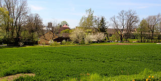
Nowy Jawor is a village in the administrative district of Gmina Pawłów, within Starachowice County, Świętokrzyskie Voivodeship, in south-central Poland. It lies approximately 3 kilometres (2 mi) south of Pawłów, 12 km (7 mi) south of Starachowice, and 35 km (22 mi) east of the regional capital Kielce.
Marianki is a village in the administrative district of Gmina Stromiec, within Białobrzegi County, Masovian Voivodeship, in east-central Poland. It lies approximately 3 kilometres (2 mi) south of Stromiec, 11 km (7 mi) east of Białobrzegi, and 67 km (42 mi) south of Warsaw.
Sułkowice is a village in the administrative district of Gmina Chynów, within Grójec County, Masovian Voivodeship, in east-central Poland. It lies approximately 3 kilometres (2 mi) north of Chynów, 18 km (11 mi) north-east of Grójec, and 33 km (21 mi) south of Warsaw.
Jędrychowice is a village in the administrative district of Gmina Branice, within Głubczyce County, Opole Voivodeship, in south-western Poland, close to the Czech border. It lies approximately 6 kilometres (4 mi) north-east of Branice, 12 km (7 mi) south of Głubczyce, and 64 km (40 mi) south of the regional capital Opole.
Bzinica Stara is a village in the administrative district of Gmina Dobrodzień, within Olesno County, Opole Voivodeship, in south-western Poland. It lies approximately 5 kilometres (3 mi) south of Dobrodzień, 21 km (13 mi) south of Olesno, and 38 km (24 mi) east of the regional capital Opole.
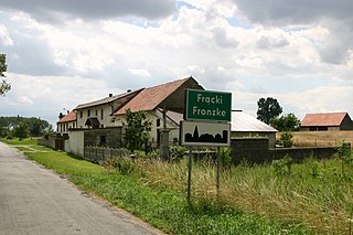
Frącki is a village in the administrative district of Gmina Biała, within Prudnik County, Opole Voivodeship, in south-western Poland. It lies approximately 7 kilometres (4 mi) north of Biała Prudnicka, 17 km (11 mi) north-east of Prudnik, and 30 km (19 mi) south-west of the regional capital Opole.
Błotowo is a settlement in the administrative district of Gmina Studzienice, within Bytów County, Pomeranian Voivodeship, in northern Poland. It lies approximately 8 kilometres (5 mi) east of Studzienice, 14 km (9 mi) east of Bytów, and 69 km (43 mi) south-west of the regional capital Gdańsk.
Wojciechowo is a village in the administrative district of Gmina Wicko, within Lębork County, Pomeranian Voivodeship, in northern Poland. It lies approximately 11 kilometres (7 mi) east of Wicko, 16 km (10 mi) north of Lębork, and 67 km (42 mi) north-west of the regional capital Gdańsk.

Vitkovo is a village in the municipality of Aleksandrovac, Serbia. According to the 2002 census, the village has a population of 488 people.
Gornje Brijanje is a village in the municipality of Bojnik, Serbia. According to the 2002 census, the village has a population of 509 people.
Beli Kamen is a village in the municipality of Lučani, Serbia. According to the 2011 census, the village has a population of 466 people.
Nõmmküla is a village in Raikküla Parish, Rapla County in northwestern Estonia.
Okruglica is a village in the municipality of Trstenik, Serbia. According to the 2002 census, the village has a population of 261 people.

Al-Dana, Maarrat al-Nu'man is a Syrian village located in Maarrat al-Nu'man Nahiyah in Maarrat al-Nu'man District, Idlib. According to the Syria Central Bureau of Statistics (CBS), Al-Dana, Maarrat al-Nu'man had a population of 2607 in the 2004 census.

Tuyyq, also known as Tuyuk, is a town in Almaty Region, southeast Kazakhstan. It lies at an altitude of 1,938 m (6,358 ft).
