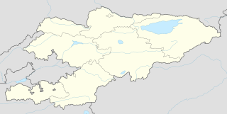
Khalmion is a village in Kadamjay District, Batken Region in south-west Kyrgyzstan, sitting practically on the border with Uzbekistan's Fergana Region. Its population was 4,602 in 2009. The village lies just to the west of a tiny enclave belonging to Uzbekistan, less than 1 km2 in area and known also as Khalmion, or alternately as Jani-Ayil or Jangy-ayyl. This enclave is located north-northwest of another Uzbek enclave (Shakhimardan). The Kyrgyz villages of Khalmion and Jani-Ayil lie outside opposite edges of this enclave, within 1 km of the Kyrgyz-Uzbek main border.

Soyuqbulaq is a village in the Lachin Rayon of Azerbaijan.

Cənubi is a village in Baku, Azerbaijan.

Wygon is a village in the administrative district of Gmina Biecz, within Gorlice County, Lesser Poland Voivodeship, in southern Poland. It lies approximately 7 kilometres (4 mi) north-west of Biecz, 15 km (9 mi) north of Gorlice, and 97 km (60 mi) east of the regional capital Kraków.

Dulcza Wielka is a village in the administrative district of Gmina Radomyśl Wielki, within Mielec County, Subcarpathian Voivodeship, in south-eastern Poland. It lies approximately 5 kilometres (3 mi) west of Radomyśl Wielki, 19 km (12 mi) south-west of Mielec, and 60 km (37 mi) west of the regional capital Rzeszów.

Kujawy is a village in the administrative district of Gmina Iwaniska, within Opatów County, Świętokrzyskie Voivodeship, in south-central Poland. It lies approximately 6 kilometres (4 mi) south-east of Iwaniska, 14 km (9 mi) south-west of Opatów, and 55 km (34 mi) south-east of the regional capital Kielce.

Gorzupia is a village in the administrative district of Gmina Krotoszyn, within Krotoszyn County, Greater Poland Voivodeship, in west-central Poland. It lies approximately 6 kilometres (4 mi) east of Krotoszyn and 89 km (55 mi) south-east of the regional capital Poznań.

Chojno is a village in the administrative district of Gmina Wronki, within Szamotuły County, Greater Poland Voivodeship, in west-central Poland. It lies approximately 12 kilometres (7 mi) west of Wronki, 28 km (17 mi) north-west of Szamotuły, and 59 km (37 mi) north-west of the regional capital Poznań.

Dąbki is a village in the administrative district of Gmina Człuchów, within Człuchów County, Pomeranian Voivodeship, in northern Poland. It lies approximately 6 kilometres (4 mi) north-west of Człuchów and 114 km (71 mi) south-west of the regional capital Gdańsk.

Krakulice is a village in the administrative district of Gmina Wicko, within Lębork County, Pomeranian Voivodeship, in northern Poland. It lies approximately 6 kilometres (4 mi) north-west of Wicko, 21 km (13 mi) north-west of Lębork, and 79 km (49 mi) north-west of the regional capital Gdańsk.

Leśniewo is a village in the administrative district of Gmina Puck, within Puck County, Pomeranian Voivodeship, in northern Poland. It lies approximately 11 kilometres (7 mi) west of Puck and 45 km (28 mi) north-west of the regional capital Gdańsk.

Gać is a village in the administrative district of Gmina Główczyce, within Słupsk County, Pomeranian Voivodeship, in northern Poland. It lies approximately 11 kilometres (7 mi) north-east of Główczyce, 38 km (24 mi) north-east of Słupsk, and 85 km (53 mi) north-west of the regional capital Gdańsk.
Adamowo is a village in the administrative district of Gmina Susz, within Iława County, Warmian-Masurian Voivodeship, in northern Poland.

Pastwiska is a settlement in the administrative district of Gmina Barciany, within Kętrzyn County, Warmian-Masurian Voivodeship, in northern Poland, close to the border with the Kaliningrad Oblast of Russia. It lies approximately 3 kilometres (2 mi) east of Barciany, 15 km (9 mi) north of Kętrzyn, and 76 km (47 mi) north-east of the regional capital Olsztyn.

Borowik is a village in the administrative district of Gmina Przybiernów, within Goleniów County, West Pomeranian Voivodeship, in north-western Poland. It lies approximately 7 kilometres (4 mi) south of Przybiernów, 17 km (11 mi) north of Goleniów, and 33 km (21 mi) north of the regional capital Szczecin.

Valevac is a village in the municipality of Knjaževac, Serbia. At the 2002 census, the village had a population of 281 people.
Tammiku is a village in Ridala Parish, Lääne County, in western Estonia.

Vlaški Do is a village in the municipality of Žabari, Serbia. According to the 2002 census, the village has a population of 1310 people.

Pajkovac is a village in the municipality of Varvarin, Serbia. According to the 2002 census, the village has a population of 142 people.
Polond Desert, also known as the Mozaffari Desert, is a desert located 40 kilometers West of Ferdows, South Khorasan Province, Iran.


