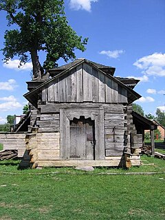
Lipoltice is a village in the Pardubice Region of the Czech Republic. It has around 400 inhabitants.

Nowy Sumin is a village in the administrative district of Gmina Cekcyn, within Tuchola County, Kuyavian-Pomeranian Voivodeship, in north-central Poland.

Karolówka is a village in the administrative district of Gmina Frampol, within Biłgoraj County, Lublin Voivodeship, in eastern Poland. It lies approximately 7 kilometres (4 mi) south-east of Frampol, 10 km (6 mi) north of Biłgoraj, and 70 km (43 mi) south of the regional capital Lublin.

Grabia Trzecia is a village in the administrative district of Gmina Sędziejowice, within Łask County, Łódź Voivodeship, in central Poland. It lies approximately 12 kilometres (7 mi) south-west of Łask and 43 km (27 mi) south-west of the regional capital Łódź.

Biçiqarbinə is a village in the Balakan Rayon of Azerbaijan. The village forms part of the municipality of Kortala.

Kərimli is a village in the Gadabay Rayon of Azerbaijan.

Hermanów is a village in the administrative district of Gmina Pabianice, within Pabianice County, Łódź Voivodeship, in central Poland. It lies approximately 5 kilometres (3 mi) south-west of Pabianice and 20 km (12 mi) south-west of the regional capital Łódź.

Sielce Lewe is a village in the administrative district of Gmina Maków, within Skierniewice County, Łódź Voivodeship, in central Poland. It lies approximately 5 kilometres (3 mi) north of Maków, 9 km (6 mi) north-west of Skierniewice, and 45 km (28 mi) north-east of the regional capital Łódź.

Podmielowiec is a village in the administrative district of Gmina Bodzentyn, within Kielce County, Świętokrzyskie Voivodeship, in south-central Poland. It lies approximately 6 kilometres (4 mi) north-west of Bodzentyn and 25 km (16 mi) north-east of the regional capital Kielce.

Hermanów is a village in the administrative district of Gmina Tarłów, within Opatów County, Świętokrzyskie Voivodeship, in south-central Poland. It lies approximately 4 kilometres (2 mi) south-east of Tarłów, 32 km (20 mi) north-east of Opatów, and 82 km (51 mi) east of the regional capital Kielce.

Rudka is a village in the administrative district of Gmina Sieniawa, within Przeworsk County, Subcarpathian Voivodeship, in south-eastern Poland. It lies approximately 6 kilometres (4 mi) north of Sieniawa, 20 km (12 mi) north-east of Przeworsk, and 50 km (31 mi) north-east of the regional capital Rzeszów.

Pączkowo is a village in the administrative district of Gmina Szreńsk, within Mława County, Masovian Voivodeship, in east-central Poland. It lies approximately 4 kilometres (2 mi) south-west of Szreńsk, 24 km (15 mi) south-west of Mława, and 106 km (66 mi) north-west of Warsaw.

Karłowo is a village in the administrative district of Gmina Iłów, within Sochaczew County, Masovian Voivodeship, in east-central Poland. It lies approximately 6 kilometres (4 mi) south-west of Iłów, 19 km (12 mi) north-west of Sochaczew, and 70 km (43 mi) west of Warsaw.
Polesie is a village in the administrative district of Gmina Krzywiń, within Kościan County, Greater Poland Voivodeship, in west-central Poland.

Sierakowo-Kolonia is a village in the administrative district of Gmina Kobylnica, within Słupsk County, Pomeranian Voivodeship, in northern Poland. It lies approximately 6 kilometres (4 mi) south of Kobylnica, 9 km (6 mi) south of Słupsk, and 107 km (66 mi) west of the regional capital Gdańsk.
Visusti is a village in Järva Parish, Järva County in northern-central Estonia.

Okolište is a village in the municipality of Bugojno, Bosnia and Herzegovina.

Ratkovići (Goražde) is a village in the municipality of Goražde, Bosnia and Herzegovina.

Pale is a village in the municipality of Srebrenica, Bosnia and Herzegovina.
Kalarijan is a village in Valupey Rural District, in the Central District of Savadkuh County, Mazandaran Province, Iran. At the 2006 census, its population was 157, in 52 families.


