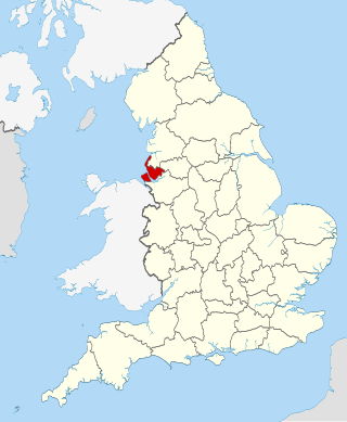
Great Yarmouth
| Name | Location | Type | Completed [note 1] | Date designated | Grid ref. [note 2] Geo-coordinates | Entry number [note 3] | Image |
|---|---|---|---|---|---|---|---|
| Wiseman's Mill | Ashby with Oby, Great Yarmouth | Drainage Mill | Built 1753 | 4 December 1987 | TG4092613793 52°40′06″N1°33′43″E / 52.668258°N 1.561814°E | 1051014 |  |
| Belton Old Hall | Belton with Browston | House | Early 18th century | 27 November 1954 | TG4828802623 52°33′53″N1°39′43″E / 52.564729°N 1.662075°E | 1372933 |  Upload Photo |
| Browston Hall Hotel | Browston Green, Belton with Browston | House | Late 17th century | 27 November 1954 | TG4997401772 52°33′23″N1°41′11″E / 52.556323°N 1.686256°E | 1051001 |  |
| Church of All Saints | Belton with Browston | Parish Church | 1866 | 27 November 1954 | TG4855502949 52°34′03″N1°39′59″E / 52.567532°N 1.66625°E | 1372932 |  |
| Church of St Nicholas | Bradwell | Parish Church | 12th century | 27 November 1954 | TG5031503855 52°34′29″N1°41′34″E / 52.574854°N 1.692846°E | 1051006 |  |
| Church of St Peter and St Paul | Burgh Castle | Parish Church | Late 11th century | 27 November 1954 | TG4764004973 52°35′10″N1°39′15″E / 52.586107°N 1.65429°E | 1051008 |  |
| Church of Holy Trinity | Caister-on-Sea | Parish Church | 13th century | 4 March 1947 | TG5199612278 52°38′59″N1°43′26″E / 52.649639°N 1.724012°E | 1287563 |  |
| Church of All Saints | Filby | Parish Church | 14th century | 25 September 1962 | TG4690113224 52°39′38″N1°38′58″E / 52.660467°N 1.649564°E | 1287564 |  |
| Church of St Margaret | Burgh St Margaret, Fleggburgh | Parish Church | 12th century | 25 September 1962 | TG4449414010 52°40′07″N1°36′53″E / 52.668609°N 1.614631°E | 1372907 |  |
| Church of St Peter | Clippesby, Fleggburgh | Parish Church | c. 1200 | 25 September 1962 | TG4284614588 52°40′28″N1°35′27″E / 52.674535°N 1.590735°E | 1051017 |  |
| Church of St Edmund | Fritton and St. Olaves | Parish Church | 12th century | 27 November 1954 | TG4732700143 52°32′35″N1°38′46″E / 52.542917°N 1.64608°E | 1372918 |  |
| Drainage Pump | St Olave's Marsh, Fritton and St. Olaves | Drainage Mill | 1910 | 27 November 1954 | TM4568499713 52°32′23″N1°37′18″E / 52.539802°N 1.621584°E | 1372904 |  |
| Fritton Old Hall | Fritton and St. Olaves | House/Restaurant | c. 1540 | 27 November 1954 | TG4760300145 52°32′34″N1°39′01″E / 52.542809°N 1.650143°E | 1305105 |  |
| Barn at Home Farm | Hemsby | Aisled Barn | Early 17th century | 4 March 1947 | TG4915917271 52°41′45″N1°41′09″E / 52.695741°N 1.685938°E | 1287567 | Upload Photo |
| Church of St Margaret | Hopton-on-Sea | Parish Church | 1866-67 | 27 November 1954 | TG5241500040 52°32′23″N1°43′15″E / 52.53966°N 1.720868°E | 1050972 |  |
| Old St Margaret's Church | Hopton-on-Sea | Parish Church (ruined) | Late 13th century | 27 November 1954 | TM5301799972 52°32′20″N1°43′47″E / 52.538771°N 1.729673°E | 1050970 |  |
| Church of St Mary | Thrigby, Mautby | Parish Church | First half 14th century | 25 September 1962 | TG4605312393 52°39′12″N1°38′11″E / 52.653397°N 1.636433°E | 1152375 |  |
| Church of St Peter and St Paul | Runham, Mautby | Church | Mid 14th century | 25 September 1962 | TG4597410827 52°38′22″N1°38′03″E / 52.639383°N 1.634101°E | 1050977 |  |
| Church of St Peter and St Paul | Mautby | Parish Church | Late 12th century | 25 September 1962 | TG4807012377 52°39′08″N1°39′58″E / 52.652335°N 1.666176°E | 1152350 |  |
| Church of St Margaret | Ormesby St. Margaret with Scratby | Parish Church | 14th century | 25 September 1962 | TG4988714532 52°40′15″N1°41′41″E / 52.670835°N 1.694611°E | 1227867 |  |
| Ormesby Old Hall | Ormesby St. Margaret with Scratby | House | Mid 17th century | 20 February 1952 | TG5003814501 52°40′14″N1°41′49″E / 52.670487°N 1.696815°E | 1287569 |  |
| Church of St Michael | Ormesby St. Michael | Parish Church | 13th century | 25 September 1962 | TG4807514883 52°40′29″N1°40′05″E / 52.674815°N 1.668134°E | 1287570 |  |
| Church of St Peter and St Paul | Repps with Bastwick | Parish Church | 12th century | 25 September 1962 | TG4219016927 52°41′45″N1°34′58″E / 52.695813°N 1.582771°E | 1051024 |  |
| Potter Heigham Bridge | Repps with Bastwick | Road Bridge | 14th century | 16 April 1955 | TG4199818473 52°42′35″N1°34′52″E / 52.70977°N 1.581073°E | 1305009 |  |
| Church of St George | Rollesby | Parish Church | 12th century | 25 September 1962 | TG4461915759 52°41′03″N1°37′04″E / 52.684244°N 1.617774°E | 1152526 |  |
| Burnley Hall | East Somerton, Somerton | House | Early 18th century | 20 February 1952 | TG4787819756 52°43′07″N1°40′08″E / 52.718622°N 1.668894°E | 1216607 |  |
| Church of St Mary | West Somerton, Somerton | Parish Church | c. 1200 | 25 September 1962 | TG4754919547 52°43′01″N1°39′50″E / 52.716897°N 1.663876°E | 1216608 |  |
| Church of St Andrew | Stokesby with Herringby | Parish Church | 13th century | 25 September 1962 | TG4359210568 52°38′17″N1°35′56″E / 52.638133°N 1.59878°E | 1152707 |  |
| Church of St Edmund | Thurne | Parish Church | Late 13th century | 25 September 1962 | TG4051015613 52°41′05″N1°33′25″E / 52.684772°N 1.557002°E | 1304567 |  |
| Thurne Dyke Windpump | Thurne | Drainage Mill | 1820 | 7 December 1962 | TG4005315918 52°41′16″N1°33′02″E / 52.687711°N 1.550477°E | 1050999 |  |
| Caister Hall | West Caister | Castle | 19th century | 4 December 1987 | TG5042012218 52°38′59″N1°42′03″E / 52.64983°N 1.70072°E | 1228031 |  |
| Church of St Andrew | Southtown and Gorleston | Parish Church | 13th century | 27 June 1953 | TG5244704408 52°34′44″N1°43′29″E / 52.57883°N 1.72466°E | 1096807 |  |
| Church of St Mary including Church Rooms and Surrounding Wall | Regent Rd, Great Yarmouth | Roman Catholic Church | 1848-1850 | 9 December 1976 | TG5289607634 52°36′27″N1°44′01″E / 52.607561°N 1.733735°E | 1245910 |  |
| Church of St Nicholas | Great Yarmouth | Parish Church | 1101-1119 | 27 June 1953 | TG5243508036 52°36′41″N1°43′38″E / 52.611382°N 1.727248°E | 1096813 |  |
| Church of St Peter | Southtown and Gorleston | Catholic Church | 1938-1939 | 5 August 1974 | TG5262904123 52°34′34″N1°43′38″E / 52.576189°N 1.727123°E | 1246581 |  |
| Custom House | Great Yarmouth | Merchants House | 1720 | 5 August 1974 | TG5240607236 52°36′15″N1°43′34″E / 52.604218°N 1.726211°E | 1245800 |  |
| Great Yarmouth Potteries | Great Yarmouth | Fish curing works | 19th century | 9 December 1976 | TG5272706909 52°36′04″N1°43′50″E / 52.601136°N 1.730691°E | 1245561 |  |
| Old Merchants House | Great Yarmouth | Merchants House | Early 17th century | 27 June 1953 | TG5246207142 52°36′12″N1°43′37″E / 52.603349°N 1.726964°E | 1245917 |  |
| Old White Lion Public House | Great Yarmouth | Public House | Early 17th century | 27 June 1953 | TG5263507081 52°36′10″N1°43′46″E / 52.602722°N 1.729467°E | 1271278 |  |
| St Nicholas Hospital Main Block | Great Yarmouth | Hospital | 1818 | 5 August 1974 | TG5289006400 52°35′47″N1°43′58″E / 52.596494°N 1.732704°E | 1245983 |  |
| St Nicholas Hospital Main Entrance Range | Great Yarmouth | Entrance | 1811 | 5 August 1974 | TG5284006464 52°35′50″N1°43′55″E / 52.597091°N 1.732016°E | 1245984 |  |
| The Hippodrome | Great Yarmouth | Circus (recreational) | 1903 | 8 December 1978 | TG5304807119 52°36′10″N1°44′08″E / 52.602871°N 1.735581°E | 1245922 |  |
| The Winter Gardens | Great Yarmouth | Glasshouse | 1878-1881 | 5 August 1974 | TG5314806762 52°35′59″N1°44′12″E / 52.599621°N 1.736781°E | 1271608 |  |
| Town Hall | Great Yarmouth | Magistrates Court | Until 1990 | 5 August 1974 | TG5231307426 52°36′21″N1°43′30″E / 52.605966°N 1.724985°E | 1246969 |  |
| Vicarage | Great Yarmouth | Vicarage | Early 17th century | 27 June 1953 | TG5243907977 52°36′39″N1°43′38″E / 52.61085°N 1.727262°E | 1096809 |  |
| 25 South Quay | Great Yarmouth | House | 1644 | 27 June 1953 | TG5243807190 52°36′14″N1°43′36″E / 52.603791°N 1.726647°E | 1245803 |  |