Grant Township, Vermilion County, Illinois

Last updated

Grant Township
Map highlighting Grant Township, Vermilion County, Illinois.svg
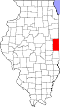
Location in Vermilion County
Coordinates: 40°26′51″N87°38′45″W / 40.44750°N 87.64583°W / 40.44750; -87.64583
Country United States
State Illinois
County Vermilion
Created1862
Area
  Total
86.69 sq mi (224.5 km2)
  Land86.66 sq mi (224.4 km2)
  Water0.03 sq mi (0.078 km2)  0.03%
Elevation
696 ft (212 m)
Population
 (2010)
  Estimate 
(2016) [1]
5,781
  Density69.6/sq mi (26.9/km2)
Time zone UTC-6 (CST)
  Summer (DST) UTC-5 (CDT)
FIPS code 17-183-30965

Grant Township is a township in Vermilion County, Illinois, USA. As of the 2010 census, its population was 6,028 and it contained 2,817 housing units. [2]

Contents

History

Grant Township was originally called Lyon Township but it was changed in 1862 to honor Ulysses S. Grant. He had just won a surrender by Confederate forces at Fort Donelson in Tennessee. [3]

Geography

According to the 2010 census, the township has a total area of 86.69 square miles (224.5 km2), of which 86.66 square miles (224.4 km2) (or 99.97%) is land and 0.03 square miles (0.078 km2) (or 0.03%) is water. [2]

Cities and towns

Unincorporated towns

Extinct towns

Adjacent townships

Cemeteries

The township contains one cemetery, Redtop.

Major highways

Airports and landing strips

Demographics

Historical population
CensusPop.Note
2016 (est.)5,781 [1]
U.S. Decennial Census [4]

References

  1. 1 2 "Population and Housing Unit Estimates" . Retrieved June 9, 2017.
  2. 1 2 "Population, Housing Units, Area, and Density: 2010 - County -- County Subdivision and Place -- 2010 Census Summary File 1". United States Census. Archived from the original on February 12, 2020. Retrieved May 28, 2013.
  3. Callary, Edmund (2009). Place Names of Illinois. Urbana: University of Illinois Press. p. 144. ISBN   978-0-252-03356-8.
  4. "Census of Population and Housing". Census.gov. Retrieved June 4, 2016.