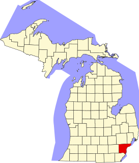
Wayne County is the most populous county in the U.S. state of Michigan. As of 2019, the United States Census estimated its population as 1,749,343 making it the 19th-most populous county in the United States. The county seat is Detroit. The county was founded in 1796 and organized in 1815. Wayne County is included in the Detroit-Warren-Dearborn, MI Metropolitan Statistical Area. It is one of several U.S. counties named after Revolutionary War-era general Anthony Wayne.

Macomb County is a county located in the eastern portion of the U.S. state of Michigan, bordering Lake St. Clair, and is part of northern Metro Detroit. As of the 2010 census, the population was 840,978, making it the third-most populous county in the state. The county seat is Mt. Clemens. Macomb County is part of the Detroit-Warren-Dearborn, MI Metropolitan Statistical Area. The city of Detroit is located south of the county's southern border. Macomb County contains 27 cities, townships and villages, including three of the top ten most-populous municipalities in Michigan as of the 2010 census: Warren (#3), Sterling Heights (#4) and Clinton Township (#10). Most of this population is concentrated south of Hall Road (M-59), one of the county's main thoroughfares.

Grosse Pointe is a city in Wayne County in the U.S. state of Michigan. As of the 2010 census, the city had a population of 5,421.

Grosse Pointe Township was a civil township of Wayne County in the U.S. state of Michigan. Originally including all of the Grosse Pointe communities, and the northeastern portion of the City of Detroit, in its later years, it was reduced to the portion of the village of Grosse Pointe Shores that was in Wayne County.

Grosse Pointe Park is a city in Wayne County in the U.S. state of Michigan. The population was 11,555 at the 2010 census.

Harper Woods is a city in Wayne County in the U.S. state of Michigan. As of the 2010 census, the city had a population of 14,236.

Grosse Pointe refers to an affluent coastal area adjacent to Detroit, Michigan, United States, that comprises five adjacent individual cities. From southwest to northeast, they are:
M-3 is a north–south state trunkline highway in the Detroit metropolitan area of the US state of Michigan. For most of its length, the trunkline is known as Gratiot Avenue. The trunkline starts in Downtown Detroit and runs through the city in a northeasterly direction along one of Detroit's five major avenues. The highway passes several historic landmarks and through a historic district. It also connects residential neighborhoods on the city's east side with suburbs in Macomb County and downtown.
M-102 is an east–west state trunkline highway in the US state of Michigan that runs along the northern boundary of Detroit following 8 Mile Road. The highway follows the Michigan Baseline, a part of the land survey of the state, and the roadway is also called Base Line Road in places. As a county road or city street, 8 Mile Road extends both east and west of the M-102 designation, which leaves 8 Mile on the eastern end to follow Vernier Road. The western terminus of M-102 is at the junction of 8 Mile Road and M-5 and the opposite end is at Vernier Road and Interstate 94 (I-94). The 8 Mile Road name extends west to Pontiac Trail near South Lyon with a discontinuous segment located west of US Highway 23 (US 23). The eastern end of 8 Mile Road is in Grosse Pointe Woods, near I-94, with a short, discontinuous segment east of Mack Avenue.
Jefferson Avenue is a 63.71-mile-long (102.53 km) scenic road along the eastern part of the Detroit metropolitan area in the southeastern part of the U.S. state of Michigan. It travels alongside Lake Erie, the Detroit River, and Lake St. Clair. This road also provides access to many recreational facilities in the area. West Jefferson Avenue is primarily a commercial, while East Jefferson Avenue contains a historic residential district.

Area code 313 is a telephone area code of the North American Numbering Plan serving Detroit and most of its closest suburbs in Wayne County, Michigan. It includes the enclave cities Hamtramck and Highland Park, as well as Allen Park, Dearborn, Dearborn Heights, Ecorse, Inkster, Melvindale, the Grosse Pointe communities, Lincoln Park, Redford, River Rouge, and Taylor north of Goddard Road and east of Holland Road.

Michigan's 13th congressional district is a United States congressional district in Wayne County, Michigan. It is currently represented by Democrat Rashida Tlaib.

This is a list of the National Register of Historic Places listings in Wayne County, Michigan.

Outer Drive is a bypass road which encircles both the eastern and western portions of the Detroit, Michigan region. It resembles a jagged horseshoe and was not originally intended to move traffic as much as it was to provide a pleasurable drive around the City of Detroit and some of its suburbs.

Michigan's 14th congressional district is a congressional district that stretches from eastern Detroit westward to Farmington Hills, then north to the suburb of Pontiac. From 2003 to 2013, it was centered in Wayne and Oakland Counties.

Wayne County Community College District (WCCCD) is a public community college district with its headquarters in Detroit, Michigan. It was founded in 1967 and has six campuses: Eastern, Downtown, Downriver, Northwest, Western, and University Square.

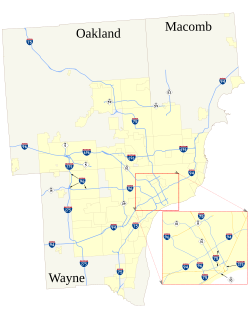
The roads and freeways in metropolitan Detroit comprise the main thoroughfares in the region. The freeways consist of an advanced network of interconnecting freeways which include Interstate highways. The Metro Detroit region's extensive toll-free freeway system, together with its status as a major port city, provide advantages to its location as a global business center. There are no toll roads in Michigan.

Transportation in metropolitan Detroit is provided by a system of transit services, airports, and an advanced network of freeways which interconnect the city of Detroit and the Detroit region. The Michigan Department of Transportation (MDOT) administers the region's network of major roads and freeways. The region offers mass transit with bus services provided jointly by the Detroit Department of Transportation (DDOT) and the Suburban Mobility Authority for Regional Transportation (SMART) through a cooperative service and fare agreement administered by the Regional Transit Authority (RTA). Cross border service between the downtown areas of Windsor and Detroit is provided by Transit Windsor via the Tunnel Bus. A monorail system, known as the People Mover, operates daily through a 2.94 mile (4.7 km) loop in the downtown area. A proposed SEMCOG Commuter Rail could link New Center, Dearborn, Detroit Metropolitan Airport, and Ann Arbor with access to DDOT and SMART buses. Amtrak's current passenger facility is north of downtown in the New Center area. Amtrak provides service to Detroit, operating its Wolverine service between Chicago, Illinois, and Pontiac. Greyhound Lines operates a station on Howard Street near Michigan Avenue. The city's dock and public terminal receives cruise ships on International Riverfront near the Renaissance Center which complements tourism in metropolitan Detroit.

MorningSide is a neighborhood on the east side of Detroit, Michigan. The area is bounded by Harper Avenue and Interstate 94 on the north, Mack Avenue to the south, East Outer Drive and Whittier on the east and Alter Road and East Outer Drive to the west. The local association that shares the name MorningSide with the community is a collaboration of residents working together to take care of this area.

East English Village is a neighborhood in Detroit, Michigan. East side of Detroit, bounded by Harper Avenue on the north, East Outer Drive on the west, Mack Avenue on the south, and Cadieux Road on the east. It was first developed in 1913 though most of the homes were built in the early 1930s through 1950.


