Brownstown Township, Michigan | |
---|---|
Charter Township of Brownstown | |
Motto: "Where The Future Looks Brighter" [1] | |
Coordinates: 42°07′34″N83°15′26″W / 42.12611°N 83.25722°W | |
Country | United States |
State | Michigan |
County | Wayne |
Established | 1827 |
Government | |
• Supervisor | Edward Smith |
• Clerk | Maureen Brinker |
Area | |
• Charter township | 30.64 sq mi (79.36 km2) |
• Land | 22.19 sq mi (57.47 km2) |
• Water | 8.45 sq mi (21.89 km2) |
Elevation | 584 ft (178 m) |
Population (2010) | |
• Charter township | 30,627 |
• Density | 1,380.2/sq mi (532.9/km2) |
• Metro | 4,285,832 (Metro Detroit) |
Time zone | UTC-5 (EST) |
• Summer (DST) | UTC-4 (EDT) |
ZIP code(s) | |
Area code | 734 |
FIPS code | 26-11220 [2] |
GNIS feature ID | 1625993 [3] |
Website | Official website |
Brownstown Charter Township is a charter township in Wayne County in the U.S. state of Michigan. Its population was 30,627 at the 2010 census. Brownstown was established in 1827, a decade prior to Michigan's admission to the Union.
Brownstown has three separate but connected segments due to the incorporation of the cities of Flat Rock, Rockwood, and Woodhaven in the early 1960s. [4]
Prior to the township's organization, the area was involved in the War of 1812, and the battles of Brownstown and Maguaga took place in the area.
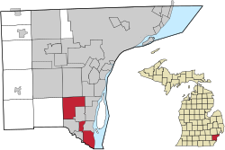
The region now known as Brownstown was, like surrounding areas in Michigan, once a part of the French colony of New France (Mid France). The area eventually fell into hands of the British and finally came under American rule in the 18th century. The original 43-square-mile (110 km2) area of land south of Detroit was designated a township by the Michigan Territorial Council on April 5, 1827, when Moses Roberts was elected its first supervisor. This made Brownstown one of Wayne County's nine original townships. [5]
Research from local historians have found that the township was named for Adam Brown, who was kidnapped by the Wyandot Indians. Brown was raised by the Wyandots, married a native woman, and grew to become a tribal leader. As time passed, settlements spread out from the lakeshore to begin changing the swampy, sandhill countryside into productive farmland. Established in 1893, Kurtzhals Farm is one of the largest remaining farms in the township. [5] [6]
According to the United States Census Bureau, the township has a total area of 30.64 square miles (79.36 km2), of which 8.45 square miles (21.89 km2) (27.58%) are covered by water. [7]
The township is divided into three different segments. The Huron River forms the southernmost boundary of the township with Berlin Charter Township in Monroe County. The southernmost point of the Detroit River is within the township, which leads to Lake Erie. Brownstown borders the cities of Flat Rock, Gibraltar, Riverview, Rockwood, Southgate, and Taylor, as well as touching corners with the cities of Romulus and Trenton. Huron Charter Township borders to the west. Brownstown shares a water boundary with Grosse Ile Township and across the international border with the city of Amherstburg in Ontario.
At the 2000 census, 22,989 people, 8,322 households, and 6,249 families resided in the township. The population density was 1,024.0 inhabitants per square mile (395.4/km2). The 9,008 housing units had an average density of 401.3 per square mile (154.9/km2). The racial makeup of the township was 89.02% White, 3.82% African American, 0.53% Native American, 3.83% Asian, 0.86% from other races, and 1.95% from two or more races. Hispanics or Latinos of any race were 3.58%. [2]
Of the 8,322 households, 40.3% had children under 18 living with them, 58.6% were married couples living together, 12.6% had a female householder with no husband present, and 24.9% were not families. About 19.8% of households were one person, and 4.3% were one person 65 or older. The average household size was 2.76, and the average family size was 3.18.
In the township, the age distribution was 28.7% under 18, 9.4% from 18 to 24, 32.7% from 25 to 44, 23.4% from 45 to 64, and 5.8% 65 were or older. The median age was 33 years. For every 100 females, there were 97.9 males. For every 100 females 18 and over, there were 94.7 males.
The median income for a household was $55,239 and for a family was $65,544. Males had a median income of $50,246 versus $29,614 for females. The per capita income for the township was $22,523. About 5.7% of families and 6.9% of the population were below the poverty line, including 8.3% of those under 18 and 7.4% of those 65 or over.
The population of Brownstown Township was 30,627. The racial and ethnic makeup of the population was 79.0% non-Hispanic white, 8.6% Black or African-American, 0.4% Native American, 5.2% Asian, 0.1% non-Hispanics of some other race, 2.1% reporting two or more races and 5.2% Hispanic or Latino. [8]
The township is also home to the Chevrolet Volt Battery Pack Assembly Plant. GM converted an empty warehouse on Sibley and King Roads between I-75 and Allen Road into a temporary plant. [9]
Amazon opened a distribution center in Brownstown in 2015. [10]
Most of the township is served by the Woodhaven-Brownstown School District. The district includes eight separate schools and students from both the City of Woodhaven and Brownstown Township may attend the district. [11] Woodhaven High School is the high school for the district. [12]
A portion of the township is within the Gibraltar School District. [13] [14]
Students in the small neighborhood south of Pennsylvania Road and west of Telegraph within Brownstown attend Taylor School District schools. These students are assigned to Eureka Heights Elementary School, [15] West Middle School, [16] and Taylor High School, all in Taylor. [17]
Residents in the northern section were once served by the Bacon Memorial Library in Wyandotte, but now all residents are served by the Trenton Veterans Memorial Library in Trenton. [18]
Wyandotte is a city in Wayne County in the U.S. state of Michigan. The population was 25,058 at the 2020 census.
Wayne County is the most populous county in the U.S. state of Michigan. As of 2020, the United States Census placed its population at 1,793,561, making it the 19th-most populous county in the United States. The county seat is Detroit. The county was founded in 1796 and organized in 1815. Wayne County is included in the Detroit-Warren-Dearborn, MI Metropolitan Statistical Area. It is one of several U.S. counties named after Revolutionary War-era general Anthony Wayne.
Huron County is a county in the U.S. state of Michigan. As of the 2020 Census, the population was 31,407. The county seat is Bad Axe. Huron County is at the northern tip of the Thumb, which is a sub region of Mid Michigan. It is a peninsula, bordered by Saginaw Bay to the west and Lake Huron to the north and east, and has over 90 miles (140 km) of shoreline, from White Rock on Lake Huron to Sebewaing on the Saginaw Bay. Huron County's most important industry is agriculture, as with most of the other Thumb counties. Huron County enjoys seasonal tourism from large cities such as Detroit, Flint, and Saginaw. A lot of the tourism is in the Port Austin and Caseville area.
Wyandotte County is a county in the U.S. state of Kansas. Its county seat and most populous city is Kansas City, with which it shares a unified government. As of the 2020 census, the population was 169,245, making it Kansas's fourth-most populous county. The county was named after the Wyandot tribe.
Au Sable Township is a charter township of Iosco County in the U.S. state of Michigan. The population was 2,206 at the 2020 census.
Clinton Township is a charter township in Macomb County in the U.S. state of Michigan. A northern suburb of Metro Detroit, Clinton is about 20 miles (32 km) northeast of downtown Detroit. As of the 2020 census, the township had a population of 100,513, making it the most populous township in the state.
Berlin Charter Township is a charter township of Monroe County in the U.S. state of Michigan. At the 2010 census, the township population was 9,299.
Brandon Charter Township is a charter township of Oakland County in the U.S. state of Michigan. The population was 15,175 at the 2010 census.
Commerce Township, officially the Charter Township of Commerce, is a charter township of Oakland County in the U.S. state of Michigan. The population was 40,186 at the 2010 census.
Bridgeport is an unincorporated community in Bridgeport Charter Township, Saginaw County in the U.S. state of Michigan. It is also a census-designated place (CDP) for statistical purposes. The population was 6,571 at the 2020 census. Bridgeport is also the name of a post office with ZIP code 48722. The area served by the ZIP code includes the southeast portion of the CDP and includes southeastern portions of Bridgeport Charter Township outside of the CDP as well as portions of southwest Frankenmuth Township and a small area of northeastern Birch Run Township. The remainder of the CDP area is served by the Saginaw ZIP code 48601.
Ypsilanti Charter Township is a charter township of Washtenaw County in the U.S. state of Michigan. The population was 53,362 at the 2010 census. The city of Ypsilanti is mostly surrounded by the township, but the two are administered autonomously.
Flat Rock is a city in Wayne County, Michigan, United States, with a small portion of the city extending into Monroe County. At the 2020 census, the population was 10,541.
Gibraltar is a city in Wayne County in the U.S. state of Michigan. The population was 4,656 at the 2010 census.
Huron Charter Township is a charter township of Wayne County in the U.S. state of Michigan. The population was 15,879 at the 2010 census. Huron Charter Township is named after the Huron River, which flows southeast through the township. The township is home to three divisions of the Huron–Clinton Metroparks system: Lower Huron, Oakwoods, and Willow.
Southgate is a city in Wayne County in the U.S. state of Michigan. The population was 30,047 at the 2020 census. Southgate was incorporated as a city in October 1958, which was one of the last remaining portions of the now-defunct Ecorse Township. It is part of the Downriver collection of communities south of the city of Detroit.
Trenton is a city in Wayne County, Michigan, United States. At the 2010 census, the city population was 18,853.
Woodhaven is a city in Wayne County, Michigan, United States. As of the 2010 census, the city had a population of 12,875. It is part of a collection of communities known as Downriver.
Downriver is the unofficial name for a collection of 19 cities and townships in Wayne County, Michigan, south of Detroit, along the western shore of the Detroit River.
Lake Erie Metropark is a park in the Huron-Clinton system of metro parks. The park is a 1,607-acre (6.50 km2) recreational facility located between the mouth of the Huron River on Lake Erie to the south and the City of Gibraltar to the north, and consists of natural marshes and ponds, hike and bike trails, nature trails, a marina, and a boat launch. The park also has a wave action swimming pool, an 18-hole regulation golf course, and the Marshlands Museum and Nature Center. It has a three-mile (5 km) shoreline along Lake Erie and is a popular bird-watching site. The children's play area, located near the Wave Pool, previously consisted of a child-size city before being reconstructed into a modernized playground.
The Gibraltar School District is a school district headquartered in Brownstown Township, Michigan.
Excerpted from the C. A. Buser files and the book, The Provisional Government of Nebraska Territory and The Journals of William Walker, Provisional Governor of Nebraska Territory – Edited by William E. Connelley