Montana is a landlocked state in the Northwestern United States. Montana has several nicknames, although none are official, including "Big Sky Country" and "The Treasure State", and slogans that include "Land of the Shining Mountains" and more recently "The Last Best Place".

The Absaroka Range is a sub-range of the Rocky Mountains in the United States. The range stretches about 150 mi (240 km) across the Montana-Wyoming border, and 75 miles at its widest, forming the eastern boundary of Yellowstone National Park along Paradise Valley (Montana), and the western side of the Bighorn Basin. The range borders the Beartooth Mountains to the north and the Wind River Range to the south. The northern edge of the range rests along I-90 and Livingston, Montana. The highest peak in the range is Francs Peak, located in Wyoming at 13,153 ft (4,009 m). There are 46 other peaks over 12,000 ft (3,700 m).

Keyesville is an unincorporated community in Kern County, California. It is located 2 miles (3.2 km) west of Lake Isabella and the Kern River Valley, at an elevation of 2,848 feet (868 m). Keyesville, founded in 1854 is named for Richard M. Keyes, whose discovery of gold in 1853 started the Kern River Gold Rush.

The Beaverhead-Deerlodge National Forest is the largest of the National Forests in Montana, United States. Covering 3.36 million acres (13,600 km2), the forest is broken into nine separate sections and stretches across eight counties in the southwestern area of the state. President Theodore Roosevelt named the two forests in 1908 and they were merged in 1996. Forest headquarters are located in Dillon, Montana. In Roosevelt's original legislation, the Deerlodge National Forest was called the Big Hole Forest Reserve. He created this reserve because the Anaconda Copper Mining Company, based in Butte, Montana, had begun to clearcut the upper Big Hole River watershed. The subsequent erosion, exacerbated by smoke pollution from the Anaconda smelter, was devastating the region. Ranchers and conservationists alike complained to Roosevelt, who made several trips to the area.
(Munday 2001)

The Greenhorn Mountains are a mountain range of the Southern Sierra Nevada, in California. They are protected within the Sequoia National Forest.

Greenhorn Mountain is the highest summit of the Wet Mountains range in the Rocky Mountains of North America. The prominent 12,352-foot (3,765 m) peak is located in the Greenhorn Mountain Wilderness of San Isabel National Forest, 5.2 miles (8.4 km) southwest by west of the Town of Rye, Colorado, United States, on the boundary between Huerfano and Pueblo counties. The summit of Greenhorn Mountain is the highest point in Pueblo County, Colorado. The peak's summit rises above timberline, which is about 11,500 feet (3,500 m) in south-central Colorado.
Greenhorn is slang for an inexperienced person. It may also refer to:

The Wet Mountains are a small mountain range in southern Colorado, named for the amount of snow they receive in the winter. They are a sub-range of the Sangre de Cristo Mountains, in the southern Rocky Mountains System. There are three variant names of mountain range: Cuerno Verde, Greenhorn Mountains, and Sierra Mojada.

The North Fork John Day Wilderness is a wilderness area within the Umatilla and Wallowa–Whitman National Forests in the Blue Mountains of northeastern Oregon.

The Gallatin Range is a mountain range of the Rocky Mountains, located in the U.S. states of Montana and Wyoming. It includes more than 10 mountains over 10,000 feet (3,000 m). The highest peak in the range is Electric Peak at 10,969 feet (3,343 m).

The Flathead Range is a mountain range of the Northern Rocky Mountains located south-east of Whitefish, Montana in the Great Bear Wilderness, part of the Bob Marshall Wilderness Complex. It is east of the Swan Range and southeast of the Whitefish Range. Its west side is drained by the South Fork Flathead River which forms Hungry Horse Reservoir.

The Greenhorn Mountains are a mountain range in Grant County, Oregon.

The Greenhorn Mountain Wilderness is a U.S. Wilderness Area located northwest of Walsenburg, Colorado in the San Isabel and Pike National Forests. The wilderness area includes the summit of Greenhorn Mountain, the highest point in the Wet Mountains of Colorado. There are 11 miles (18 km) of trails, all in the northern half of the wilderness.

The Centennial Mountains are the southernmost sub-range of the Bitterroot Range in the United States states of Idaho and Montana. The Centennial Mountains include the Western and Eastern Centennial Mountains. The range extends east from Monida Pass along the Continental Divide to Henrys Fork 48 km (30 mi) NNW of Ashton, Idaho; bounded on the west by Beaver Creek, on the north by Centennial Valley and Henrys Lake Mountains, on the east by Henrys Lake Flat, and on the south by Shotgun Valley and the Snake River Plain. The highest peak in the range is Mount Jefferson.

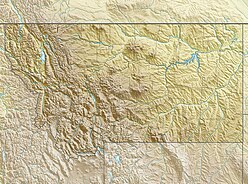
The Ruby Range is a mountain range in Madison and Beaverhead counties Montana. The range lies east of Dillon and southwest of Sheridan. The highest point, Ruby Peak with an elevation of 9,391 feet (2,862 m), lies in the northeast portion of the range. Gordon Peak with an elevation of 8,478 ft (2,584 m) lies in the southwest part of the range to the southeast of Dillon. The range is oriented NE–SW with a length of about 42.7 kilometres (26.5 mi). The Beaverhead River lies to the northwest of the range. Ruby River runs along the southeast and east flanks of the range with Ruby Reservoir on the southeast flank. Blacktail Deer Creek drains the southwest portion of the range and the Blacktail Mountains lie to the southwest. The Tobacco Root Mountains and the Greenhorn Range lie to the northeast and east respectively.
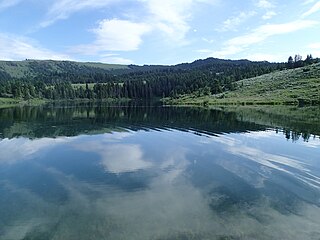
Twin Lakes are a pair of small sub-alpine lakes in the Axolotl Lakes group in the Greenhorn Range southwest of Ennis, Montana. Lower Twin Lakes is approximately 11 acres (4.5 ha). Upper Twin Lakes is considerably smaller and located approximately .25 miles (0.40 km) southwest of the lower lake. Twin Lakes is located on state owned land and accessible by a one-lane dirt road connecting Montana Highway 287 and the Gravelly Range road.

The Greenhorn Limestone or Greenhorn Formation is a geologic formation in the Great Plains Region of the United States. It preserves fossils dating back to the Cenomanian and Turonian of the Late Cretaceous period.
The Benton Shale is a geologic formation in Montana, Wyoming, North Dakota, South Dakota, Colorado, Kansas, and Nebraska. It preserves fossils dating to the Cretaceous Period. The term Benton Limestone has also been used to refer to the chalky portions of the strata, especially the upper beds of the strata presently classified as Greenhorn Limestone. The Benton classification is obsolete in some regions, having been replaced by the ascending sequence Graneros Shale, Greenhorn Limestone, and Carlile Shale.