
Tonawanda is a city in Erie County, New York, United States. The population was 15,129 at the 2020 census. It is at the northern edge of Erie County, south across the Erie Canal from North Tonawanda, east of Grand Island, and north of Buffalo. It is part of the Buffalo-Niagara Falls metropolitan area.

The Boston Manufacturing Company was a business that operated one of the first factories in America. It was organized in 1813 by Francis Cabot Lowell, a wealthy Boston merchant, in partnership with a group of investors later known as The Boston Associates, for the manufacture of cotton textiles. It built the first integrated spinning and weaving factory in the world at Waltham, Massachusetts, using water power. They used plans for a power loom that he smuggled out of England as well as trade secrets from the earlier horse-powered Beverly Cotton Manufactory, of Beverly, Massachusetts, of 1788. This was the largest factory in the U.S., with a workforce of about 300. It was a very efficient, highly profitable mill that, with the aid of the Tariff of 1816, competed effectively with British textiles at a time when many smaller operations were being forced out of business. While the Rhode Island System that followed was famously employed by Samuel Slater, the Boston Associates improved upon it with the "Waltham System". The idea was successfully copied at Lowell, Massachusetts, and elsewhere in New England. Many rural towns now had their own textile mills.
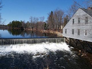
The Squannacook River is a 16.4-mile-long (26.4 km) river in northern Massachusetts. It is a tributary of the Nashua River and part of the Merrimack River watershed flowing to the Atlantic Ocean.

Wheelockville is a village in the town (township) of Uxbridge, Massachusetts, United States. Part of the village centering on Mendon and Henry streets is listed on the National Register of Historic Places as the Wheelockville Historic District. Wheelockville appears on the Blackstone U.S. Geological Survey Map. The Village receives municipal services from Uxbridge, for fire, police, EMS, School district, public works, and other services. Worcester's Judicial District includes Uxbridge District Court. The geography of Wheelockville includes several other distinct mill villages, including: Hecla and Elmdale.

The Blackstone Manufacturing Company Historic District encompasses the "New City" or "High Rocks" area of Blackstone, Massachusetts, an industrial village associated with the Blackstone Manufacturing Company, which began operations in 1809. It includes an area roughly surrounding Butler, Canal, Church, County, Ives, Main, Mendon, Old Mendon, and School Streets. The district includes a wide variety of worker housing, as well as a granite storehouse, the only surviving company structure. The district was added to the National Register of Historic Places in 1995.
The Linwood Historic District is an industrial historic district in the Linwood village of Northbridge, Massachusetts. It is the site of the Linwood Cotton Mill and is roughly bounded by Linwood Avenue, Maple Court, and Pine Court. On June 16, 1989, it was added to the National Register of Historic Places.

Mill Conversion or mill rehab is a form of adaptive reuse in which a historic mill or industrial factory building is restored or rehabilitated into another use, such as residential housing, retail shops, office, or a mix of these non-industrial elements (mixed-use).

The Acushnet Heights Historic District is a predominantly residential historic district in central New Bedford, Massachusetts. It encompasses a densely-built urban area about 20 acres (8.1 ha) in size, which was developed as a working-class area, beginning in the 1860s, for the many workers in the city's factories. The district was listed on the National Register of Historic Places in 1989. It abuts the North Bedford Historic District, which is just to the south, and includes the following separately-listed properties: the Union Street Railway Carbarn, the Bradford Smith Building, and the Dawson Building.
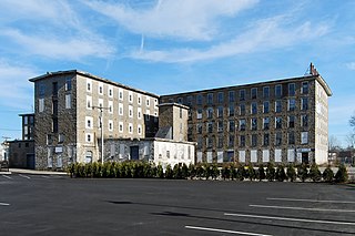
Wampanoag Mills is a historic textile mill complex located at 420 Quequechan Street in Fall River, Massachusetts. Built beginning in 1871, it is a large and well-preserved example of granite textile mill construction. The site was added to the National Register of Historic Places in 1983.

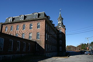
Pilgrim Mills is an historic textile mill located at 847 Pleasant Street in Fall River, Massachusetts. The mill was built in 1911 from red brick and was the first mill in the city powered entirely by electricity, provided from the local grid. It was one of the last mill complexes built in the city. The property was listed on the National Register of Historic Places in 1983.

The Lockville Historic District is a historic district encompassing the area of a historic mill village in Southampton, Massachusetts. The district is located about 1 mile (1.6 km) south of Southampton Center along College Highway, in the area where the road crosses the Manhan River. The river in this area provided a drop in elevation that was used to provide power for a modest mill complex, which operated from the 1830s until about 1900. The district includes the house of the first documented mill family, the Ichabod Strong House, the Lyman Mill, Lyman Pond and the dam that impounds it.

The Ipswich Mills Historic District encompasses a major textile mill complex and associated worker housing along the Ipswich River near the center of Ipswich, Massachusetts. The district includes the factories of the Ipswich Mill Company, and several blocks of modest worker cottages mostly on side streets off Estes and Kimball Streets. The site had been used as for mills since the 17th century, and was purchased by the Ipswich Mill Company in 1868. Mill worker housing was built surrounding the complex through the early 20th century, when River Court, Peatfield Street, and 1st through 6th Streets were laid out. The district was listed on the National Register of Historic Places in 1996.
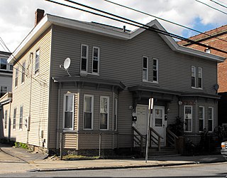
113–115 Center Street is a historic two-family house in the Arlington Mills district of southern Methuen, Massachusetts. Built about 1880, it is a rare surviving example of the type of worker housing built early in the expansion of the Arlington Mills. It was added to the National Register of Historic Places in 1984.

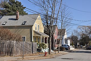
The Windsor Court Historic District is a residential historic district in Southbridge, Massachusetts, United States. It is a collection of five three-family residences located on Windsor Court and adjacent North Street that were built by the American Optical Company between 1915 and 1917 to provide worker housing. The district was listed on the National Register of Historic Places in 1989.

The Hamilton Mill—West Street Factory Housing is a historic house at 45 West Street in Southbridge, Massachusetts. Built in the second quarter of the 19th century, it was a particularly architecturally elaborate example of a worker tenement house with Greek Revival elements, and was listed on the National Register of Historic Places in 1989 for its architecture. It has since been resided, losing most of those features.
The Saco–Lowell Shops Housing Historic District encompasses the only 20th-century factory working housing enclave in the city of Newton, Massachusetts. It is located in Newton Upper Falls, near the Saco–Pettee Machine Shops, and was developed to provide housing for employees of the machinery manufacturers located there. It is roughly bounded by Oak, Williams, Butts, and Saco Streets, and includes eight small-scale brick houses with vernacular Colonial Revival styling. These houses were built in 1919 and 1920, adjoining a small number of worker houses built in the early 1890s. The district was listed on the National Register of Historic Places in 1990.

The Jaffrey Mills is a historic mill complex at 41 Main Street, in the central business district of Jaffrey, New Hampshire. It consists of a connected series of primarily brick buildings flanking the Contoocook River just north of Main Street. Its oldest buildings, the original mill and office building, are on the west side of the river. They were built in 1868, and feature mansard roofs and banded dentil brick cornices. The mill building has a tower that originally sported a cupola, but this was removed early in the 20th century. In 1872 the building on the east side was built, and the two sides joined by timber-frame bridges were added in 1897, at the same time the east building was extended northward. Later additions to the north of the east building include a storage area and a loading dock. The mill complex, the only 19th-century industrial complex of its type to be built in Jaffrey, was listed on the National Register of Historic Places in 1982. It has been converted into residences.

Blackstone River Valley National Historical Park is a National Park Service unit in the states of Rhode Island and Massachusetts. The park was created for the purpose of preserving, protecting, and interpreting the industrial heritage of the Blackstone River Valley and the urban, rural, and agricultural landscape of that region. The Blackstone River Valley was the site of some of the earliest successful textile mills in the United States, and these mills contributed significantly to the earliest American Industrial Revolution. The subsequent construction of the Blackstone Canal, a few years after the successful completion of the Erie Canal, helped to sustain the region's industrial strength.
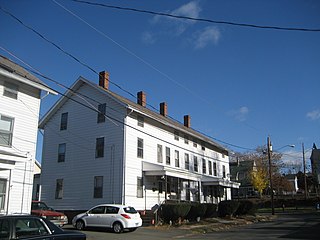
The Bigelow-Hartford Carpet Mills Historic District encompasses a company-built factory and residential area in the Thompsonville area of Enfield, Connecticut. In addition to the former factory buildings of the Bigelow-Hartford Carpet Mills, it includes more than 150 housing units built by the company between about 1830 and 1920. It is roughly bounded on the north by Lafayette Street and Alden Avenue, the east by Hartford Avenue and Lincoln Street, the south by High Street, and the west by River Street. It was listed on the National Register of Historic Places in 1994.

The Curtisville Historic District encompasses a predominantly residential area along Naubuc Avenue and Pratt Streets in northwestern Glastonbury, Connecticut. Developed mainly in the 19th century, it illustrates the coexistence of agricultural and industrial pursuits in a single village area, mixing worker housing, former farm properties, and a small mill complex. The district was listed on the National Register of Historic Places in 1992.


