Guardarraya

Last updated
Guardarraya
Barrio
Playa Guardarraya, Patillas, Puerto Rico.jpg
Guardarraya Beach
Guardarraya, Patillas, Puerto Rico locator map.png
Location of Guardarraya within the municipality of Patillas shown in red
Caribbean location map.svg
Red pog.svg
Guardarraya
Location of Puerto Rico
Coordinates: 17°58′28″N65°56′09″W / 17.97435°N 65.935946°W / 17.97435; -65.935946 [1]
Commonwealth Flag of Puerto Rico.svg  Puerto Rico
Municipality Flag of Patillas.svg Patillas
Area
[1]
  Total5.94 sq mi (15.4 km2)
  Land2.92 sq mi (7.6 km2)
  Water3.02 sq mi (7.8 km2)
Elevation
[2]
10 ft (3 m)
Population
 (2010)
  Total1,603
  Density530.8/sq mi (204.9/km2)
 Source: 2010 Census
Time zone UTC−4 (AST)

Guardarraya is a barrio in the municipality of Patillas, Puerto Rico. Its population in 2010 was 1,603. [3] [4] [5]

Contents

History

Guardarraya, located where the Cordillera Central mountains meet the Caribbean Sea, in 1765 was known for its agriculture, fishing and production of aromatic oils. Guardarraya is where the legendary pirate Roberto Cofresí was captured and turned over to authorities. [6]

Guardarraya was in Spain's gazetteers [7] until Puerto Rico was ceded by Spain in the aftermath of the Spanish–American War under the terms of the Treaty of Paris of 1898 and became an unincorporated territory of the United States. In 1899, the United States Department of War conducted a census of Puerto Rico finding that the population of Guardarraya barrio was 1,013. [8]

Historical population
CensusPop.Note
1900 1,013
1910 1,19017.5%
1920 1,2041.2%
1930 1,56429.9%
1940 1,541−1.5%
1950 1,5923.3%
1960 1,6654.6%
1970 1,660−0.3%
1980 1,7093.0%
1990 2,20228.8%
2000 2,013−8.6%
2010 1,603−20.4%
U.S. Decennial Census
1899 (shown as 1900) [9] 1910-1930 [10]
1930-1950 [11] 1980-2000 [12] 2010 [13]

Sectors

Barrios (which are, in contemporary times, roughly comparable to minor civil divisions) [14] in turn are further subdivided into smaller local populated place areas/units called sectores (sectors in English). The types of sectores may vary, from normally sector to urbanización to reparto to barriada to residencial, among others. [15] [16] [17]

The following sectors are in Guardarraya barrio: [18]

Calle Buena Vista, Calle Ceiba, Calle Monte Mar, Calle Monte, Calle Vista Alegre, Calle Vista Horizonte, Calle Vista Mar, Calle Vista Monte, Carretera 3, Carretera 7758, Centro Cooperativo, Comunidad Guardarraya, Sector Cofresí, Sector La Mina, Sector Mala Pascua, Sector Recio, Sector San Bartolo, and Sector Tamarindo.

See also

Related Research Articles

<span class="mw-page-title-main">Santa Rosa, Guaynabo, Puerto Rico</span> Barrio of Puerto Rico

Santa Rosa is a barrio in the municipality of Guaynabo, Puerto Rico. Its population in 2010 was 16,904.

<span class="mw-page-title-main">Jagual, Patillas, Puerto Rico</span> Barrio of Puerto Rico

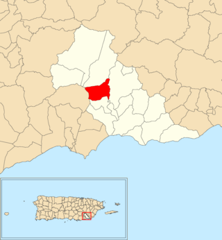
Jagual is a barrio in the municipality of Patillas, Puerto Rico. Its population in 2010 was 363.

<span class="mw-page-title-main">Pueblo, Rincón, Puerto Rico</span> Barrio of Puerto Rico

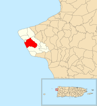
Pueblo barrio is a barrio in the municipality of Rincón, Puerto Rico. Its population in 2010 was 3,796. There is also the administrative center and seat called Rincón barrio-pueblo in this municipality, with a smaller population.

<span class="mw-page-title-main">Apeadero</span> Barrio of Patillas, Puerto Rico

Apeadero is a barrio in the municipality of Patillas, Puerto Rico. Its population in 2010 was 699.

<span class="mw-page-title-main">Cacao Bajo</span> Barrio of Patillas, Puerto Rico

Cacao Bajo is a barrio in the municipality of Patillas, Puerto Rico. Its population in 2010 was 1,437.

<span class="mw-page-title-main">Egozcue</span> Barrio of Patillas, Puerto Rico

Egozcue is a barrio in the municipality of Patillas, Puerto Rico. Its population in 2010 was 52.

<span class="mw-page-title-main">Jacaboa</span> Barrio of Patillas, Puerto Rico

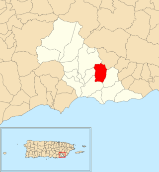
Jacaboa is a barrio in the municipality of Patillas, Puerto Rico. Its population in 2010 was 1,278.

<span class="mw-page-title-main">Quebrada Arriba, Patillas, Puerto Rico</span> Barrio of Puerto Rico

Quebrada Arriba is a barrio in the municipality of Patillas, Puerto Rico. Its population in 2010 was 711.

<span class="mw-page-title-main">Marín, Patillas, Puerto Rico</span> Barrio of Puerto Rico

Marín is a barrio in the municipality of Patillas, Puerto Rico. Its population in 2010 was 890.

<span class="mw-page-title-main">Mulas</span> Barrio of Patillas, Puerto Rico

Mulas is a barrio in the municipality of Patillas, Puerto Rico. Its population in 2010 was 439.

<span class="mw-page-title-main">Muñoz Rivera</span> Barrio of Patillas, Puerto Rico

Muñoz Rivera is a barrio in the municipality of Patillas, Puerto Rico. Its population in 2010 was 673.

<span class="mw-page-title-main">Pollos, Patillas, Puerto Rico</span> Barrio of Puerto Rico

Pollos is a barrio in the municipality of Patillas, Puerto Rico. Its population in 2010 was 3,146.

<span class="mw-page-title-main">Ríos, Patillas, Puerto Rico</span> Barrio of Puerto Rico

Ríos is a barrio in the municipality of Patillas, Puerto Rico. Its population in 2010 was 348.

<span class="mw-page-title-main">Bajo, Patillas, Puerto Rico</span> Barrio of Puerto Rico

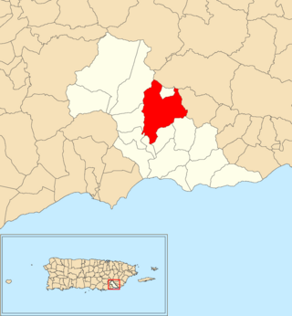
Bajo also spelled Bajos is a barrio in the municipality of Patillas, Puerto Rico. Its population in 2010 was 1,530.

<span class="mw-page-title-main">Corrales, Aguadilla, Puerto Rico</span> Barrio of Puerto Rico

Corrales is a rural barrio in the municipality of Aguadilla, Puerto Rico. Its population in 2010 was 7,659. In Corrales barrio is Cabán, a comunidad.

<span class="mw-page-title-main">Lares barrio-pueblo</span> Historical and administrative center (seat) of Lares, Puerto Rico

Lares barrio-pueblo is a barrio and the administrative center (seat) of Lares, a municipality of Puerto Rico. Its population in 2010 was 2,690.

<span class="mw-page-title-main">San Antonio, Quebradillas, Puerto Rico</span> Barrio of Puerto Rico

San Antonio is a barrio in the municipality of Quebradillas, Puerto Rico. Its population in 2010 was 5,164.

<span class="mw-page-title-main">Monte Llano, Morovis, Puerto Rico</span> Barrio of Puerto Rico

Monte Llano is a barrio in the municipality of Morovis, Puerto Rico. Monte Llano has about 15 sectors and its population in 2010 was 2,948.

<span class="mw-page-title-main">Cocos, Quebradillas, Puerto Rico</span> Barrio of Puerto Rico

Cocos is a barrio in the municipality of Quebradillas, Puerto Rico. Its population in 2010 was 4,889.

<span class="mw-page-title-main">Bayamón, Cidra, Puerto Rico</span> Barrio of Puerto Rico

Bayamón is a barrio in the municipality of Cidra, Puerto Rico. Its population in 2010 was 5,995.

References

  1. 1 2 "US Gazetteer 2019". US Census. US Government.
  2. U.S. Geological Survey Geographic Names Information System: Guardarraya barrio
  3. Picó, Rafael; Buitrago de Santiago, Zayda; Berrios, Hector H. Nueva geografía de Puerto Rico: física, económica, y social, por Rafael Picó. Con la colaboración de Zayda Buitrago de Santiago y Héctor H. Berrios. San Juan Editorial Universitaria, Universidad de Puerto Rico,1969.
  4. Gwillim Law (20 May 2015). Administrative Subdivisions of Countries: A Comprehensive World Reference, 1900 through 1998. McFarland. p. 300. ISBN   978-1-4766-0447-3 . Retrieved 25 December 2018.
  5. Puerto Rico: 2010 Population and Housing Unit Counts.pdf (PDF). U.S. Dept. of Commerce, Economics and Statistics Administration, U.S. Census Bureau. 2010.
  6. "La Historia de Puerto Rico a través de sus Barrios: Barrio Guardarraya de Patillas [The History of Puerto Rico through its Barrios: Guardarraya Barrio of Patillas]" (video). www.pbslearningmedia.org (in Spanish). Fundación Puertorriqueña de las Humanidades. Retrieved 29 August 2020.
  7. "Anuario del comercio, de la industria, de la magistratura y de la administración. 1881". Biblioteca Nacional de España (in Spanish). p. 1614. Retrieved 4 April 2023.
  8. Joseph Prentiss Sanger; Henry Gannett; Walter Francis Willcox (1900). Informe sobre el censo de Puerto Rico, 1899, United States. War Dept. Porto Rico Census Office (in Spanish). Imprenta del gobierno. p.  163.
  9. "Report of the Census of Porto Rico 1899". War Department Office Director Census of Porto Rico. Archived from the original on July 16, 2017. Retrieved September 21, 2017.
  10. "Table 3-Population of Municipalities: 1930 1920 and 1910" (PDF). United States Census Bureau. Archived (PDF) from the original on August 17, 2017. Retrieved September 21, 2017.
  11. "Table 4-Area and Population of Municipalities Urban and Rural: 1930 to 1950" (PDF). United States Census Bureau. Archived (PDF) from the original on August 30, 2015. Retrieved September 21, 2014.
  12. "Table 2 Population and Housing Units: 1960 to 2000" (PDF). United States Census Bureau. Archived (PDF) from the original on July 24, 2017. Retrieved September 21, 2017.
  13. Puerto Rico: 2010 Population and Housing Unit Counts.pdf (PDF). U.S. Dept. of Commerce Economics and Statistics Administration U.S. Census Bureau. 2010. Archived (PDF) from the original on 2017-02-20. Retrieved 2019-08-02.
  14. "US Census Barrio-Pueblo definition". factfinder.com. US Census. Archived from the original on 13 May 2017. Retrieved 5 January 2019.
  15. "Agencia: Oficina del Coordinador General para el Financiamiento Socioeconómico y la Autogestión (Proposed 2016 Budget)". Puerto Rico Budgets (in Spanish). Retrieved 28 June 2019.
  16. Rivera Quintero, Marcia (2014), El vuelo de la esperanza: Proyecto de las Comunidades Especiales Puerto Rico, 1997-2004 (first ed.), San Juan, Puerto Rico Fundación Sila M. Calderón, ISBN   978-0-9820806-1-0
  17. "Leyes del 2001". Lex Juris Puerto Rico (in Spanish). Retrieved 24 June 2020.
  18. "PRECINTO ELECTORAL Patillas 091" (PDF). Comisión Estatal de Elecciones (in Spanish). Junta de Planificación - Gobierno de Puerto Rico. 22 September 2020. Retrieved 4 January 2021.