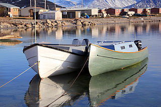
Sanirajak, Syllabics: ᓴᓂᕋᔭᒃ), formerly known as Hall Beach until 27 February 2020, is an Inuit settlement within the Qikiqtaaluk Region of Nunavut, Canada, approximately 69 km (43 mi) south of Igloolik.
In Canada, the National Airport System is a group of major airports defined in the National Airports Policy published in 1994. It was intended to include all airports with an annual traffic of 200,000 passengers or more, as well as airports serving the national, provincial and territorial capitals.
Alert Airport is located at Alert, Nunavut, Canada, approximately 830 km (520 mi) south of the true North Pole. It is operated by the Canadian Department of National Defence and is part of Canadian Forces Station Alert. A weather station was established on the site in 1950, and in 1957 construction began on the military facilities which are still in use to this day. It is the northernmost airport in the world, although not used by public scheduled flights.

Arviat Airport is located at Arviat, Nunavut, Canada, and is operated by the government of Nunavut. Local taxis provide service between the hamlet and the airport for $7.

Baker Lake Airport is located 3 nautical miles southwest of Baker Lake, Nunavut, Canada. It is operated by the government of Nunavut. It has a single gravel runway 4,195 ft × 100 ft.

Cambridge Bay Airport is located 1.6 nautical miles southwest of Cambridge Bay, Nunavut, Canada, and is operated by the government of Nunavut.

Clyde River Airport is located 2.2 nautical miles northeast of Clyde River, Nunavut, Canada, and is operated by the government of Nunavut.

Kugluktuk Airport is located at Kugluktuk, Nunavut, Canada, and is operated by the Government of Nunavut.
Pond Inlet Airport is located at Pond Inlet, Nunavut, Canada, and is operated by the government of Nunavut.

Rankin Inlet Airport is located at Rankin Inlet, Nunavut, Canada, and is operated by the government of Nunavut.

Naujaat Airport, formerly Repulse Bay Airport, is located at Naujaat, Nunavut, Canada, and is operated by the government of Nunavut.

Resolute Bay Airport is located at Resolute, Nunavut, Canada, and is operated by the government of Nunavut. It is one of the northernmost airfields in Canada to receive scheduled passenger airline service.
Sanikiluaq Airport is located at Sanikiluaq, Nunavut, Canada, and is operated by the Government of Nunavut. It is one of the few airports in Nunavut that uses magnetic headings for the runway rather than true headings.
Chesterfield Inlet Airport is located 1 nautical mile northwest of Chesterfield Inlet, Nunavut, Canada, and is operated by the government of Nunavut.

Grise Fiord Airport is located in Grise Fiord, Nunavut, Canada, and is operated by the Government of Nunavut. The only building at this airport is the Air Passenger Shelter and the companies that operate there are Canadian North. Flights to this airport are usually from Resolute Bay Airport and most of them only carry cargo with few to no passengers.

Igloolik Airport is located at Igloolik, Nunavut, Canada, and is operated by the government of Nunavut.

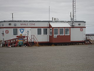
Whale Cove Airport is located 4.3 nautical miles from Whale Cove, Nunavut, Canada, and is operated by the government of Nunavut.

Qikiqtarjuaq is a community located on Broughton Island in the Qikiqtaaluk Region of Nunavut, Canada. The island is known for Arctic wildlife, bird watching at the Qaqulluit National Wildlife Area. The community serves as the northern access point for Auyuittuq National Park and Pangnirtung is the southern access point.

Kugaaruk, formerly known as Pelly Bay until 3 December 1999, is located on the shore of Pelly Bay, just off the Gulf of Boothia, Simpson Peninsula, Kitikmeot, in Canada's Nunavut territory. Access is by air by the Kugaaruk Airport, by annual supply sealift, and by sea ice. Kugaaruk means "little stream", the traditional name of the brook that flows through the hamlet.


