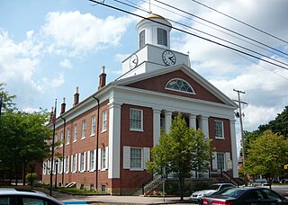
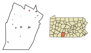
Snake Spring Township is a township in Bedford County, Pennsylvania, United States. The population was 1,639 at the 2010 census.
Woodbury is a borough in Bedford County, Pennsylvania, United States. The population was 284 at the 2010 census.

Frankstown Township is a township in Blair County, Pennsylvania, United States. It is part of the Altoona Metropolitan Statistical Area. The population was 7,381 at the 2010 census. On March 15, 1874, Harold L. Ickes was born in Frankstown Township.

Taylor Township is a township in Blair County, Pennsylvania, United States. It is part of the Altoona, PA Metropolitan Statistical Area. The population was 2,465 at the 2010 census.

The Little Juniata River, sometimes called the "Little J," is a river that is not owned by anyone person. It is held in trust by the state of Pennsylvania for the people of the state and beyond. Pennsylvania. 32.1-mile-long (51.7 km) tributary of the Juniata River in the Susquehanna River watershed. It is formed at Altoona by the confluence of several short streams. It flows northeast in the Logan Valley at the foot of Brush Mountain.
Yellow Creek is a 20.9-mile-long (33.6 km) tributary of the Raystown Branch Juniata River in Bedford County, Pennsylvania, in the United States.
Clover Creek is a 24.5-mile-long (39.4 km) tributary of the Frankstown Branch Juniata River in Bedford and Blair counties, Pennsylvania, in the United States.
Brush Creek is a 24.7-mile-long (39.8 km) tributary of the Raystown Branch Juniata River in Fulton and Bedford counties, Pennsylvania, in the United States.

The Raystown Branch Juniata River is the largest and longest tributary of the Juniata River in south-central Pennsylvania in the United States.
Morrisons Cove, is an eroded anticlinal valley in Blair and Bedford counties of central Pennsylvania, United States, extending from Evitts Mountain near New Enterprise, north to the Frankstown Branch Juniata River at Williamsburg. The width of the valley varies from 10 to 15 miles between Tussey Mountain on the east to the chain of Dunning, Loop and Lock Mountains on the west. Almost entirely enclosed by these mountains, the only openings in the cove are at Loysburg Gap in the south, McKee Gap in the west, and at Williamsburg to the north. The floor of the valley is mostly level, with many large fertile farm fields. The southern end of the valley drains to the Raystown Branch Juniata River via Yellow Creek through Loysburg Gap, and the northern end drains to the Frankstown Branch, via Clover Creek.

Evitts Creek is a tributary stream of the North Branch Potomac River in the U.S. states of Pennsylvania and Maryland. The confluence of Evitts Creek and the North Branch Potomac River is located 2 miles (3 km) east of Cumberland, Maryland.

Evitts Mountain is a stratigraphic ridge in the Ridge and Valley region of the Appalachian Mountains, located in Bedford County, Pennsylvania and Allegany County, Maryland

Loysburg Gap is a water gap where Pennsylvania Route 36 and the Yellow Creek pass through Tussey Mountain in near Loysburg in Bedford County, Pennsylvania, United States.

Tussey Mountain is a stratigraphic ridge in central Pennsylvania, United States, trending east of the Bald Eagle, Brush, Dunning and Evitts Mountain ridges. Its southern foot just crosses the Mason–Dixon line near Flintstone, Maryland, running north 130 km (80 mi) to the Seven Mountains of central Pennsylvania, near Tusseyville, making it one of the longest named ridges in this section of the Ridge-and-valley Appalachians. The ridge line separates Morrison Cove from the Woodcock Valley and Friends Cove from the Black Valley. Tussey Mountain lies in, and the ridge line forms parts of the borders of, Centre, Blair, Bedford and Huntingdon counties.

Pennsylvania Route 164 is a 36-mile-long (58 km) state highway located in Cambria, Blair, and Bedford counties in Pennsylvania. The western terminus is at an interchange with U.S. Route 22 (US 22) in Munster Township. The eastern terminus is at PA 26 near Raystown Lake.

The Narrows is a water gap where the Raystown Branch of the Juniata River passes through Evitts Mountain in Bedford County, Pennsylvania. Both U.S. Route 30 and the Pennsylvania Turnpike pass through the gap. It is located in the townships of Snake Spring and Bedford.
Loysburg Gap is a water gap where Pennsylvania Route 36 and the Yellow Creek pass through Tussey Mountain in near Loysburg in Bedford County, Pennsylvania, United States.

The Pennsylvania State Game Lands Number 147 are Pennsylvania State Game Lands in Blair County in Pennsylvania in the United States providing hunting, trapping, bird watching, and other activities.