
Fanning Springs is a city in Gilchrist and Levy counties in the U.S. state of Florida. It is part of the Gainesville, Florida Metropolitan Statistical Area. The population was 1,182 at the 2020 census, up from 764 at the 2010 census.

Eagle is a city in Ada County, Idaho, ten miles (16 km) northwest of downtown Boise. The population was 30,346 at the 2020 census.

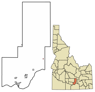
McCammon is a city in Bannock County, Idaho, United States. It is part of the Pocatello, Idaho Metropolitan Statistical Area'. The population was 825 at the 2020 census. In 1892, McCammon became the junction point between the Oregon Short Line Railroad and Utah and Northern Railway, and city gained the nickname Junction City.

Paris is a city and county seat of Bear Lake County, Idaho, United States. Located on the western side of the Bear Lake Valley, the city's population was 541 at the 2020 census. Paris was settled on September 26, 1863, by pioneer settlers of the Church of Jesus Christ of Latter-day Saints.
Plummer is a city in Benewah County, Idaho, United States. The population was 1,044 at the 2010 census, up from 990 in 2000. It is the largest city within the Coeur d'Alene Reservation, and is accessed by U.S. Route 95, the state's primary north–south highway.
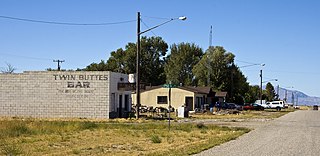
Atomic City is an unincorporated area in Bingham County, Idaho, United States. The population was 41 at the 2020 census, up from 29 in 2010.

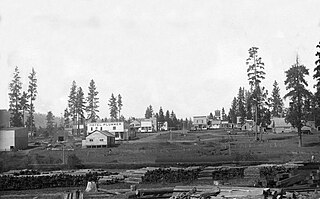
Crouch is a city in Boise County, Idaho, United States. The population was 162 at the 2010 census. It is part of the Boise City–Nampa, Idaho Metropolitan Statistical Area. In 2018, it has multiple commercial businesses for tourists and residents: a small grocery mart, a hardware store, three restaurants, a bar, The Starlight Mountain Theater, and a community thrift store. At that time, the construction of the Banks/Lowman road 2512A, The "Wildlife Canyon Scenic Byway highway, transformed a small unpaved road unto a paved modern road between Crouch and Lowman. Now it is a fully modern paved roadway with informational and white water rafting pull outs which serves to transport tourists, rafters, commuters, and other traffic across the middle Idaho region.

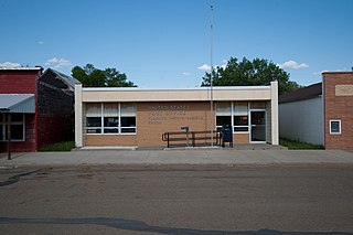
Swan Valley is a city in Bonneville County, Idaho, United States. It is part of the Idaho Falls, Idaho Metropolitan Statistical Area. The population was 204 at the 2010 census.

Parma is a city in Canyon County, Idaho, United States. The population was 1,983 at the 2010 census, up from 1,771 in 2000. It is the fourth largest city in the county and the largest in the rural western portion. It is part of the Boise City–Nampa, Idaho Metropolitan Statistical Area.

Dubois is a city in Clark County, Idaho, United States. The population was 511 at the 2020 census. The city is the county seat of Clark County.

Clayton is a city in Custer County, Idaho, United States. The population was 7 at the 2010 census, down from 27 in 2000. It is adjacent to the Salmon River.

Drummond is a city in Fremont County, Idaho, United States. The population was 16 at the 2010 census. It is part of the Rexburg, Idaho Micropolitan Statistical Area.

Eden is a city in Jerome County, Idaho, United States. The population was 405 at the 2010 census. It is part of the Twin Falls, Idaho Metropolitan Statistical Area.

Jerome is a city in and county seat of Jerome County, Idaho, United States. The population was 10,890 at the 2010 census, up from 7,780 in 2000. The city is the county seat of Jerome County, and is part of the Twin Falls Micropolitan Statistical Area. It is the second largest city in Idaho's Magic Valley region, second only to Twin Falls which is located 10 miles (16 km) southeast. Jerome's economy is largely agrarian, with dairy farming being one of the main revenue sources for the local economy.
Minidoka is a city in Minidoka County, Idaho, United States. The population was 86 at the 2020 census, down from 112 in 2010. It is part of the Burley, Idaho Micropolitan Statistical Area.

Castleford is a city in Twin Falls County, Idaho, United States. The population was 226 at the 2010 census. It is part of the Twin Falls, Idaho Micropolitan Statistical Area.
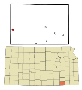
Cedar Vale is a city in Chautauqua County, Kansas, United States. As of the 2020 census, the population of the city was 476.

Pettibone is a small city in Kidder County, North Dakota, United States. The population was 60 at the 2020 census.
Flasher is a city in Morton County, North Dakota, United States. It is part of the "Bismarck, ND Metropolitan Statistical Area" or "Bismarck-Mandan". The population was 217 at the 2020 census. Flasher was founded in 1902.

Burnsville is a town in Braxton County, West Virginia, United States, at the confluence of the Little Kanawha River and Saltlick Creek. The population was 401 at the 2020 census. Burnsville was incorporated in 1902 by the Circuit Court and named for Captain John Burns who operated the first sawmill in that section of the state and who established the town shortly after the close of the American Civil War. It was named "All West Virginia City" in 1976.

