Mud Lake, Idaho

Last updated
Mud Lake, Idaho
Jefferson County Idaho Incorporated and Unincorporated areas Mud Lake Highlighted 1655450.svg
Location of Mud Lake in Jefferson County, Idaho.
Coordinates: 43°50′27″N112°28′55″W / 43.84083°N 112.48194°W / 43.84083; -112.48194 Coordinates: 43°50′27″N112°28′55″W / 43.84083°N 112.48194°W / 43.84083; -112.48194
Country United States
State Idaho
County Jefferson
Area
[1]
  Total0.14 sq mi (0.37 km2)
  Land0.14 sq mi (0.37 km2)
  Water0.00 sq mi (0.00 km2)
Elevation
4,790 ft (1,460 m)
Population
 (2010) [2]
  Total358
  Estimate 
(2019) [3]
419
  Density2,950.70/sq mi (1,136.06/km2)
Time zone UTC-7 (Mountain (MST))
  Summer (DST) UTC-6 (MDT)
ZIP code
83450
Area code 208
FIPS code 16-55450
GNIS feature ID0397940

Mud Lake is a city in Jefferson County, Idaho, United States. It is part of the Idaho Falls, Idaho Metropolitan Statistical Area. The population was 358 at the 2010 census. Since then the population has grown to 419 as seen in the 2020 census as well as idaho demographics

Contents

Mud Lake is also home to a large lake (3094.9 acres) Idaho.gov

  1. "2019 U.S. Gazetteer Files". United States Census Bureau. Retrieved July 9, 2020.

History

In 1919 the Latter-day Saint settlers in Mud Lake were organized into a branch. [1]

Mud Lake made national news in 1981 when it had an infestation of jackrabbits. [2] [3] [4] [5]

On August 21, 2017, Mud Lake became part of the 'path of totality' during the total solar eclipse.

Geography

Mud Lake is located at 43°50′27″N112°28′55″W / 43.84083°N 112.48194°W / 43.84083; -112.48194 (43.840818, -112.481806). [6]

According to the United States Census Bureau, the city has a total area of 0.16 square miles (0.41 km2), all of it land. [7]

Demographics

Historical population
CensusPop.Note
1960 187
1970 1943.7%
1980 24325.3%
1990 179−26.3%
2000 27050.8%
2010 35832.6%
2019 (est.)419 [8] 17.0%
U.S. Decennial Census [9]

2010 census

As of the census [10] of 2010, there were 358 people, 96 households, and 84 families residing in the city. The population density was 2,237.5 inhabitants per square mile (863.9/km2). There were 107 housing units at an average density of 668.8 per square mile (258.2/km2). The racial makeup of the city was 63.4% White, 1.1% Native American, 32.4% from other races, and 3.1% from two or more races. Hispanic or Latino of any race were 44.4% of the population.

There were 96 households, of which 63.5% had children under the age of 18 living with them, 66.7% were married couples living together, 15.6% had a female householder with no husband present, 5.2% had a male householder with no wife present, and 12.5% were non-families. 8.3% of all households were made up of individuals, and 2.1% had someone living alone who was 65 years of age or older. The average household size was 3.73 and the average family size was 4.01.

The median age in the city was 22.2 years. 45% of residents were under the age of 18; 7.8% were between the ages of 18 and 24; 24.8% were from 25 to 44; 18.4% were from 45 to 64; and 3.9% were 65 years of age or older. The gender makeup of the city was 48.3% male and 51.7% female.

2000 census

As of the census [11] of 2000, there were 270 people, 85 households, and 65 families residing in the city. The population density was 1,623.1 inhabitants per square mile (626.7/km2). There were 91 housing units at an average density of 547.0 per square mile (211.2/km2). The racial makeup of the city was 77.41% White, 0.37% Native American, 21.48% from other races, and 0.74% from two or more races. Hispanic or Latino of any race were 27.41% of the population.

There were 85 households, out of which 47.1% had children under the age of 18 living with them, 68.2% were married couples living together, 7.1% had a female householder with no husband present, and 23.5% were non-families. 18.8% of all households were made up of individuals, and 5.9% had someone living alone who was 65 years of age or older. The average household size was 3.18 and the average family size was 3.74.

In the city, the population was spread out, with 35.6% under the age of 18, 15.6% from 18 to 24, 24.1% from 25 to 44, 16.7% from 45 to 64, and 8.1% who were 65 years of age or older. The median age was 24 years. For every 100 females, there were 123.1 males. For every 100 females age 18 and over, there were 107.1 males.

The median income for a household in the city was $28,194, and the median income for a family was $29,583. Males had a median income of $30,938 versus $16,250 for females. The per capita income for the city was $11,159. About 21.7% of families and 24.8% of the population were below the poverty line, including 22.4% of those under the age of eighteen and 15.8% of those 65 or over.

See also

Related Research Articles

<span class="mw-page-title-main">Jefferson County, Idaho</span> County in Idaho, United States

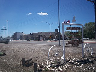
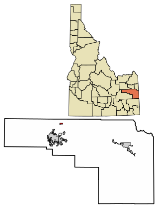
Jefferson County is a county located in the U.S. state of Idaho. As of the 2020 Census, the county's population was 30,891. In the 2010 census, the population was 26,140. The county seat and largest city is Rigby. The county was established in 1913 and named after Thomas Jefferson, the third U.S. President. Jefferson County is part of the Idaho Falls, ID Metropolitan Statistical Area.

<span class="mw-page-title-main">Eagle, Idaho</span> City in Idaho, United States

Eagle is a city in the western United States in Ada County, Idaho, ten miles (16 km) northwest of downtown Boise. The population was 30,346 at the time of the 2020 census.

<span class="mw-page-title-main">Bloomington, Idaho</span> City in Idaho, United States

Bloomington is a city in Bear Lake County, Idaho, United States. The population was 206 at the 2010 census. It was first settled in 1864.

<span class="mw-page-title-main">Montpelier, Idaho</span> City in Idaho, United States

Montpelier is a city in Bear Lake County, Idaho, United States. The population was 2,538 at the 2019 estimation, down from 2,597 in 2010 census. The city is the largest community in the Bear Lake Valley, a farming region north of Bear Lake in southeastern Idaho along the Utah border. It was settled in 1863 by Mormon pioneers on the route of the Oregon Trail. Nearby to the east is the border with Wyoming.

<span class="mw-page-title-main">Paris, Idaho</span> City in Idaho, United States

Paris is a city and county seat of Bear Lake County, Idaho, United States. Located on the western side of the Bear Lake Valley, the city's population was 513 at the 2010 census, down from 576 in 2000. Paris was settled on September 26, 1863, by pioneer settlers of the Church of Jesus Christ of Latter-day Saints.

<span class="mw-page-title-main">St. Charles, Idaho</span> City in Idaho, United States

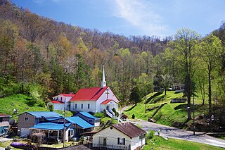
St. Charles is a city in southern Bear Lake County, Idaho, United States, that is located near the northwestern shore of Bear Lake. Its population was 131 at the 2010 census, down from 156 in 2000.

<span class="mw-page-title-main">St. Maries, Idaho</span> City in Idaho, United States

St. Maries is a city in north central Idaho, the largest in rural Benewah County and its county seat. Its population was 2,402 at the 2010 census, down from 2,652 in 2000.

<span class="mw-page-title-main">Firth, Idaho</span> City in Idaho, United States

Firth is a city in Bingham County, Idaho, United States. The population was 477 at the 2010 census.

<span class="mw-page-title-main">Carey, Idaho</span> City in Idaho, United States

Carey is a city in Blaine County, Idaho, United States. The population was 604 at the 2010 census. Carey is primarily an agricultural city and is the location of the Blaine County Fairgrounds. Nearby recreational destinations include the Craters of the Moon National Monument, Carey Lake, Silver Creek and the Little Wood River. Further west is the Big Wood River Valley, leading to the Sun Valley resort. In recent years, the city of Carey has experienced significant growth.

<span class="mw-page-title-main">Priest River, Idaho</span> City in Idaho, United States

Priest River is a city in Bonner County, Idaho. The population was 1,751 at the 2010 census. Located in the Idaho Panhandle region of the state, the city is at the mouth of the Priest River on the Pend Oreille River.

<span class="mw-page-title-main">Ucon, Idaho</span> City in Idaho, United States

Ucon is a city in Bonneville County, Idaho, United States. It is part of the Idaho Falls, Idaho Metropolitan Statistical Area. The population was 1,108 at the 2010 census. Ucon was first settled in 1883.

<span class="mw-page-title-main">Clifton, Idaho</span> City in Idaho, United States

Clifton is a city in Franklin County, Idaho, United States. The population was 259 at the 2010 census. It is part of the Logan, Utah-Idaho Metropolitan Statistical Area.

<span class="mw-page-title-main">Fernan Lake Village, Idaho</span> City in Idaho, United States

Fernan Lake Village is a city in Kootenai County, Idaho, United States. The population was 169 at the 2010 census.

<span class="mw-page-title-main">Hauser, Idaho</span> City in Idaho, United States

Hauser is a city in Kootenai County, Idaho, United States. The population was 678 at the 2010 census. The city is located on the southern end of Hauser Lake.

<span class="mw-page-title-main">Spirit Lake, Idaho</span> City in Idaho, United States

Spirit Lake is a city in Kootenai County, Idaho. The population was 1,945 at the time of the 2010 census, up from 1,376 in 2000. It is part of the Coeur d'Alene Metropolitan Statistical Area, which includes the entire county.

<span class="mw-page-title-main">Fruitland, Idaho</span> City in Payette County, Idaho, United States

Fruitland is a city along the Snake and Payette rivers in Payette County, Idaho, United States. It lies along U.S. Route 95 in the Treasure Valley of southwest Idaho, about 50 miles (80 km) west of Boise on the border with Oregon. It is part of the Ontario Micropolitan Area. Fruitland is named after apple orchards that surround the community, and its slogan is "The Big Apple of Idaho."

<span class="mw-page-title-main">Donnelly, Idaho</span> City in Idaho, United States

Donnelly is a city in rural Valley County, Idaho, United States. The population was 152 at the 2010 census.

<span class="mw-page-title-main">Earlville, Iowa</span> City in Iowa, United States

Earlville is a city in Delaware County, Iowa, United States. The population was 716 at the time of the 2020 census.

<span class="mw-page-title-main">Elkton, South Dakota</span> City in South Dakota, United States

Elkton is a city in Brookings County, South Dakota, United States. The population was 755 at the 2020 census. Some of Elkton's population also have Minnesota addresses since the city is located so close to the state line.

<span class="mw-page-title-main">Kermit, West Virginia</span> Town in West Virginia, United States

Kermit is a town in Mingo County, West Virginia, United States. The population was 406 at the 2010 census. Kermit is located along the Tug Fork, opposite Warfield, Kentucky. The Norfolk Southern Railway's Kenova District runs through town.

References

  1. Andrew Jenson. Encyclopedic History of the Church. (Salt Lake City: Deseret News Press, 1941) p. 554
  2. Hillinger, Charles (November 8, 1981). "The invasion of the jackrabbits". Lewiston Morning Tribune. (Los Angeles Times). p. 5B.
  3. "Farmers spread out in a two-mile line". United Press International. (archives). December 12, 1981. Retrieved December 20, 2018.
  4. "1,500 jackrabbits clubbed to death in Idaho roundup". Lewiston Morning Tribune. (Los Angeles Times). December 13, 1981. p. 1B.
  5. "Second rabbit roundup". United Press International. (archives). December 19, 1981. Retrieved December 20, 2018.
  6. "US Gazetteer files: 2010, 2000, and 1990". United States Census Bureau. 2011-02-12. Retrieved 2011-04-23.
  7. "US Gazetteer files 2010". United States Census Bureau. Archived from the original on 2012-01-25. Retrieved 2012-12-18.
  8. "Population and Housing Unit Estimates". United States Census Bureau. May 24, 2020. Retrieved May 27, 2020.
  9. "Census of Population and Housing". Census.gov. Retrieved June 4, 2015.
  10. "U.S. Census website". United States Census Bureau . Retrieved 2012-12-18.
  11. "U.S. Census website". United States Census Bureau . Retrieved 2008-01-31.

Commons-logo.svg Media related to Mud Lake, Idaho at Wikimedia Commons