Jefferson County is a county located in the U.S. state of Idaho. As of the 2020 Census, the county's population was 30,891. The county seat and largest city is Rigby. The county was established in 1913 and named after Thomas Jefferson, the third U.S. President. Jefferson County is part of the Idaho Falls, ID Metropolitan Statistical Area.

Lewisville is a city in Lafayette County, Arkansas, United States. The population was 1,280 at the 2010 census. It is the county seat of Lafayette County.

Garden City is a city in Ada County, Idaho. The population was 12,316 at the time of the 2020 census. Garden City is nearly surrounded by Boise but retains a separate municipal government.

Chubbuck is a city in Bannock County, Idaho. It is part of the Pocatello Metropolitan Statistical Area. The population was 15,570 at the 2020 census. Chubbuck is located immediately north of Pocatello, Idaho, and has opposed several consolidation proposals since the 1960s.
Downey is a city in the Marsh Valley in southern Bannock County, Idaho, United States. It is part of the Pocatello Metropolitan Statistical Area. The population was 571 at the 2020 census.

Basalt is a city in Bingham County, Idaho, United States. The population was 394 at the 2010 census.
Firth is a town in Bingham County, Idaho, United States. The population was 517 at the 2020 census.

Shelley is a city in Bingham County, Idaho, United States. The population was 4,409 at the 2010 census.
Ucon is a city in Bonneville County, Idaho, United States. It is part of the Idaho Falls, Idaho Metropolitan Statistical Area. The population was 1,108 at the 2010 census. Ucon was first settled in 1883.

Wilder is a city in Canyon County, Idaho, United States. The population was 1,533 at the 2010 census.

Albion is a city in Cassia County, Idaho, United States. It is part of the Burley, Idaho Micropolitan Statistical Area. The population was 234 at the 2020 census. Albion was the county seat of Cassia County from 1879 to 1918.

Oxford is a city in Franklin County, Idaho, United States. The population was 42 at the 2020 census.

Drummond is a city in Fremont County, Idaho, United States. The population was 16 at the 2010 census. It is part of the Rexburg, Idaho Micropolitan Statistical Area.

Hamer is a city in Jefferson County, Idaho, United States. It is part of the Idaho Falls Metropolitan Statistical Area. The population was 83 at the 2020 census.

Menan is a city in Jefferson County, Idaho, United States. It is part of the Idaho Falls, Idaho Metropolitan Statistical Area. The population was 741 at the 2010 census.

Mud Lake is a city in Jefferson County, Idaho, United States. It is part of the Idaho Falls, Idaho Metropolitan Statistical Area. The population was 358 at the 2010 census. Since then the population has grown to 419 as seen in the 2020 census as well as Idaho demographics

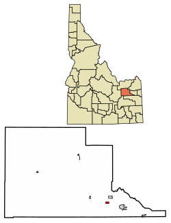
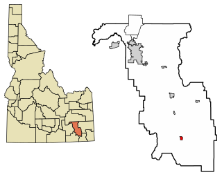
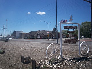
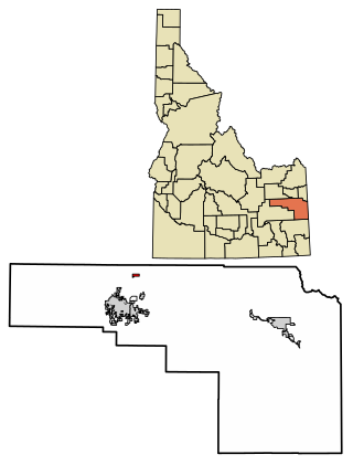
Rigby is a city in and the county seat of Jefferson County, Idaho, United States. The population was 5,038 at the 2020 census, up from 3,945 in 2010.

Roberts is a city in Jefferson County, Idaho, United States. It is part of the Idaho Falls, Idaho Metropolitan Statistical Area. The population was 580 at the 2010 census.

Rockland is a city in Power County, Idaho, United States. The population was 295 at the 2010 census.

The Idaho Falls Metropolitan Statistical Area, as defined by the United States Census Bureau, is an area consisting of three counties in eastern Idaho, anchored by the city of Idaho Falls. As of the 2020 census, the MSA had a population of 154,855. It is just north of the Pocatello, Idaho Metropolitan Area.