Great Barrier Island lies in the outer Hauraki Gulf, New Zealand, 100 kilometres (62 mi) north-east of central Auckland. With an area of 285 square kilometres (110 sq mi) it is the sixth-largest island of New Zealand and fourth-largest in the main chain. Its highest point, Mount Hobson, is 627 metres (2,057 ft) above sea level. The local authority is the Auckland Council.

The Mercury Islands are a group of seven islands off the northeast coast of New Zealand's North Island. They are located 8 kilometres (5 mi) off the coast of the Coromandel Peninsula, and 35 kilometres (22 mi) northeast of the town of Whitianga.

Rotokura / Cable Bay is a bay and small settlement 18 kilometres (11 mi) north-east of Nelson in New Zealand. The settlement at the head of the bay is at the southern end of a thin strip of land or causeway connecting Pepin Island with the South Island.

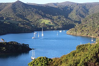
Port Fitzroy is a harbour and coastal community on Great Barrier Island in New Zealand's Hauraki Gulf.

The Mohaka river is on the North Island of New Zealand in the east central region of Hawke’s Bay. Mohaka is a Maori word, roughly translated it means “place for dancing”. The iwi associated with the Mohaka River are Ngāti Pāhauwera, Ngāti Hineuru, Ngāti Tūwharetoa and Mana Ahuriri. The headwaters are found in the Kaweka and Kaimanawa ranges. From the range it winds southeast before twisting northeast and finally southeast again to empty into the Pacific Ocean near the town of Mohaka. There are many gorges on the Mohaka; some as steep as 200m. Its main tributaries are the Waipunga, Taharua, Hautapu rivers. The full length is 172 kilometres (107 mi) and it drains a basin of 2,357 square kilometres (910 sq mi).

Cape Rodney-Okakari Point Marine Reserve is a 5.5 km2 (2.1 sq mi) protected area in the North Island of New Zealand.

Anaura Bay is a bay and community in the Gisborne District of New Zealand's North Island. It is located just south of Tokomaru Bay and north of Tolaga Bay.

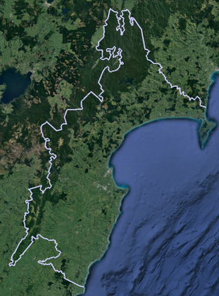
Aotea Conservation Park is a 12,300 hectare protected area on Great Barrier Island in New Zealand's Hauraki Gulf. It was established in 2015, and comprises 43 percent of the island.

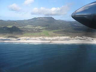
Kaitoke Beach is a long sandy beach and settlement on the east coast of Great Barrier Island in the Hauraki Gulf of the Auckland Region of New Zealand. At the northern end is the Kaitoke Creek, which drains the Kaitoke Swamp, and a headland, beyond which is Palmers Beach. At the southern end is the Sugar Loaf headland and beyond that Medlands Beach. Kaitoke Beach has golden sand and dunes.
Awana Bay is a beach on the east coast of Great Barrier Island in the Hauraki Gulf of New Zealand's Auckland Region. The beach is used by both swimmers and surfers alike. It is deep-sloping, with a risk of both strong waves and rip currents. There are several peaks for intermediate to expert surfers, including a good left-hander at the northern end and a good left-hander at the southern end.

Tryphena is a beach settlement on the southern coast of Great Barrier Island in the Hauraki Gulf of New Zealand's Auckland Region.
Ōkiwi is a small settlement and rural community at the head of the Whangapoua Estuary, in Whangapoua Bay, on Great Barrier Island in New Zealand's Hauraki Gulf.

Whangapoua Beach is on the east coast of Great Barrier Island in New Zealand's Hauraki Gulf. The beach runs roughly north–south and has views of Rakitu Island. The Whangapoua Creek drains large estuarine wetlands and enters the sea at the southern end of the beach.

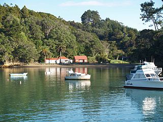
Whangaparapara is a harbour and coastal community on Great Barrier Island in New Zealand's Hauraki Gulf.

Whitireia Park is a headland north of Titahi Bay and Te Awarua-o-Porirua Harbour in Porirua, in the Wellington Region at the southern end of New Zealand's North Island. It is a regional park administered by Wellington Regional Council.

Te Matuku Marine Reserve is a marine reserve administered by the New Zealand Department of Conservation. It includes Te Matuku Bay, one of the largest and least disturbed estuaries on Waiheke Island, as well as a surrounding area of sea. It covers an area of 690 ha and was established in 2003.

Te Matuku Bay is a bay on Waiheke Island in New Zealand's Hauraki Gulf. It is one of the largest and least disturbed estuaries on the island. Since 2003, the area has been protected as part of Te Matuku Marine Reserve.

Tauparikākā Marine Reserve is a marine reserve located offshore about 20 kilometres (12 mi) north of Haast on the West Coast of New Zealand's South Island. It covers the area immediately offshore from Ship Creek, which is also known as Tauparikākā in Māori.

Te Angiangi Marine Reserve is a marine reserve covering a marine area of 446 hectares in the Hawke's Bay Region of New Zealand's North Island. It was established in 1997 and is administered by the Department of Conservation.

Omaha Cove, also known as Leigh Harbour, is a bay in the Auckland Region of New Zealand's North Island. It is located to the north-east of the township of Leigh in the Rodney local board area.


