Harmon Valley, Alberta

Last updated
Harmon Valley
Canada Alberta location map 2.svg
Red pog.svg
Location of Harmon Valley in Alberta
Coordinates: 56°07′00″N116°50′00″W / 56.11666°N 116.83329°W / 56.11666; -116.83329 Coordinates: 56°07′00″N116°50′00″W / 56.11666°N 116.83329°W / 56.11666; -116.83329
CountryFlag of Canada.svg  Canada
Province Flag of Alberta.svg  Alberta
Census division No. 17
Municipal district Northern Sunrise County
Government
  Type Unincorporated
  Governing body Northern Sunrise County Council
Elevation 635 m (2,083 ft)
Time zone MST (UTC-7)

Harmon Valley is an unincorporated community in northern Alberta, Canada.

Northern Alberta geographical object

Northern Alberta is a region located in the Canadian province of Alberta.

Canada Country in North America

Canada is a country in the northern part of North America. Its ten provinces and three territories extend from the Atlantic to the Pacific and northward into the Arctic Ocean, covering 9.98 million square kilometres, making it the world's second-largest country by total area. Canada's southern border with the United States is the world's longest bi-national land border. Its capital is Ottawa, and its three largest metropolitan areas are Toronto, Montreal, and Vancouver. As a whole, Canada is sparsely populated, the majority of its land area being dominated by forest and tundra. Consequently, its population is highly urbanized, with over 80 percent of its inhabitants concentrated in large and medium-sized cities, many near the southern border. Canada's climate varies widely across its vast area, ranging from arctic weather in the north, to hot summers in the southern regions, with four distinct seasons.

Contents

The community was named for Daniel Harmon, a fur trader. [1]

The Harmon Valley Fair Grounds is hosts to the Harmon Valley Quad Rally. [2]

Administration

The community is located in census division No. 17. It is administered by Northern Sunrise County, and is represented by the Ward 1 - Harmon Valley / Reno councillor. [3]

Census division is an official term in Canada and the United States. The census divisions of Canada are second-level census geographic unit, below provinces and territories, and above "census subdivisions" and "dissemination areas". In provinces where they exist, the census division may correspond to a county, a regional municipality or a regional district.

Division No. 17, Alberta Census division in Alberta in Canada

Division No. 17 is a census division in Alberta, Canada. It spans the central and northwest portions of northern Alberta and its largest urban community is the Town of Slave Lake. Division No. 17 is the largest census division in Alberta according to area and also has the lowest population density.

Northern Sunrise County Municipal district in Alberta, Canada

Northern Sunrise County is a municipal district in northern Alberta, Canada. Located in Census Division 17, its municipal office is located east of the Town of Peace River at the intersection of Highway 2 and Highway 688.

Geography

The community is located in the Heart River valley, approximately 25 km (16 mi) east of the Village of Nampa. It has an elevation of 635 meters (2,083 ft).

Heart River (Alberta) river in Canada

The Heart River is a river in northern Alberta, Canada. It is a major tributary of the Peace River.

Nampa, Alberta Village in Alberta, Canada

Nampa is a village in Northern Alberta located 27 km south of the Town of Peace River, along Highway 2. Heart River crosses the Highway 2 just north of community. Canadian National Railway owned railway traverses the village.

The Harmon Member of the Peace River Formation, a stratigraphic unit of the Western Canadian Sedimentary Basin is named for the community.

Peace River Formation

The Peace River Formation is a stratigraphical unit of middle Albian age in the Western Canadian Sedimentary Basin.

Western Canadian Sedimentary Basin

The Western Canadian Sedimentary Basin (WCSB) is a vast sedimentary basin underlying 1,400,000 square kilometres (540,000 sq mi) of Western Canada including southwestern Manitoba, southern Saskatchewan, Alberta, northeastern British Columbia and the southwest corner of the Northwest Territories. It consists of a massive wedge of sedimentary rock extending from the Rocky Mountains in the west to the Canadian Shield in the east. This wedge is about 6 kilometres (3.7 mi) thick under the Rocky Mountains, but thins to zero at its eastern margins. The WCSB contains one of the world's largest reserves of petroleum and natural gas and supplies much of the North American market, producing more than 16,000,000,000 cubic feet (450,000,000 m3) per day of gas in 2000. It also has huge reserves of coal. Of the provinces and territories within the WCSB, Alberta has most of the oil and gas reserves and almost all of the oil sands.

See also

Related Research Articles

Peace River, Alberta Town in Alberta, Canada

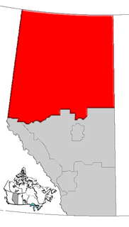
Peace River, originally named Peace River Crossing, and known as Rivière-la-Paix in French, is a town in northwestern Alberta, Canada, situated along the banks of the Peace River, at its confluence with the Smoky River, the Heart River and Pat's Creek. It is located 486 kilometres (302 mi) northwest of Edmonton, and 198 kilometres (123 mi) northeast of Grande Prairie, along Highway 2. It was known as the Village of Peace River Crossing between 1914 and 1916.

Whitecourt Town in Alberta, Canada

Whitecourt is a town in central Alberta, Canada within Woodlands County. It is located approximately 177 km (110 mi) northwest of Edmonton and 279 km (173 mi) southeast of Grande Prairie at the junction of Highway 43 and Highway 32, and has an elevation of 690 m (2,260 ft). The Whitecourt meteor impact crater is found on nearby Whitecourt Mountain.

Tawatinaw

Tawatinaw is a hamlet in Alberta, Canada within Westlock County. It is located on Township Road 614, 2 kilometres (1.2 mi) east of Highway 2 and approximately 70 kilometres (43 mi) north of the City of Edmonton.

St. Isidore, Alberta Hamlet in Alberta, Canada

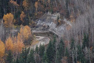
St. Isidore is a hamlet in northwest Alberta, Canada, within Northern Sunrise County. It is located approximately 16 kilometres (9.9 mi) east of the Town of Peace River on Range Road 204 off Highway 688. St. Isidore is flanked by deep ravines cut by Pat's Creek to the north and Pat's Creek tributary to the south. The ravines are surrounded by pine forests.

County of Vermilion River Municipal district in Alberta, Canada

The County of Vermilion River is a municipal district located in the eastern part of central Alberta, Canada in Census Division #10. The municipal district was formerly named the County of Vermilion River No. 24 prior to an official name change that became effective on September 13, 2006.

Wabasca, Alberta Hamlet in Alberta, Canada

Wabasca, also known as Wabasca-Desmarais, is a hamlet in northern Alberta, Canada, within the Municipal District of Opportunity No. 17. It is located between and along the South and North Wabasca Lakes, at the intersection of Highway 813 and Highway 754. It is approximately 123 kilometres (76 mi) northeast of Slave Lake.

Cadotte Lake lake in Alberta, Canada

Cadotte Lake is an unincorporated community in northern Alberta, Canada within Northern Sunrise County. It is located on the northern shore of the homonymous lake, along Highway 986, 79 km (49 mi) east of Peace River and 68 km (42 mi) west of the Bicentennial Highway.

Brownfield, Alberta

Brownfield is a hamlet in central Alberta, Canada within the County of Paintearth No. 18. It is located approximately 25 km (16 mi) north of Highway 12 and 122 km (76 mi) southeast of Camrose. It is only a few miles south from the Battle River and positioned along Highway 872.

Little Buffalo, Alberta Hamlet in Alberta, Canada

Little Buffalo is a hamlet in northern Alberta, Canada within Northern Sunrise County. It is located on Highway 986, approximately 100 kilometres (62 mi) northeast of the Town of Peace River and 47 kilometres (29 mi) west of Highway 88. Little Buffalo Lake is to the south of the community.

Marie Reine Hamlet in Alberta, Canada

Marie Reine is a hamlet in northwest Alberta, Canada within Northern Sunrise County. It is located approximately 18 km (11 mi) south of the Town of Peace River on four quarter sections split by Highway 744.

Notikewin

Notikewin is a hamlet in northern Alberta, Canada within the County of Northern Lights.

Reno, Alberta

Reno is a hamlet in northern Alberta, Canada within Northern Sunrise County. It is located 8 kilometres (5.0 mi) east of Highway 2, approximately 146 kilometres (91 mi) northeast of Grande Prairie. It is probably named after Reno, Nevada.

St. Lina

St. Lina or Ste-Lina in French, is a hamlet in northern Alberta, Canada within the County of St. Paul No. 19. It is home of St. Lina Community Hall. It is located approximately 14 kilometres (8.7 mi) north of Highway 28 and 85 kilometres (53 mi) southwest of Cold Lake.

The Woodland Cree First Nation is a First Nation in Alberta, Canada adjacent to the Cadotte Lake in Northern Sunrise County northeast of the Town of Peace River. The hamlet of Cadotte Lake is located within the reserve.

Three Creeks, Alberta Place in Alberta, Canada

Three Creeks is an unincorporated community in northern Alberta, Canada.

References

  1. ePodunk. "Harmon Valley, Alberta" . Retrieved 2010-10-17.
  2. "Harmon Valley Quad Rally" . Retrieved 2010-10-17.
  3. Northern Sunrise County. "Reeve and Council" . Retrieved 2010-10-17.