
Milk River is a tributary of the Missouri River, 729 miles (1,173 km) long, in the U.S. state of Montana and the Canadian province of Alberta. Rising in the Rocky Mountains, the river drains a sparsely populated, semi-arid watershed of 23,800 square miles (62,000 km2), ending just east of Fort Peck, Montana.

The Mackenzie River is a river in the Canadian boreal forest. It forms, along with the Slave, Peace, and Finlay, the longest river system in Canada, and includes the second largest drainage basin of any North American river after the Mississippi.
The Fort Nelson River, often shortened to simply the Nelson River, is in north-eastern British Columbia, Canada. It flows 517 kilometres (321 mi) generally north-westward to the Liard River, a tributary of the Mackenzie River, which empties into the Arctic Ocean. The river drains a watershed of 55,900 square kilometres (21,600 sq mi) and is formed by the confluence of the Fontas River flowing from the east, and the Sikanni Chief River flowing from the south. These, along with the Sahtaneh and Muskwa Rivers, constitute the major tributaries. The source of the Sikanni Chief, on the eastern slope of the Rocky Mountains, is ultimately the headwater of the Fort Nelson River.
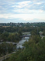
The Elbow River is a river in southern Alberta, Canada. It flows from the Canadian Rockies to the city of Calgary, where it merges into the Bow River.

Nampa is a village in northern Alberta, Canada. It is 27 km (17 mi) south of the Town of Peace River on Highway 2. Heart River crosses the Highway 2 just north of community. Canadian National Railway owned railway traverses the village. Nampa is an Indigenous word for 'the Place'.

Shamokin Creek is a tributary of the Susquehanna River in Northumberland County, Pennsylvania, in the United States. It is approximately 32.4 miles (52.1 km) long and flows through Mount Carmel, Mount Carmel Township, Coal Township, Shamokin, Ralpho Township, Shamokin Township, Snydertown, Upper Augusta Township, and Sunbury. The watershed of the creek has an area of 137 square miles (350 km2). It experiences significant impacts by abandoned mine drainage and many abandoned mine drainage discharges are in its watershed. Various other impairments also affect parts of the creek's watershed. Shamokin Creek is in the Appalachian Mountains section of the Ridge and Valley physiographic province. Rock formations consisting of sandstone, shale, and anthracite deposits occur in the watershed.

Beaver River is a large river in east-central Alberta and central Saskatchewan, Canada. It flows east through Alberta and Saskatchewan and then turns sharply north to flow into Lac Île-à-la-Crosse on the Churchill River which flows into Hudson Bay.

The Middle Fork Feather River is a major river in Plumas and Butte Counties in the U.S. state of California. Nearly 100 miles (160 km) long, it drains about 1,062 square miles (2,750 km2) of the rugged northern Sierra Nevada range.
The North Fork Clearwater River is a major tributary of the Clearwater River in the U.S. state of Idaho. From its headwaters in the Bitterroot Mountains of eastern Idaho, it flows 135 miles (217 km) westward and is dammed by the Dworshak Dam just above its mouth in north-central Idaho. Draining a rugged watershed of 2,462 square miles (6,380 km2), the river has an average flow of over 5,600 cubic feet per second (160 m3/s), accounting for a third of the discharge from the Clearwater basin. The river drains parts of Clearwater, Shoshone, Latah, and Idaho counties. Most of the watershed is managed by the U.S. Forest Service. Some of the fish of the river include westslope cutthroat trout, rainbow trout, mountain whitefish, and the threatened bull trout. It also has smallmouth bass and a kokanee salmon run, both from Dworshak Reservoir. The North Fork drainage is home to grizzly bears, cougars, deer, moose, black bear, elk, grey wolves, and osprey. The river used to have a large steelhead run before the implementation of Dworshak Dam. The North Fork of the Clearwater is located within the Clearwater National Forest

San Mateo Creek is a stream in Southern California in the United States, whose watershed mostly straddles the border of Orange and San Diego Counties. It is about 22 miles (35 km) long, flowing in a generally southwesterly direction. Draining a broad valley bounded by the Santa Ana Mountains and Santa Margarita Mountains, San Mateo Creek is notable for being one of the last unchannelized streams in Southern California.

The Rosebud River is a major tributary of the Red Deer River in Alberta, Canada. The Rosebud River passes through agricultural lands and ranchland for most of its course, and through badlands in its final reaches. It provides water for irrigation canals through a variety of dams built on its course and that of its tributaries.

The Kakisa River is a major tributary of the Mackenzie River in the Northwest Territories of Canada.
The Notikewin River is a tributary of the Peace River in northern Alberta, Canada. The Notikewin Provincial Park is established at the mouth of the river.
The Puskwaskau River is a short river in Northern Alberta, Canada. It is a tributary of the Smoky River flowing westwards in the Peace River Country. Its waters flow through the Smoky River, Peace River, Slave River, Great Slave Lake and Mackenzie River into the Arctic Ocean.
The Cadotte River is a tributary of the Peace River in Northern Alberta, Canada.
Harmon Valley is an unincorporated community in northern Alberta, Canada.

Pat's Creek is a tributary of the Peace River in northern Alberta, Canada whose mouth is located within the Town of Peace River.

Peace Vallis is an ancient stream valley on the northern rim of Gale Crater on the planet Mars. It is notable for its associated alluvial fan which lies near the Mars Science Laboratory Curiosity landing site. The valley and alluvial fan provide evidence for geologically recent (Amazonian-aged) fluvial activity and sustained water flow on Mars. Recent high-resolution orbital images of Peace Vallis and its watershed also suggest that at least one glacial episode affected Gale crater. All of this evidence has implications for the history of water on Mars and the planet's long-term habitability. Understanding Peace Vallis and its fan also provides geologic context for the rocks observed on the ground by the Curiosity rover.

Toby Creek is a tributary of the Susquehanna River in Luzerne County, Pennsylvania, in the United States. It is approximately 10.5 miles (16.9 km) long and flows through Dallas Township, Dallas, Kingston Township, Courtdale, Luzerne, Pringle, Kingston, Edwardsville, and Larksville. The watershed of the creek has an area of 36.5 square miles (95 km2). The entire drainage basin is designated as a Migratory Fishery and parts are designated as either a Coldwater Fishery, a Warmwater Fishery, or a Trout Stocking Fishery. The creek has two named tributaries: Huntsville Creek and Trout Brook. It is said to show "some degraded conditions", but does not experience severe pollution and is not considered to be impaired. The creek is piped underground in Pringle, but resurfaces in Edwardsville.

Spruce Run is a tributary of Buffalo Creek in Union County, Pennsylvania, in the United States. It is approximately 14 miles (23 km) long and flows through Hartley Township, Lewis Township, West Buffalo Township, White Deer Township, Buffalo Township, and Kelly Township. The watershed of the stream has an area of 27.2 square miles (70 km2). The stream has two named tributaries: Black Run and Muddy Run. It is not designated as an impaired waterbody, but it is affected by sediment and nutrients.


