
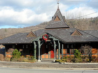
Ringwood is a borough in Passaic County, New Jersey, United States. As of the 2010 United States Census, the borough's population was 12,228, reflecting a decrease of 168 (-1.4%) from the 12,396 counted in the 2000 Census, which had in turn declined by 227 (-1.8%) from the 12,623 counted in the 1990 Census.
Tuxedo is a town located in Orange County, New York along the Ramapo River. As of the 2010 census, the town had a total population of 3,624. The town is in the southeastern part of the county in the Ramapo Mountains. New York State Route 17 and the New York State Thruway pass through the town. The name is derived from a Lenape word tucseto, which has several known meanings.

The City of Maroondah is a local government area in Victoria, Australia in the eastern suburbs of Melbourne. Maroondah had a population of approximately 110,000 as at the 2016 Census.

Croydon railway station is located on the Lilydale line in Victoria, Australia. It serves the eastern Melbourne suburb of Croydon opening as Warrandyte on 1 December 1882, being renamed Croydon on 1 August 1884.

The Belgrave railway line is a 1,600 mm broad-gauge electric suburban railway in Melbourne, Australia. It branches from the Lilydale line at Ringwood station.

Croydon Hills is a suburb of Melbourne, Victoria, Australia, 31 km north-east of Melbourne's Central Business District. Its local government area is the City of Maroondah. At the 2011 Census, Croydon Hills had a population of 5,185.
Ringwood North is a suburb of Melbourne, Victoria, Australia, 25 km north-east of Melbourne's Central Business District. Its local government area is the City of Maroondah. At the 2011 Census, Ringwood North had a population of 9,657.

Mullum Mullum Creek is a creek in the outer eastern suburbs of Melbourne, Victoria, Australia. It is the main watercourse of the Mullum Mullum Valley, a tributary of the Yarra River and Yarra Valley. For tens of thousands of years it was used as a food and tool source sustainably by the Wurundjeri people, Indigenous Australians of the Kulin nation, who spoke variations of the Woiwurrung language group.

Ringwood State Park is a 4,444 acres (17.98 km2) state park in Passaic County in northeastern New Jersey, USA. The Park is located in the heart of the Ramapo Mountains in Ringwood. Its forests are part of the Northeastern coastal forests ecoregion.

Ramapo Mountain State Forest is a 4,200 acres (17 km2) state forest in Bergen and Passaic Counties in New Jersey. The park is operated and maintained by the New Jersey Division of Parks and Forestry.
There are several roads named Skyline Drive:

The Skylands Region is a region and marketing area of the State of New Jersey located in the Northern and Central part of the state. It is one of six tourism regions established by the New Jersey State Department of Tourism, the others being the Gateway Region, Greater Atlantic City Region, the Southern Shore Region, the Delaware River Region and the Shore Region. The area officially encompasses Hunterdon, Morris, Somerset, Sussex and Warren counties; the northwestern part of the Passaic County fits in with the Skylands Region, but it is part of the Gateway Region and not the Skylands Region. One could also say that the western most part of Bergen is also part of the skylands. The area features uplifted land, rolling hills and mountains characteristic of North Jersey. The region contains 60,000 acres of state parkland, and a diverse geography filled with lakes, rivers and picturesque hills.
Ringwood Mines landfill site is a 500-acre former iron mining site located in the Borough of Ringwood, New Jersey. Used in the late 1960s and early 1970s by the large Ford Motor Plant in nearby Mahwah, New Jersey for disposal of waste, it was identified by the Environmental Protection Agency (EPA) for its Superfund priority list in 1984 for cleanup of hazardous wastes. EPA deleted the site from the Superfund list in 1994 and nevertheless subsequently relisted the site several times due to failed environmental remediation. Portions of the landfill site were repurposed as land used for affordable housing for the Ramapough people in the 1970s, even though the land was contaminated.
Bald Mountain is a mountain in Bergen County, New Jersey, just south of the New York state line. The peak rises to 1,152 feet (351 m). It is part of the Ramapo Mountains. This summit is the highest elevation in Bergen County.
Drag Hill is a mountain in Bergen County, New Jersey. The peak rises to 1,060 feet (323 m), and overlooks Bear Swamp Lake to the west. It is part of the Ramapo Mountains.
Green Hill is a mountain in Bergen County, New Jersey. The peak rises to 814 feet (248 m), and overlooks the Ramapo River to the southeast. It is part of the Ramapo Mountains.
High Mountain is a mountain on the Bergen and Passaic county line, New Jersey. The peak rises to 1,106 feet (337 m). It is part of the Ramapo Mountains, and is not to be confused with the like-named High Mountain in the Preakness Range of the Watchung Mountains. High Mountain is partially within Ringwood State Park.
Rocky Mountain is a mountain in Bergen County, New Jersey. The peak rises to 1,056 feet (322 m), and overlooks Bear Swamp Lake to the northwest. It is part of the Ramapo Mountains. Rocky Mountain is part of Ringwood State Park.
Mount Defiance is a mountain in Ringwood State Park in Passaic County, New Jersey. The peak rises to 1,040 feet (317 m). It is part of the Ramapo Mountains.


